First, Frederick Augustus Hihn dreamed of a railroad up the San Lorenzo Valley. But before progress could even be made on that vision, Hihn joined in the incorporation of another venture, the California Coast Railroad. This new railroad, incorporated in June 1867, was intended to connect Santa Cruz to Gilroy, where the under-construction Santa Clara & Pajaro Valley Railroad was to terminate. However, this plan, too, stalled due to infighting, a lack of stock subscriptions, and confusion regarding the plans of the Central Pacific Railroad, which purchased the trackage to Gilroy in 1868. In January 1870, the Santa Cruz County Railroad Committee, headed by Hihn, petitioned the local city, county, and state governments for funds to support a coastal line between Gilroy and Santa Cruz and two branch lines up Soquel Creek and the San Lorenzo Valley. Yet once again Hihn's plans were sidelined when Central Pacific incorporated the California Southern Railroad Company, which planned to build a railroad between Gilroy and Salinas. Hihn changed tact and included this new railroad in his funding plan, but the state legislature voted against the idea and the entire campaign fizzled.
Santa Cruz Railroad advertisement, 1879, from S, H. Willey's History of Santa Cruz County, California.
Hihn, though, was not one to give up easily. Despite ongoing legal troubles with his San Lorenzo Valley Railroad and two failed attempts to build a coastal line that would connect to the now-Southern Pacific trackage, which reached Pajaro in November 1871, Hihn convinced several wealthy Santa Cruz residents of the merits of financing a railroad. The reason this time was tribal: with the railroad passing through Watsonville, Santa Cruzans feared that they would be left behind since much of the county's wealth would go through Watsonville via railroad. On January 18, 1872, a second coastal railroad company was incorporated under the name Santa Cruz & Watsonville Railroad. The conditions of construction were that five miles needed to be built before the project received Santa Cruz City and County funding and that the entire project had to be completed within two years. But as before, things went wrong. This time, the Atlantic & Pacific Railroad implied strongly its desire to build a railroad from San Francisco down the coast through Santa Cruz County and then eastward toward the California-Nevada border. Optimism was at an all-time high in the county and several important deadlines lapsed while further word on the Atlantic & Pacific plans were eagerly awaited. It wasn't the last time Santa Cruz would be led down by a company attempting to bridge the coast or place Santa Cruz on a transcontinental line. By Autumn 1872, the Santa Cruz & Watsonville Railroad was effectively dead, with reluctant investors pulling out and lacking any government funding.
Santa Cruz Railroad's Cherry Street Depot outside downtown Santa Cruz, c. 1890. Frederick Hihn kept his local offices in the upstairs of the depot until his retirement in 1892. This depot marked the end-of-track for the Santa Cruz Railroad until the adjacent South Pacific Coast Railway trackage was standard-gauged in 1908. The depot itself shut down in 1892 when the Santa Cruz Union Depot was built at the end of Center Street. [Harold van Gorder Collection – Santa Cruz Museum of Art & History]
Flustered and impatient for any railroad in the county—it had been nearly eight years since his failed San Lorenzo Valley Railroad had incorporated—Hihn proposed one last plan to build a route between Santa Cruz and Pajaro. In September 1872, he suggested that individuals in the county pool their money together to build a narrow-gauge railroad using the cheapest equipment, rolling stock, and material available. Hihn even saved some money by using the survey maps done by the Atlantic & Pacific Railroad, which clung more closely to the coast than earlier surveys. Hihn made one important deviation: he curved the trackage inland at Aptos in order to reach his timber tracts up Soquel, Aptos, and Valencia creeks. Just as yet another railroad company was ready to incorporate, Leland Stanford of Southern Pacific visited and implied strongly that his railroad would soon be building a route through the county. As before, this almost derailed the entire project, but Hihn and his investors had grown wiser over the past decade. When the stock market crashed a few months later, they were unfazed and decided to incorporate the Santa Cruz Railroad on August 4, 1873, with plans to build a line between Pajaro and Point Año Nuevo on the northern county line.
The Betsy Jane with its crew, c. 1875. [University of Southern California]
The new railroad began construction at once, fearing that some interruption would delay or end their plans for a fourth time. Construction was not continuous, but rather occurred in somewhat haphazardly along the surveyed right-of-way. All of the initial construction in late 1873 and 1874 happened between the San Lorenzo River and Aptos, the former because of the obstacle the river presented, the latter because the final alignment to Pajaro had not been decided yet. Although locals were involved in the project, Chinese laborers did most of the heavy lifting. When enough track was laid, a small locomotive, the Betsy Jane, was brought in to help with construction. By May 1875, all of the tracks between the river and Aptos were in place. The massive gulch above Soquel Creek presented a significant engineering problem, but this bridge was finished by the end of 1874.
A Santa Cruz Railroad mixed train passing beneath houses on Beach Hill, c. 1878. [Santa Cruz Public Libraries]
Just as things were progressing, the people of Watsonville revolted. The published survey bypassed the city by a half mile—punishment for fighting against the railroad and throwing obstacles at its completion. But as the riotous settlement realized that the railroad would happen and that they would be left off this railroad route, they suddenly demanded to be included. They sued the Santa Cruz Railroad and the railroad's heads decided to relent—indeed, they probably had planned to do so all along. The route was resurveyed along the southern side of Watsonville, where it then turned across the Pajaro River and met the Southern Pacific right-of-way.
A Santa Cruz Railroad passenger train crossing Soquel Creek, c. 1878. [Santa Cruz Public Libraries]
From the middle of 1875, construction continued at a breakneck pace. The bridge over the San Lorenzo River was opened on April 17 and the track reached the northern terminus on Cherry Street at the end of the month. On May 22, a grand opening celebration was held in Santa Cruz, despite the fact that the bridge over Valencia Creek remained incomplete and the track from there to Pajaro was still under construction. Progress throughout the rest of the year was rapid, but an especially wet winter ensured the line's completion would be delayed. The route between Santa Cruz and Watsonville was finally opened to through traffic on May 7, 1876. As a way to celebrate, a new Baldwin locomotive was brought in named the Pacific to replace the tiny Betsy Jane. Two other locomotives, Jupiter and Neptune, joined it shortly afterwards. The completion of the bridge over the Pajaro River, thereby joining the isolated railroad to the larger Southern Pacific network, was not done until November, although all passenger and freight still had to be transferred since the two railroads ran on separate gauges. Plans to extend the track north of Santa Cruz to the county line remained on the books, but were never acted upon.
Jupiter sitting on the tracks near the Cherry Street depot in Santa Cruz, c. 1878. [Pacific Coast Narrow Gauge]
Despite so many plans and so much hype, the Santa Cruz Railroad had a surprisingly short life as an operating railroad. The damage to the line in early 1876 had cost the railroad dearly, and the Santa Cruz & Felton Railroad, completed in 1875, decided to ship out timber and lime from steamships at its piers at the beach rather than using the coastal railroad line. And Hihn himself was actively undermining his own project by working with the South Pacific Coast Railroad to route an alignment down Soquel Creek, although he undoubtedly hoped that the South Pacific Coast would purchase the coastal trackage as a part of such a deal. By 1878, it became clear that the South Pacific Coast planned to build a route down the San Lorenzo Valley—or buy the existing line, as it happened—thereby creating a shorter and more cost-effective route between Santa Cruz and San Francisco. This alone scared a lot of investors, but the line itself was barely viable. The bridge over the San Lorenzo River washed out in 1877, forcing financiers to spend much of their recent profits to revive the line again. Investors were asked to give an additional $10 per share to maintain the company in 1878, but only Hihn paid the amount.
The second San Lorenzo River Bridge following its collapse during a storm on January 27, 1881.
The final death blows came quickly. In May 1880, the South Pacific Coast finished its line through the Santa Cruz Mountains. There was little reason for anyone except rural businesses to need the coastal line after this. Still, the railroad trudged on. Then, in late January 1881, large portions of the line had washed out and the San Lorenzo River bridge has collapsed for a second time. Hihn was the only person willing to finance the line by this point, and he saw no profit in it. In March, the company declared bankruptcy and went up for auction, almost exactly five years after it had first opened. The next month, the Pacific Improvement Company—one of Southern Pacific's property investment firms—bought the dilapidated line and began refurbishing it. Limited operations resumed in June while Pacific Improvement initiated plans to standard gauge the line. In mid-November 1883, standard-gauging was complete and on June 3, 1884, the line was rebranded the Pajaro & Santa Cruz Railroad, a wholly-owned subsidiary of Southern Pacific, which later consolidated it in 1888 and reclassified the 21-mile-stretch of track as the Santa Cruz Branch.
Jupiter as it is displayed today at the Smithsonian. [Smithsonian Museum]
Except for a short portion of track in the vicinity of New Brighton State Beach, as well as the stretch over Woods Lagoon (the harbor), the original right-of-way of the Santa Cruz Railroad still exists and serves as the southern two-thirds of the Santa Cruz Branch Line, which was purchased by Santa Cruz County in 2012. None of the original structures associated with the railroad survive but the third locomotive bought by the company, Jupiter, has been restored and is now on permanent display at the Smithsonian's "America on the Move" exhibit.
Who was Frederick Augustus Hihn? He wasn't the founder of Santa Cruz County, but his power and influence in its early years means that he might as well have been. He didn't own the county, but a good portion of its land passed through his hands at one point or another. He wasn't the county's biggest or wealthiest lumberman, but that certainly didn't stop him from trying to be both. And he wasn't the county's most famous or popular politician, but in his time he was both famous and popular. No, Frederick Hihn was something different: he was a visionary, an entrepreneur, a philanthropist, and an everyman in almost every way. He was the quintessential Gilded Age gentleman. He appeared on the scene just as California was becoming a state and lingered into the second decade of the twentieth century. In many ways, Santa Cruz during the second half of the nineteenth century was Hihn's town, and everyone knew it.
Frederick Augustus Hihn in stately repose, c. 1900. [California State Library]
Friedrich August Ludewig Hühn was born on August 16, 1829, in Holzminden in the Duchy of Brunswick, at the time a part of the German Confederation but otherwise an independent duchy. His father was a merchant and he had six brothers and two sisters, some of whom will accompany Friedrich to the United States. For most of his early years, Hühn was expected to become a merchant, and most of his training in this time was toward that goal. In 1844, he graduated from the local gymnasium and began working for A. Hoffmann in Schöningen as an apprentice merchant. In 1847, he started his first business collecting medicinal herbs and preparing them for commercial sale. But Hühn was becoming dissatisfied with German politics and sought an escape.
Hundreds of abandoned ships left by gold-seekers in Yerba Buena Bay, San Francisco, 1853. The Reform may well be one of these ships. [Smithsonian National Museum of American History]
He began making plans to move to Wisconsin when gold was discovered in California. After much contemplation, Hühn finally decided that the best option for himself and his family was to head to California and search for gold. It was not an entirely selfish motivation that drove him, though—his family was not wealthy and Hühn wanted to provide for them and his parents so they could live more comfortably. He boarded the ship Reform on April 20, 1849 and spent the next six months sailing around Cape Horn to San Francisco, where he arrived on October 12.
Gold mining in Placer Ravine near Auburn, 1852. [Smithsonian]
Hühn spent the next month preparing himself for the Gold County and purchasing a claim near the Feather River's south fork. But he did not anticipate the winter rains, which flooded his claim and washed most of his tools and supplies downriver. By December 1, 1849, Hühn was back in Sacramento without money or any practical ability to return to his claim. Giving up on the dream, he joined with a partner who had worked the claim with him, E. Kunitz, and opened a candy shop in downtown Sacramento. But disaster struck again on Christmas Day when the American River overflowed and destroyed their shop. Hühn decided to return to the gold mines and went to Long Ear near Auburn, where he finally had some success.
Downtown San Francisco in 1851, showing several of the main businesses in town including a drug store left of center, although whether this was Hihn's is unknown. Photograph by Daniel Hagerman. [Fine Art America]
Therese Paggen, c. 1870. [Hihn-Younger Archives, University of California, Santa Cruz]
It was while working near Auburn that Hühn finally decided to apply to become an American citizen on June 6, 1850. Casting off his German origins, he adopted the new name Frederick August Hihn. Shortly afterwards in August, he returned to Sacramento and became the manager of two hotels on K Street. But this venture proved too tedious for the ambitious Hihn and he moved back to San Francisco, where he opened his first mercantile store, a drug store on Washington Street. It was in San Francisco that he met Therese Paggen, a French immigrant, whom he married three years later on November 23, 1853.
Hihn did not thrive while living in San Francisco. His drug store burned down on May 5, 1851, and he immediately switched to selling mattresses. But his mattress stock caught fire and were destroyed on June 22. During this time, he also lost most of spare cash to theft and was at times living on friends' spare beds and couches. By June 30, Hihn had decided to return home, but a friend convinced him to get a job at the Sacramento Soap Factory. It was there that he met Henry Hintch, who convinced Hihn to relocated with him to Mission San Antonio to grow tobacco. They took a substantial load of supplies with them on muleback and discovered, to their surprise, how popular their items were with the local Californios when they stopped to rest for a night at San Juan Bautista. Within days, they had run out of supplies, so Hihn rode back to San Francisco to purchase more goods for sale.
Therese Paggen, their first child Katherine Hihn, and Frederick, c. 1858. [Hihn-Younger Archives, UCSC]
After make a few more sales, Hintch and Hihn rode on to San Antonio, but near Soledad the two decided to turn back and make for Santa Cruz instead in order to catch a ship bound for San Francisco. It was a fateful decision. The pair crossed the Pajaro River into Santa Cruz County on September 19, 1851, and Hihn never really left again. He purchased a home at the corner of Willow Street (Pacific Avenue) and Front Street and opened a mercantile shop in late 1852. His was one of the few local businesses to stay afloat during the terrible financial recession of the mid-1850s, and it meant he was in a good position to expand afterwards. It also meant he was finally financially secure enough to marry Therese Paggen.
Charles B. Younger, Jr., husband of Agnes Hihn, who together with her helped preserve Hihn's legacy. [Hihn-Younger Archive, UCSC]
Hihn's family came along rather slowly, at least comparably to the time. He was twenty-four when he married Therese and she was only seventeen, which may explain the delay before their first child was born. Katherine Charlotte Hihn was born on September 8, 1856. She would later marry William Thomas Cope. Louis William Hihn was their second son, who married Harriet Israel and had two children. Their third child, Elizabeth, died at less than a year old, and this seemed to delay the couple from having more children until 1864, when August Charles Hihn was born. August married Grace E. Cooper but had no children. The most famous of the Hihn children was Frederick Otto, the fifth child, who married Minnie E. Chace and had one son, Frederick Day Hihn. Frederick and Therese had another son, Hugo, in 1869, but he also died young. The couple's penultimate child, Theresa, married George Henry Ready and had a daughter, Ruth Ready, who lived until 1988. But it was their final child, Agnes, who proved the most prolific. She married Charles Bruce Younger, Jr., the son of Frederick Hihn's lawyer, and they had three children, the youngest of whom, Jane, only died in 1999. It was the Younger family that ultimately donated much of Hihn's business and personal documents to the University of California, Santa Cruz, which forms the basis of the university's special collections archive.
Hihn officially became a citizen on July 2, 1855, and a strange story developed around the same time relating to his wealth. Around 1855, Hihn purchased a gold claim along Gold Gluch. This was in response to a large boulder that was found on the gulch that contained a large amount of gold. The rumor goes that Hihn sacrificed his wheat-grinder, that he had used extensively over the previous two years to grind wheat into flour, in order to grind the boulder down to dust, from which the gold could be extracted. Naturally, he received a portion of the gold in payment for both purchasing the claim and sacrificing his grain mill. While there is no evidence to the truth of this story, it does explain the fate of the gold-laden boulder, the disappearance of Hihn's flour industry, and his substantial fortune that somewhat suddenly appeared in the late 1850s. The truth of the matter will likely never be known for certain.
Image may be NSFW. Clik here to view.
The earliest-known photograph of downtown Santa Cruz, 1866. The brick-built flatiron building at the center of the photograph was built by Hugo Hihn in 1860 to house the mercantile store he purchased from his brother three years earlier. [Santa Cruz Public Libraries]
Frederick Hihn entered the most significant stage of his life on August 21, 1855, when he purchased his first major property in Rancho Soquel Augmentacion through a court auction. Over the next five years, Hihn purchased several other tracts in Ranchos Soquel and Soquel Augmentacion. At this time, Hihn was also increasing his interest in business investing. In 1856, he joined Elihu Anthony in developing the Santa Cruz municipal water system. Tired of owing money and being in debt, he sold his mercantile business in December 1857 to his brother, Hugo, who had recently arrived in California with their brother, Lewis. Hugo rented the upstairs for use as city hall for four years while running his business downstairs. Hugo eventually sold the building and returned to Germany. In 1858, Frederick Hihn invested heavily in the Santa Clara Turnpike Company, a firm that passed through portions of his Rancho Soquel land on its way to the Summit.
Hihn's majestic estate on Locust Street in downtown Santa Cruz.
By 1861, Hihn was also looking into expanding a railroad into Santa Cruz County. In that year, he helped organize the San Lorenzo Valley Railroad, which ultimately hoped to build a railroad route into the Santa Clara Valley from Santa Cruz, but initially planned to connect Santa Cruz and the pioneer settlement emerging around Boulder Creek. It was probably for this cause that Hihn ran for and was elected onto the Santa Cruz County Board of Supervisors on September 4, 1861, beginning his term on May 5. He quickly discovered that the position did not provide him with all of the benefits that he sought, but he nonetheless was reelected in 1864. As his railroad plans languished in the courts over property rights, Hihn organized a second company, the California Coast Railroad, in 1867 with the goal of connecting Santa Cruz to Gilroy via a coastal route. Confusion spread by the Southern Pacific Railroad delayed this plan, and this delay likely led to him running and becoming a California State Assemblyman in 1871. Using his state-level influence, Hihn hoped to finally secure some funds to build a railroad in the county. But again, he was met with heavy opposition and did not run again in 1873. Shortly afterwards, he incorporated the Santa Cruz Railroad Company and became its president. This railroad was finally completed in 1876.
Hotel Capitola on the beach at Camp Capitola, c. 1890. [Hihn-Younger Archives, UCSC]
Much of Hihn's other public projects were linked to private ventures, generally housing subdivisions. Hihn founded Camp Capitola in 1869 on the beach at the mouth of Soquel Creek. On this land, he built a sprawling tent and cottage city and the massive Hotel Capitola. Up near the Summit, Hihn's Sulphur Springs was established along the turnpike to make commercial use of a hot spring found there. Hihn also was a key player in the founding of towns of Felton, Aptos, Valencia, Laurel, and the Fairview Park subdivision south of Capitola (all of the area south of Capitola Road and east of 41st Avenue to 49th Avenue). Further afield, he also helped layout the city of Paso Robles in 1899 and owned its famed El Paso de Robles Hot Springs Hotel.
An oxen team working in Gold Gulch near Felton, 1898. [History San Jose]
But the primary use Hihn had for his vast property holdings in Santa Cruz County was for harvesting lumber. When the South Pacific Coast Railroad began surveying its route into Santa Cruz County around 1877, Hihn tried to convince the company to run its line through Rancho Soquel. When this plan was rejected, he still managed to convince them to skirt the top of his property at Laurel, where a small lumber mill was established that cut timber for the railroad's tunnels and crossties. This mill operated on Hihn's land, but it was not his venture. The first mill that Hihn personally ran was on Trout Gulch in Aptos in 1883. It was a small operation able to cut 30,000 board feet of lumber per day, but the nearby timber was quickly exhausted.
The Valencia apple barn, c. 1900, still standing in Aptos and home of Village Fair Antiques. [Aptos Museum]
In 1884, a new mill was built three miles up Valencia Creek. This became Hihn's major base of operations. It could cut 40,000 board feet of lumber per day and ran for three years before burning down on November 29, 1886. Hihn rebuilt the next year with a larger 70,000 board foot capacity mill and constructed a narrow-gauge railroad line to it in order to make shuttling lumber to Aptos significantly easier. The mill shut down at the end of 1893 after almost completely clearcutting the Valencia Creek watershed. For the workers he left behind, he established an apple company and sold tracts of former timberland to his former employees to be used as orchards. Meanwhile, his lumber operations moved to Gold Gulch, then Laurel, King's Creek, and finally back to Laurel.
F. A. Hihn Company letter head showcasing various businesses that the company was involved in. [Hihn-Younger Archives, UCSC]
It was at this time that Frederick Hihn decided to retire and pass on the company to his family. He founded the F. A. Hihn Company in 1889 and officially retired from business at this time, although in reality he remained quite hands on for two more decades. During this time, he served as president of the Society of California Pioneers of Santa Cruz County, whose offices were in the upstairs of the Santa Cruz Southern Pacific depot. He helped to organize the Santa Cruz City Bank and the City Savings Bank of Santa Cruz. He served as a trustee of the Santa Cruz School District, and he also was president of the Santa Cruz Fair building Association. In 1902, he became one of the five founding trustees of the California State Polytechnic College, which became CalPoly San Luis Obispo. It was he who selected and arranged the purchase of the campus site and helped design and build the first structures, with help from local architect William Henry Weeks.
Frederick Hihn with his daughter, Agnes, during a European vacation in 1893. [Hihn-Younger Archives, UCSC]
By the late 1900s, age was finally having an impact on Frederick Hihn. He negotiated the sale of his commercial lumber business to the A. B. Hammond Lumber Company in March 1909, although the F. A. Hihn Company retained all properties and could continue to cut lumber, just not sell it to anyone other than Hammond. Hihn continued to be seen in town and participate to the best of his abilities until his death on August 23, 1913 at his home on Locust Street. He had just turned eighty-four years old. He was survived by several children, grandchildren, and great-grandchildren, several of whom still live in Santa Cruz County today. In later years, his home served as city hall before eventually being demolished in the 1960s to build the current city hall.
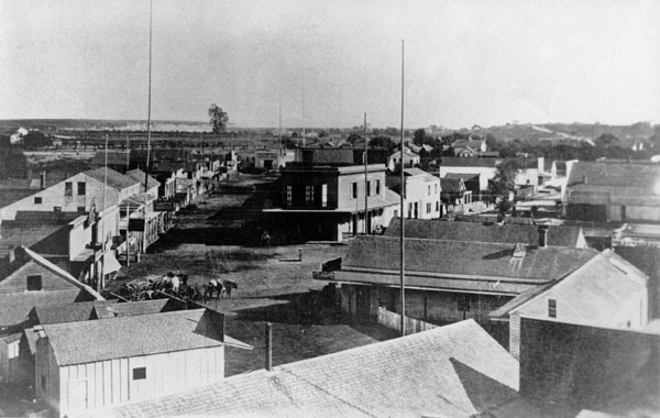
Passenger rail service in Santa Cruz County was nothing new in the 1920s. The Santa Cruz Railroad had first connected the county to Southern Pacific Railroad's Coast Division via a coastal route in 1876, and the South Pacific Coast Railroad effectively did the same via a route through the mountains in 1880. The two routes proved popular with tourists for different reasons. Both had Santa Cruz—and specifically the Santa Cruz Beach Boardwalk—as their ultimate destination, but whereas the coastal route had the beautiful Monterey Bay as part of its backdrop and catered to beach-goers, the mountain route was oriented more to the rugged outdoors-people and picnickers.
A Sun Tan Special at Santa Cruz Beach Boardwalk, preparing to head off for the mountains after picking up passengers, June 11, 1939. [Wilbur C. Whittaker]
In 1927, two years before the stock market crash that would trigger the Great Depression, railroad patronage was still relatively high despite the increase in automobile ownership. At the time, Santa Cruz County had a robust passenger rail system via two competing routes, both controlled by Southern Pacific. Yet the railroad company had an idea to make some extra money on the side.
The inaugural Miss California Bathing Beauty Contest participants at the Santa Cruz Main Beach wearing the form-fitting swimsuit styles of the period, 1924. Fay Lanphier, Miss Oakland (front-center), later became Miss America in 1925. [Santa Cruz Life]
The summer months were always a popular vacation time with children home from school and the weather warm enough to swim in the often frigid Monterey Bay. By the 1920s, the prudish swimming costumes of the 1910s had finally given way to simpler swimsuits that allowed flexibility and movement, and women for the first time could feel comfortable wading or swimming without the need of a bath cart or floor-length wool swimming dress. The Santa Cruz Main Beach had been a popular swimming spot since the 1860s but the Santa Cruz Beach Boardwalk, composed of the Casino, the Plunge, the Casa del Rey Hotel, the recently-opened Giant Dipper roller coaster, and several other rides and attractions, increased its popularity and drew crowds from throughout the Bay Area. But the Glenwood Highway—the main thoroughfare to Santa Cruz from San José—was crowded on sunny summer days, and the weekend commuter trains were insufficient to keep up with passenger traffic.
A Sun Tan Special heading across Los Gatos Creek just south of Los Gatos on its way to Santa Cruz, 1937. [Wilbur C. Whittaker]
On Fourth of July weekend, 1927, Southern Pacific district passenger agent George B. Hanson ran a special excursion train between San José and Santa Cruz via the direct route through the Santa Cruz Mountains. It was intended to be a one-off special express train, with stops at Big Trees (Henry Cowell Redwoods State Park), Santa Cruz, and the Santa Cruz Beach Boardwalk. Because of the holiday, most of Southern Pacific's locomotives and passenger cars were sitting idle, so appropriating them for a special was easy enough to do. In the end, the excursion trains outdid Southern Pacific's wildest imagination and were a massive success. Two more trains ran over the first summer on September 5 (Labor Day) and September 9 (Admission Day). In 1928, service was expanded to begin on Memorial Day—May 30—and run every two weeks plus holidays until Admission Day. The year 1929 inaugurated weekly Sunday service. Lacking any formal name, the newspapers and advertisements at the time simply called these trains "Popular Excursions."
A Sun Tan Special passing Capitola Station, July 4, 1940. [Wilbur C. Whittaker]
It took three years for these seasonal excursion trains to get the official green light from Southern Pacific management. In October 1930, the route was finally christened the Sun Tan Special and it became Santa Cruz County's only official named excursion service. The name was a reference to several things: its destination was the beach; people went to the beach for a tan and needed suntan lotion; the fact that the train initially ran on Sundays (although in later years it often ran on Saturdays, as well); and the name harkened to the Sunset Route, one of Southern Pacific Railroad's most popular transcontinental excursions.
A Sun Tan Special passing by Aptos Station, May 28, 1939. [Wilbur C. Whittaker]
Beginning in 1931, the Sun Tan Special ran every weekend and holiday from Memorial Day to Labor Day, charging only $1.00 for a round trip from San José. An increase of special excursion trains throughout that summer season led to Southern Pacific expanding the route all the way to San Francisco in 1932. Three to four trains per day ran between the two stations and were packed full of beachgoers. The time it took to travel between San Francisco and Santa Cruz was almost precisely three hours each way. A second Sun Tan Special with its origin in Oakland joined the established route in 1934, and this allowed the original train to run via the Mayfield Cut-off, avoiding San José entirely and cutting off time from the run. Up to seven trains ran each direction in summer months in the mid- to late-1930s, all of them being led by two locomotives to overcome the steep and twisting terrain of the Santa Cruz Mountains and specifically San Lorenzo Gorge. At least one train also ran each operating day along the coast to Watsonville Junction to drop passengers off at Seabright, Capitola, and Aptos.
A Sun Tan Special heading back over the San Lorenzo River after picking up tourists at the Boardwalk, c. 1950. Photo by Fred Stoes. [Jim Vail]
The damage sustained to the route through the Santa Cruz Mountains in the winter storm of late February 1940 led to the abandonment of that trackage in November. It did not, however, stop the Sun Tan Specials from coming to the Boardwalk. Beginning on April 28, 1940, the Sun Tan Special took a more circuitous route south of San José through Gilroy and Pajaro Gap and then along the Santa Cruz Branch to Casino Station. The net difference in time was only about thirty minutes despite the significantly longer route. This was due to the more level terrain and gentler curves, which allowed the trains to go faster. Many Sun Tans continued north to Big Trees to give tourists a taste of the earlier route and a place to picnic under the redwoods. One casualty of the changed was that the Oakland Sun Tans were cancelled, although a regular passenger train was rescheduled to be able to meet the southbound Sun Tans (to return home, passengers detrained at San Francisco and took a train across the newly-opened Bay Bridge to Oakland).
A row of Sun Tan Special locomotives sitting beneath the watertower at Santa Cruz Station, July 31, 1949. [Wilbur C. Whittaker]
The first year that the Sun Tan Special ran along the Santa Cruz Branch generated record profits, further proving to Southern Pacific that they did not need the route through the mountains. This year and 1941 benefited from a public still recovering from the Great Depression and an economy gearing up for the country's inevitable entry into World War II. Indeed, the special excursios ran right through Labor Day and only stopped on September 21 that year. However, when war finally did break out at the end of the year, it meant a temporary cessation to all non-vital railroad traffic along the coast. The Sun Tan Special was put on hold for the duration of the war and tourism in Santa Cruz County screeched to a halt as gasoline and food were rationed and coastal lighting dimmed.
The iconic photograph of the first Sun Tan Special after World War II arriving at the Boardwalk, July 4, 1947. Photo by Fred Stoes. [Jim Vail]
For six long years, Santa Cruz County lacked any passenger service, and ongoing military control of the railroad network meant that even after the war, special excursion trains could not return to service. But on July 4, 1947, the Sun Tan Special came back to Santa Cruz at last. And these trains were long—often more than twenty cars—carrying hundreds of passengers to the beach. At Watsonville Junction (Pajaro), the train would lose its high-efficiency locomotive and be replaced with two nimble consolidated engines that could handle the hills and curves of the Santa Cruz Coast.
Bands on the Entrance 2 stairs welcoming the arrival of a Sun Tan Special, 1941. [Santa Cruz Seaside Company]
Life on the Sun Tan Special was an exciting affair. Despite the three-hour slog to Santa Cruz from San Francisco, people were excited. Everyone was dressed for the beach and some people had brought anything more than their swimsuits and towels. Food carts were rolled up and down the train for the entire run, offering candy, coffee, and healthier snacks. Most trains ran a beauty contest en route to determine who would reign as the Beauty Queen of the train. All Sun Tans also featured an open-ended observation car at the end. Upon arrival at Casino Station, the Cocoanut Grove band played several Big Band songs, welcoming passengers to the Santa Cruz Main Beach. The return journey, though equal in length and time, usually was quieter, with many of the passengers sleeping off the salt air or relaxing with views of the mountains and ocean.
An advertising pamphlet, c. 1949, showing the schedule and some of the features of the Sun Tan Special. [Jim Vail]
On its original route, the Sun Tans left San Francisco at 7:55am and arrived at Casino Station around 10:30. The train departed at 4:50pm and arrived back in San Francisco at 8:25. After 1940, the first train left San Francisco at 8:17am and arrived at Casino at 11:40. It departed Casino at 5:20pm and returned to San Francisco at 8:50. The train made several stops along its route from San Francisco, picking up or dropping off passengers at Burlingame, Palo Alto, Fruitvale, San José, Watsonville Junction, and Capitola.
Several Sun Tan Special trains parked at Santa Cruz Station, awaiting the trip back to San José, 1950s. [Gene O'Lague Jr.]
The 1950s were the hay-day of the Sun Tan Special. In 1956, annual passenger numbers reached an all-time record of 15,485 riders along any of the Sun Tan routes. Every year of the 1950s saw at least 10,000 passengers per year. But in 1957, ridership dropped for the first time since the service had begun in 1927. And it was a fairly drastic drop: 3,000 riders. As often happens in such situations, fingers were pointed with Southern Pacific claiming declining interest and members of the public claiming the railroad was neglecting the line. Both were probably true. By this time, the Sun Tan Special was the last regularly-scheduled summer excursion train operating in America. It was a nuisance to run and Southern Pacific may have been looking for ways to get out of their assumed obligations to Santa Cruz. By the mid-1950s, the Sun Tan Special schedule was beginning later in the season—in mid-June— and the trains were gradually becoming shorter with fewer trains running on summer weekends. However, the trains that did run were still packed, which probably led to a public presumption that the service was still doing just fine. Even the changeover to diesel locomotives in 1957, which ostensibly saved money since they did not require the level of attention as steam locomotives and could perform the entire journey with a single locomotive without the need to refuel, did not delay the inevitable end.
Mary Ann Arras of Boulder Creek advertising the Suntan Special, 1958. [Santa Cruz Seaside Company]
The last Sun Tan ran on Labor Day—September 7—1959. At the time, nobody, including Southern Pacific, knew that the special had made its last run. There was still the assumption that service would resume the next year until April 10, 1960, when the railroad company pronounced the Sun Tan Special's death. Southern Pacific claimed that it was a "money losing train," but passenger numbers alone prove that this was a patent lie. While numbers in 1959 were only 7,752—nearly half that of three years before—the railroad had almost entirely given up advertising the trains and was doing everything it could to undermine its potential success. Quite simply, the railroad no longer wanted to deal with running trains on weekends, maintaining the Santa Cruz Branch trackage to passenger quality levels, or organizing the consists that would be required to run the trains each week in the summer.
A rare photograph of a Sun Tan Special being led by a mixed consist of diesel and steam locomotives, c. 1958. [Arthur Lloyd]
The dream of the Sun Tan lived on, though. On July 4, 1960, a chartered excursion train borrowed the name Sun Tan Special and ran to the Boardwalk and Big Trees, as had many official Sun Tans done for the past three decades. These chartered trains continued to run every year through 1964, while chartered Big Trees picnic trains ceased in 1965. At this point, Southern Pacific reclassified all trackage in Santa Cruz County for light freight use only. And since they were the exclusive common carrier and the track was all their property, nobody could do much to change this situation. For thirty-one years, no passenger train ran along the Santa Cruz Branch, although Roaring Camp Railroads did purchase the Felton Branch in 1985 and began running a private tourist train to the Boardwalk in 1987 under the name Santa Cruz Big Trees & Pacific Railway. This service still operates seasonally.
Beach traffic at the Pacific Avenue-Beach Street intersection near the wharf, 1970s. [Ann Fuellenbach]
Between 1971 and 1995, the idea of restoring the Sun Tan Special was one of the primary motivations for proposals of rebuilding the former railroad route through the Santa Cruz Mountains and restoring passenger service along the Santa Cruz Branch. The idea came up constantly, despite heavy resistance from both Southern Pacific and vocal groups of Santa Cruz residents. Proposition 116, passed in 1990, encouraged funding for rail projects throughout California and made funds available for such purposes. But public resistance was still high and the wheels of bureaucracy turned slowly. Meanwhile, summer weekend traffic to Santa Cruz via Highway 17 and Highway 1 continued to increase to a point where people sometimes waited three to four hours to travel from the Bay Area to the Boardwalk.
The "Return of the Sun Tan Special" train at Aptos, May 18, 1996. [Aptos Museum]
When Southern Pacific and Union Pacific merged in 1996, it provided an unprecedented opportunity to restore passenger service along the line. Three demonstration trains were arranged that would each feature different options for passenger service along the Santa Cruz Branch. The first and most popular event was held on May 18, 1996 and involved a pair of Amtrak-Caltrain trains hauling 1,250 passengers to the Boardwalk from San José in an event entitled "Return of the Sun Tan Special." It stopped at Watsonville, Aptos, and Capitola on its way to the Boardwalk.
The Amtrak Flexliner passing the abandoned Watsonville Station, August 1996. [Sam Reeves]
In August, an Amtrak IC3 Flexliner running as the "Coastal Cruzer" transported an additional 1,000 fare-paying passengers between the two locations. The Flexliner was composed of six passenger cars and stopped at Aptos and Capitola on its way to the Boardwalk. At the Boardwalk, passengers were let off and three cars were detached while the rest of the train continued to Wilder Ranch.
The demonstration RegioSprinter in Campbell, December 20, 1996.
At the end of the year as a part of the First Night Santa Cruz annual event, a RegioSprinter running as the "First Night Trolley" was introduced. The trolley could seat seventy-four passengers per run and simply ran a ten-minute circuit from Chestnut Street to demonstrate the merits of the system. Santa Cruz County officials hoped to use the trolley to demonstrate a potential intra-county rail system for future commuter service. They estimated that roughly 2,000 people rode the trolley for the First Night event.
An Iowa Pacific train parked outside Neptune's Kingdom at the Boardwalk, 2012.
Despite the runaway success of the three demonstration trains, Union Pacific showed no interest in allowing regular passenger service—even seasonally—along its line to Santa Cruz and shut down future runs. This resistance eventually prompted the Santa Cruz Country Regional Transportation Commission to look into purchasing the line outright. This process began in 2001 and took over a decade to complete.
The St. Paul & Pacific Railroad's City of Watsonville hauling freight in Watsonville, August 16, 2018. [Santa Cruz Sentinel]
In recent years, there has been increasing interest in reviving the sixty-year-defunct Sun Tan Special in some form. Iowa Pacific Holdings, running as the Santa Cruz & Monterey Bay Railway, played with the idea during their five years as a common carrier, but made no actual effort toward restoring any passenger service along the line. Progressive Rail, operating as the St. Paul & Pacific Railroad, which took over common carrier duties in 2018, also has promised a return of the Sun Tan and has put more serious planning in such a proposal. Their goal is to establish summer weekend train service between San José's Diridon Station to the Santa Cruz Beach Boardwalk via Watsonville Junction (Pajaro). To accomplish this, they would coordinate with the Transit Authority for Monterey County (TAMC), which could also use the revived service to send excursion trains to Monterey Station once the Monterey Branch is rehabilitated. One of the ongoing difficulties is the fact that Union Pacific, which owns the trackage between San José and Pajaro, has been reluctant to reinstate a passenger station at Watsonville Junction and it could also potentially conflict with the company's regular freight operations. Further opposition from within Santa Cruz and Monterey Counties and foot-dragging from all parties has seen these proposals never move beyond rhetoric. Only the future can tell whether the Sun Tan Special returns to bring tourists to the beaches of Santa Cruz again.
Citations & Credits:
Hamman, Rick. California Central Coast Railways. Second edition. Santa Cruz, CA: Otter B Books, 2007.
Santa Cruz Evening News and Santa Cruz Sentinel, various articles, 1927-1960.
Scott, Barry. Personal correspondence and Facebook group posts.
Stindt, Fred A. "Sun-Tan Special." Archival material. Watsonville, CA: Pajaro Valley Historical Association.
The railroad route through the Santa Cruz Mountains was not engineered and surveyed by chance or by convenience. It was a deliberate action decided by the board of the South Pacific Coast Railroad in cooperation with three influential landowners in Santa Cruz County: William P. Dougherty, Frederick A. Hihn, and Charles C. Martin. Dougherty, owner of the Santa Clara Valley Mill & Lumber Company, operated a large redwood mill along Zayante Creek and needed the railroad to veer into his property in order to profitably export his lumber. Hihn, who owned much of Rancho Soquel, wanted the railroad to go directly through his property to Capitola on the Monterey Bay, but he was willing to compromise and agreed to let the route pass through the upper part of Soquel Creek, where he could access at least some of his timber. Martin's substantial land was located in a valley between the Soquel Creek headwaters and the Zayante Creek basin, making him an unlikely but fortuitous beneficiary of the negotiations made by his neighbors.
Born in Nova Scotia around 1830, Charles Christopher Martin moved to Eastport, Maine when he was two years old and grew up surrounded by the sea. Thus, it should come as no surprise that he shipped out at the age of seventeen for a voyage around the continents for San Francisco. Traveling around Cape Horn, Martin arrived in San Francisco (then called Yerba Buena) in 1848 and jumped ship. It is unknown precisely what he was doing for the years immediately following his arrival in California, although he may have cut timber on Bodega Bay or even tried his hand at searching for gold in the Sierra foothills. He eventually made his way to Lexington, above Los Gatos, and worked as a teamster, during which time he purchased a herd of hogs that he drove to the Gold Country and made a pretty profit. He returned to the Santa Cruz Mountains in 1851 and stayed.
Martin purchased a small valley at the top of the ridge adjoining Hihn's Rancho Soquel, John M. Bean's Bean Hollow, and land owned by Charles McKiernan on the summit. Mountain Charley, as McKiernan was known, maintained the crude remnant of the Franciscan Trail as a stage road through his property, but a portion of it also went through Martin's land, so they two agreed to work together to improve the route and make it more endurable for the long ride over the mountains. McKiernan ran it as a toll road and managed the station at the summit, while Martin installed his own toll gate at the bottom of the road. Martin also setup a small stable and stage coach station where tired horses could be swapped with fresh ones. It was his first business of many in the Santa Cruz Mountains.
Meanwhile, Martin was settling into his new life in the mountains. He built a rough-hewn cabin along the road and soon found a need for it when the Carver family of Maine passed through the remote valley in 1857. After their surprise at finding a fellow Mainer in the mountains, the families became close friends and Hannah Carver married Martin in 1859. Life on the mountains was hard in the 1850s and 1860s. Grizzly bears still roamed freely and often ate pigs and other livestock with little consequence. It was one such encounter with a bear that relieved Mountain Charlie of one of his eyes. Martin, though brave, was not so reckless and simply accepted the losses.
The Glenwood Hotel at its maximum extent, c 1900. The smaller structure to the right is the Martin family home.
Martin's valley did not become a town all at once. Until the mid-1860s, nearby Bean Hollow served more as the local watering hole, although it was little more. But the tollroad, the stage stop, and Martin's charisma slowly shifted focus to his property. Martin perhaps foresaw this development and built a larger, more accommodating home lower in the valley directly alongside the road, where he and Hannah raised their children: William, Herbert Jason, Edwin Scott, Sarah, and Margaret May. Martin remained active in the local lumber scene and had stints in many of the local mills. The family also briefly relocated to the Russian River, where they picked up two Native Americans given the names "Indian Charley" and "Indian Mary." These two returned with the Martins to their little hamlet in the mountains and helped raise the three children.
Martin perhaps grew bored in the mountains because he began to make investments in businesses in downtown Santa Cruz in 1866. He ran the San Lorenzo Livery Stable for several years and also ran, with Aaron A. Goodwin, the Goodwin & Martin Stable, which was next to the Santa Cruz House downtown. But these may have been more cunning plans than they first appeared. He used the stables to advertise the merits of his growing village and encouraged people to hire horses and carriages to visit the area for picnics, fishing, parties, hunting, and bathing in Bean Creek. The scheme seemed to work, too, since Martin returned to the area permanently in the early 1870s to reap what he had sown.
Martin's winery, which sat on the bank of Bean Creek west of Glenwood Station, c 1979. [Jeff Escott]
In 1873, Martin opened a general store near his home and began calling the settlement Martinsville. But a Scottish friend complained about the name and suggested instead Glenwood. Martin accepted the change and the valley has been named Glenwood ever since. As the popularity of the town grew, Martin began branching out in his industries. He planted grapes on the hills and opened a winery. Not far away, the Glenwood Magnetic Springs opened as the first commercial accommodation in the area, although Martin quickly gradually began acting as a hosteller, first by erecting vacation cabins and tents, and later by building the Glenwood Hotel on the meadow overlooking the town. Another meadow between the tollroad and Bean Creek was clearcut, fenced, and manicured into Glenwood Grove to cater to picnickers and bathers. Martin, meanwhile, joined politics briefly as a member of the City of Santa Cruz's Common Council in 1876. This likely gave him the added leverage to negotiate with the railroad.
A passenger train at Glenwood across from the post office on a snowy winter's day, c 1890s. [Jeff Escott]
The South Pacific Coast Railroad had incorporated in 1876 with the intention of building a narrow-gauge railroad line between San José and Santa Cruz through the Santa Cruz Mountains, thereby bypassing the route taken by Southern Pacific and the Santa Cruz Railroad, which wrapped down to the Pajaro Valley and then up the coast. As the company sent survey crews into the mountains in 1877, they found several potential routes. At first considered one of the less likely, the route that meandered up Los Gatos Creek to Soquel Creek, Bean Creek, and finally Zayante Creek was chosen more because of potential profit than anything else. This route would touch upon three major timber areas, including the San Lorenzo Valley, and Martin was just happy to be at the middle and highest point of this route. He also had the land to spare, which the railroad needed in these early years of lighter-weight locomotives. As the railroad route neared completion in 1879, Glenwood finally made its jump from hamlet into a fully-fledged town. Construction crews built up work camps along the route while railroad officials stayed in the Glenwood Hotel. And visitors began turning up to watch progress while also enjoying themselves in the beautiful scenery of the mountains.
The original Glenwood School, 1902, three years before it was destroyed in a fire. In this photo, veterans of the Spanish-American War are presenting the school with an American flag. [Margaret Koch]
As with any town, two essential elements were still required, and both appeared over the next few years. On August 23, 1880, the Glenwood Post Office was opened within Martin's general store and Martin was designated postmaster. The title remained in his family for three generations before the office finally closed on April 30, 1954, with Martin's granddaughter Margaret Koch as the last postmistress. In 1886, the town's schoolhouse opened at the junction of Glenwood Drive and Mountain Charley Road. This burned down in 1905 and a new school was built overlooking the valley north of town in 1920. The school closed in 1951 and its students were amalgamated into the Scotts Valley school district.
Advertisements for various local resorts, with the Glenwood store at left, c 1900. [Jeff Escott]
Throughout the 1880s, Glenwood was a freight town at night and a picnic stop in the day. The South Pacific Coast Railroad used the extensive yard in town to shuttle lumber flatcars to the top of the ridge and then assemble them into trains for the long haul to the yards and planing mill in Santa Clara. During the day, excursion and commuter trains passed through regular, divesting themselves of passengers who would either remain in the valley or catch wagons to Glenwood Magnetic Springs, Villa Fontenay, Glenwood Hotel, or Summer Home. Martin benefited from all of this through ticket sales, coach and wagon rentals, road tolls, mercantile sales, postage fees, and renting rooms. Despite the influx of businesses within the valley, Glenwood was undeniably Charles Martin's town.
The Glenwood Hotel horseless carriage, designed by William Martin prior to the arrival of the Model T. William is driving the vehicle with a full load of passengers from Glenwood Station to the Glenwood Hotel, c 1905. [Margaret Koch]
The Martins kept an eclectic staff on their property, many of whom they considered family and treated as such. In addition to Indian Charley and Indian Mary, the family had a Chinese cook, a housekeeper named Phyllis Bertorelli Patten, a caretaker nicknamed Uncle Monk, and a Native American boy Hannah Martin had rescued from being killed by his tribe named Tom Martin.
Colorized postcard showing Glenwood Highway near the summit, 1920s.
Charles Martin was a pragmatic man and, as with the railroad survey crews, knew that a paved road would eventually be built through the mountains once the automobile became an essential commodity. He paid for a survey of a route in the early 1910s that went directly through his town, and the state accepted this plan in 1916, when construction of the Glenwood Highway began. In 1919, Martin placed his hands and name in the fresh concrete near his home, marking the road as his own. This was still visible when the road was paved over with asphalt in 1972. The completion of this road ensured that Glenwood remained on the map for many more years. Martin had a service station installed and the railroad upgraded the old station in town to match the times.
It was probably fortunate that Charles Martin died when he did. His town's future seemed secure, with the route of the main highway passing directly through it and his family in firm ownership of many of the town's utilities and services. Hannah Martin had died in April 25, 1917, but Charles held on for another three years, passing away on December 30, 1920.
Margaret Koch, from her obituary in the Santa Cruz Sentinel, Jan. 21, 2011.
The Glenwood Hotel closed in 1924 due to aging infrastructure and a decline in people wishing to spend long vacations in the mountains. After the stock market crash in 1929, it became home to a State Emergency Relief Administration work crew responsible for upgrading the bridges in the area. Other nearby resorts began closing around the same time while many local residents moved to nearby cities. Ten years later, his store and service station closed down as the state highway was realigned through an alternative route through the mountains. Glenwood Highway, though an engineering marvel, was too narrow and unable to keep up with the summer and commuter traffic demands placed upon it. The abandonment of the railroad route—which officially occurred in November 1940—was preceded in 1933 with the closure of the station, although passengers could still flag passing trains or detrain at Glenwood. The school and the post office were the last to close, officially sounding the death of Glenwood as a town.
The Martin family dominated the area around Glenwood for over a hundred years as pioneers, entrepreneurs, and hostellers. They were a frequent presence in Santa Cruz and remained so into the 1990s through Margaret Koch, Martin's granddaughter and a local historian and reporter for the Santa Cruz Sentinel. And the history of Santa Cruz County itself would have been very different without Martin's vision and drive to make the most of his little valley in the mountains. He had a magnetism that drew people toward him, which allowed him to direct both a railroad company and the state roads board to run important thoroughfares directly through his town.
Every religion must have its Mecca, Jerusalem, or Rome, and the ambitious cult leader William Edward Riker chose an isolated hillside above Los Gatos Creek along the highway to Santa Cruz to establish his utopian center called Holy City in 1919.
An especially decorated commercial building in Holy City, c. 1930s. Not the barber pole at left and a radio speaker at right. [Santa Cruz Museum of Art & History]
William E. Riker and his fourth wife, Lucille, c. 1940s. [Find A Grave]
Riker was a late-comer to the utopian movement and was certainly not someone many would consider a good candidate for cult leader. Born in Oakdale in 1873, Riker became a street hawker in San Francisco until he realized that he had a skill in proselytizing. He claimed several years later that a revelation in the hills above San José in 1906 had inspired his religious beliefs, at which point he took on the mantle of "The Comforter." He turned to recruiting financially-struggling, partially-educated, middle-aged midwesterners who had found their way to California as his disciples. And the scheme worked. By 1915, he had convinced a small group of his religious qualities and they moved into 674 Hayes Street in San Francisco. Three years later, he founded, alongside Irvin Fisher and Anna Schramm, Perfect Christian Divine Way, Inc., as the face of his new religious enterprise. Almost immediately, things got weird.
In one of the group's earliest scandals in 1921, a member named Frieda Schwartz was deprived of her eight children, who were taken to be raised by the cult, and her husband, who was married off to two different women. She filed a complaint to the government, which charged Riker with grand larceny, conspiracy against public morals, and child endangerment. In the end, four children were seized by the court but were later returned to their parents and all the charges were dropped. Riker was a known bigamist even before the group was founded, but discovered that blind religious devotion meant he could coerce sex from all of his female disciples. In 1920, he was found to have seven married women living at his home in San Francisco—all without their husbands.
Wishing to leave the city and have better control over his converts, Riker gathered funds from his disciples and purchased 142 acres of land above Los Gatos Creek near Moody Gulch beginning in 1919. Despite creating a religion based on celibacy, temperance, white supremacy, and racism, he knew that these features would not sell the cult to the public, so he instead built a false front: a town that revelled in vice. The initial buildings in the town were common features of any road-side settlement of the time, including a service station, ice cream parlor, restaurant, dance hall, and some commercial businesses. Like any good town, Holy City also acquired a post office in 1927, in effect resurrecting the former office that was in the town of Patchen. He also went all out, building a tiny airport in order to draw in more people. But these didn't sell the town, they just established it.
Streetscene, Holy City, showing the service station, January 1929. [Oakland Tribune]
Riker wanted to create a tourist trap, and he succeeded in excess. His soda fountain offered alcoholic carbonated beverages—quite unusual for the time. It also featured peep show stereoscopic machines, which directly contradicted his doctrines on celibacy and separation of the sexes but certainly underlined his belief in the inherent subservience of women under men. Meanwhile, to draw in families, his community supported a small zoo and featured nine large Santa Claus statues along the road. It also had an observatory with a telescope where people could view the moon at night. However, other features of the town emphasized just how bizarre the community really was.
Large placards lining the road into Holy City, c. 1930s. [San Francisco Gate]
Riker ran a print shop from the town that, rather than publishing books, focused almost exclusively on pamphlets, brochures, propaganda newsletters, and large placards. The pamphlets and brochures unsurprisingly advertised the merits of joining the religious community while also attacking the government and other religions. But the town was known more for its placards, which were installed along the road to and through the town and extolled the merits of the Perfect Christian Divine Way. The majority of them, though, were anti-government, vehemently sexist, or blatantly white supremacist, with some even showing distasteful depictions of the vehement rhetoric. Riker also ran the second licensed radio station in California beginning in 1929, inappropriately given the letters KFQU, which became notorious for drifting from its assigned frequency, ultimately resulting in it being shut down in April 1931 for irregularities.
Downtown Holy City showing the Glenwood Highway, January 26, 1929. [San Francisco Gate]
From its inception, Holy City was built to capitalize on the state highway that passed through the middle of the town, The Santa Cruz Highway, rebranded the Glenwood Highway in 1920, was the main thoroughfare and only paved road between San José and Santa Cruz through the mountains. The small town used the road to advertise itself and attract potential disciples. But for the residents of Holy City and its surroundings, there was another option until February 1940: the railroad. Running up Los Gatos Creek about a half-mile below the town, the Southern Pacific Railroad maintained the old branch line through the mountains and had one stop that could cater to residents of the area. Aldercroft Station had been established about fifteen years earlier at the confluence of Hendrys Creek into Los Gatos Creek. While it was about two miles away from Holy City, it was the closest stop to the state highway, so transportation from the stop to the town would have been relatively easy. Two other stops, Eva and Call of the Wild, were about the same distance but were more remote, with no paved roads nearby, so they were probably not used by residents except within the immediate vicinity of the stops.
View of the observatory and the defunct radio station in Holy City, July 9, 1953. [San Francisco Gate]
Holy City never thrived as a religious community. Only around thirty people ascribed to Riker's beliefs, although another 250 people lived in the surrounding area and frequented the town regularly. His insistence on celibacy—or abortion when a member was found pregnant—ensured that the cult would only live for so long. Riker became increasingly delusional throughout the 1930s, as well, insisting that he could cure cancer, heart disease, and several other common ailments. He was often found walking Holy City with his dog, shouting at tourists and challenging them to theological arguments. He eventually entered politics in 1938, running for governor of California under the Progressive Party. He ran three more times until finally giving up after the 1950 primaries. By that point, Riker had lost all his credibility, if he ever had any, and his town and cult were dead.
More billboards lining the road, with some extolling less tolerant traits, c. 1920s.
As a white supremacist, Riker did not condemn the Nazi Party and, indeed, subscribed to some of their periodicals, which he used to reinforce his own doctrines. In 1942, soon after Germany declared war on the United States, Riker openly declared himself in favor of the Axis Powers and wrote to Hitler directly. Riker was arrested and tried for treason, but was acquitted. By this point, the railroad through the mountains had shut down and the opening of Highway 17 in 1940 had bypassed Holy City. Most of the remaining cult members moved away at this time, since the end of the Great Depression and start of the war meant that jobs were once again in abundance. Deprived of its vital source of tourist traffic and its strange cultish allure, the town declined rapidly. Hoping to restore the community, Riker sold the property to a minor Hollywood producer, Maurice Kline, in 1956, but this just led to legal battles that led to the deincorporation of Holy City in 1959 and its abandonment by the remaining Perfect Christian Divine Way board the following year. Most of what was left of Holy City burned down, possibly by the hand of Riker, or was bulldozed over the following decade. Riker converted to Catholicism in 1966 and died three years later.
The cathedral grove behind the Holy City post office which is thought to have been the religious center of Riker's cult. Pboto by Michael Maloney. [San Francisco Gate]
When developers purchased Holy City in 1968, it was mostly populated with vagabond hippies and plans to convert the town into a campground never materialised. The location fell into decay for four decades until Grubb & Ellis purchased it in 2006. But the firm went bankrupt in 2012 and struggled to make any progress with the town, lowering its price several times to no avail. It was finally purchased in 2016 by Robert and Trish Duggan on behalf of the Church of Scientology, but its fate has yet to be determined.
The only substantial structures remaining in Holy City from Riker's time are his large Victorian home, which is now a private home, and the old post office, which has served as the Holy City Art Glass shop for many years but is now closed. One other feature from Riker's era, a stone fence wrapping around a redwood cathedral grove, allegedly served as the religious center of the cult, although details are scarce. Access to the town is via the Madrone Drive (southbound) or Redwood Estates Road (northbound) exits on Highway 17. Follow either road to the west to Oneda Court, which becomes Holy City Road. The old town site is where Holy City Road meets Old Santa Cruz Highway.
Citation & Credits:
Beal, Richard A. Highway 17: The Road to Santa Cruz. Second edition. Aptos, CA: The Pacific Group, 1991.
Sometimes it is necessary to outsource a project to save time and money. And while this may not be the most popular truth, it certainly was the case on November 9, 1874, when the Santa Cruz & Felton Railroad was incorporated by a group of Santa Clara County elites. In all fairness, locals had their chance...several times, in fact. Projects to build a railroad route within Santa Cruz County had been feted for over fifteen years by that time and Frederick A. Hihn's San Lorenzo Railroad had actually gone so far as to grade much of the route between Santa Cruz and Felton before a court order forced the project to halt before it installed a single rail. With Hihn's project dead in January 1874, some other source of financing was required to fund a project that could transport the millions of board feet of redwood timber from the San Lorenzo Valley to points outside the county had to be found.
The end of a Santa Cruz & Felton train showing the first-class passenger car with two men on the car and two more men and a dog posing beside it, c. 1877. Photo by F. A. Cook. [Pacific Narrow-Gauge]
The initial solution was not a railroad. In August 1874, the San Lorenzo Valley Flume & Lumber Company was founded to link the city of Santa Cruz with the rich, old-growth timber tracts located over sixteen miles up the San Lorenzo River. The plan was simple enough: a V-flume would run from a lumber mill located near the confluence of Boulder Creek, Bear Creek, and the San Lorenzo River—the modern-day town of Boulder Creek—and water from various feeder creeks along the way would refresh the flume as it made its way to Santa Cruz. But as surveyors mapped the intended route and assessed potential difficulties, they realized that the final seven miles would have to snake down the steep San Lorenzo Gorge without the benefit of additional water sources. This proved entirely untenable since the county as a whole lacked rain through the summer months and flumes notoriously leaked like a sieve.
The flume-railroad interchange in Felton, with downtown visible at top-right, c. 1876. [California State Library]
To overcome this challenge, the company decided to found the Santa Cruz & Felton Railroad in November as a replacement for the last seven miles. Its major backers included Edmund J. Cox, John S. Carter, Charles Silent, and Cornelius G. Harrison, among others. Fortunately, the town of Felton had recently been established at precisely the place where the lumber would have to be unloaded from the flume and stacked onto flatcars. The town sat on a relatively high, flat meadow to the west of the river and the company set up its yards just south of town. Meanwhile, in Santa Cruz, a new pier was planned at the Santa Cruz Main Beach, which would be accessed through a deep cut made through the northwest side of Beach Hill, forever isolating Blackburn Terrace from the rest of the hill. At the pier, steamships could pick up lumber for delivery to San Francisco, Southern California, and beyond.
A man and his dog sitting beside a trestle bridge along the Santa Cruz & Felton Railroad's line in San Lorenzo Gorge, c. 1878. [UC Santa Cruz]
Construction of the railroad started in the winter of 1874 and progressed rapidly. Avoiding the mistakes of the failed San Lorenzo Valley Railroad, the company negotiated a right-of-way through the Davis & Cowell property. But to satisfy their demands, the route the railroad took was much higher on the hillside than the previous railroad had planned, meaning that fewer bridges were required but the route had a much steeper grade with sharper turns. Both plans had called for a tunnel at the Hogsback—a solid granite promontory that rises above the west bank of the river three miles north of Santa Cruz—but the higher elevation of the route also meant that a 0.4-mile-long trestle was required to bring the track from the top of the grade into Santa Cruz.
Men standing around at the end of the Railroad Wharf with the second-class passenger car at right and a horsecar in the distance, c. 1875. [Harold von Gorder – Santa Cruz Museum of Art & History]
As construction continued, the erection of the pier began in April 1875, by which time two miles of the flume were already built. The Railroad Wharf, as it was called locally, was completed on June 15. Crews working for the Pacific Bridge Company were involved with the pier construction and building the eleven bridges required by the railroad and the entirety of the flume construction. Appropriate for the time, Chinese workers were involved in grading and track-laying and possibly some of the flume erection. The rails used for the narrow-gauge track were light-weight, low-grade iron, popular with small lumber operations but not especially qualified for heavy freight trains running hard on steep grades.
Closeup of the Santa Cruz stopped for a photograph over the Coon Gulch bridge with the first-class passenger car behind it, c. 1877. Photo by F. A. Cook. [Pacific Narrow-Gauge]
The company's rolling stock was light and cheap. Flatcars for lumber and boxcars for lime barrels were all built at the Carter Bros. workshop in Sausalito or locally at one of the iron foundries using Carter designs. The Carters also built the company's only two passenger cars, one a first-class carriage with glass windows and a decorated interior, the other a second-class carriage without glass and with a more austere look. The company's motive power, the twin Santa Cruz and the Felton, were H.K. Porter 0-6-0 steam locomotives. The first engine arrived at Pajaro on July 5, 1875, after which it assisted with the construction work. The Felton arrived in 1876.
The St. Charles Hotel in Santa Cruz, which served as the unofficial passenger station for the Santa Cruz & Felton Railroad, c. 1875. Photo by Romanzo E. Wood. [California State Library]
The route formally opened on October 9 and was celebrated with an all-day gala, with passengers invited to take a ride in flatcars along the route to Big Trees Landing (today near Cotillion Gardens south of Felton). Freight operations commenced shortly afterwards and the first revenue shipment from the Railroad Wharf—30,000 board feet of lumber bound for Oakland—was sent on November 4. For the next five years, operations continued in a rather routine pattern, with lumber shipments made throughout summer and fall, the route virtually shut down through winter, and the cutting season running from late winter through spring. Although the line never officially offered passenger service, it was nonetheless a feature from the very beginning, with passengers riding on flatcars until the two passenger cars were purchased in 1876 and 1877. The de facto station in Santa Cruz was the St. Charles Hotel at the junction of River Street and Pacific Avenue, while a warehouse in Felton served as the northern terminus.
Downtown Santa Cruz during an event, c. 1875. Note the railroad tracks down the center of Pacific Avenue. Photo by R. E. Wood. [CSU Chico]
Several problems confronted the railroad from its earliest days. Even before the route was completed, Santa Cruz residents complained of the railroad running down Pacific Avenue to the Railroad Wharf. The noisy and smokey iron horse with its consist of construction cars simply made downtown less appealing and too industrial. A city ordinance was therefore passed making it illegal to run locomotives through town. To correct for this, the company was forced to use horses to pull the heavy flatcars to the Railroad Wharf from a makeshift freight yard beside Mission Hill, where San Lorenzo Lumber is located today. Meanwhile, the company simultaneously began construction of a tunnel under Mission Hill that would bypass downtown altogether and run trains down the lesser-used Chestnut Street three blocks away. While all of this was occurring, the company was also forced to establish, due to a different city ordinance, the Pacific Avenue Street Railroad Company, a horsecar line that ran down the Pacific Avenue track between River Street and the Santa Cruz Main Beach. In 1877, the company sold the business to one of its financiers, James P. Pierce.
The southern end of Pacific Avenue, c. 1875, showing the Santa Cruz & Felton Railroad's tracks turning toward the west toward the Railroad Wharf. A horsecar is walking away from the camera in the distance. Photo by R. E. Wood. [CSU Chico]
The re-routing in Santa Cruz did not alleviate more serious structural problems along San Lorenzo Gorge. Only months after the route had been completed, in January 1876, large sections of the trackage in the gorge washed out partially or completely from torrential rains. This was revealed to be a recurring problem and one that the railroad's sometimes rival, the Santa Cruz Railroad, also faced along the coast. Every spring, as the mill near Boulder Creek returned to operation, the first loads of lumber were sent to repair the damaged right-of-way. It cut into profits and efficiency, but it also prompted the railroad to gradually upgrade the quality and integrity of its route, helping ensure its long-term survival.
A South Pacific Coast Railroad locomotive parked over the Shady Gulch bridge overlooking the California Powder Works, c. 1885. [California State Library]
At its peak, the Santa Cruz & Felton Railroad shipped hundreds of thousands of board feet of lumber per year to the Railroad Wharf in Santa Cruz. In addition, it shipped thousands of barrels of lime from the Holmes and IXL lime-works in Felton, gunpowder from the California Powder Works, and mercantile products, mail and parcels, foodstuffs, and miscellany. The company management also had aspirations: in November 1876, a new parent company was incorporated entitled the Felton & San Lorenzo Company, which intended to extend the railroad route along the path of the flume to the headwaters of Boulder Creek with additional branches up Bear Creek and to the San Lorenzo River's headwaters. It was a bold plan, but required far more money than the small company could gather.
A Santa Cruz & Felton Railroad train threading its way through the perilous San Lorenzo Gorge, c. 1878. [University of California, Santa Cruz]
Unlike the Santa Cruz Railroad, the Santa Cruz & Felton Railroad survived the late 1870s, but not entirely intact. Financial mismanagement and low returns meant that the railroad was only barely surviving, and its future prospects were grim, with low lumber yields and insurmountable bottlenecks. Financial investment was required and soon to pull the company out of its doldrums. Fortunately, just such a potential savior had emerged in the Bay Area.
A section of the Santa Cruz & Felton Railroad's line integrated into a color advertisement for the South Pacific Coast Railroad, c. 1880. [Bancroft Library]
The South Pacific Coast Railroad incorporated in May 1876 with plans to connect Alameda near Oakland with Santa Cruz. Several local investors, including Alfred E. "Hog" Davis, rolling-stock engineer Thomas Carter, and former Santa Cruz & Felton Superintendent A. Williams, joined the new railroad company. As grading crews entered the Santa Cruz Mountains in 1877, it became clear that the cheapest option for the firm was to simply purchase the Santa Cruz & Felton Railroad and incorporate it into the final route. After heavy wrangling, where Santa Cruz & Felton management threatened to construct its own route to San José and the South Pacific Coast countered with a plan to build a better route down the San Lorenzo Gorge, the former agreed to being leased to the latter in 1879.
The massive, snaking composite bridge built by the South Pacific Coast Railroad over the San Lorenzo River south of Big Trees, c. 1880. Photo by C. W. J. Johnson. [Pacific Narrow Gauge]
At a point called Felton Junction, just south of Big Trees, a bridge was built over the San Lorenzo River that linked the old railroad route to the new when it was completed on September 6, 1879. Although it was another eight months before the line through the mountains was opened to through traffic, the Santa Cruz & Felton had lost most of its identity by this point. Throughout the winter and spring of 1880, the tracks were replaced, curves reduced, and a tunnel built to bypass an especially sharp curve a half mile south of Felton Junction. When regular freight traffic resumed using the route in May, it had become a core part of the South Pacific Coast line. Granted, it would always be a unique part of the line. Its grades, especially from the Hogsback to downtown Santa Cruz, were still exceptionally steep, and a few curves were still sharper than the preferred degrees, but it was undeniably part of something bigger.
The Santa Cruz outside the Santa Cruz & Felton Railroad's machine shop and depot in Santa Cruz, c. 1877. [California State Railroad Museum]
The corporate independence of the Santa Cruz & Felton Railroad lived on for another seven years, but the reality was that the railroad had ceased to exist as a separate entity. The only physical structures the company owned were a warehouse in Felton and a machine shop in Santa Cruz near Neary Lagoon. The shop was replaced with a large facility while the warehouse remained but was leased to one of the local lime companies—probably IXL—for storage. The Santa Cruz, meanwhile, was sold, while the Felton assisted in the construction of the Felton & Pescadero Railroad beginning in late 1883. Afterwards, it too was sold to the Santa Clara Valley Mill & Lumber Company, along with most of the flatcars. The first class passenger car probably became the temporary end-of-track station for the Felton & Pescadero Railroad and was installed at Lorenzo until the permanent Boulder Creek station was installed further down the track in 1885. Finally, on May 23, 1887, the Santa Cruz & Felton Railroad was consolidated into the newly-formed South Pacific Coast Railway Company, which was promptly leased to the Southern Pacific Railroad Company on July 1.
Citations & Credits:
Hamman, Rick. California Central Coast Railways. Second edition. Santa Cruz, CA: Otter B Books, 2007.
MacGregor, Bruce. The Birth of California Narrow-Gauge. Palo Alto, CA: Stanford University Press, 2003.
Like in much of the United States in the 1870s, the Gilded Age hit California hard. Although the Gold Rush had officially ended twenty-five years earlier, the bonanza from the Comstock Lode and inspired entrepreneurs continued to invest in California infrastructure with dreams that far outpaced reality. Several of these investors were involved in the South Pacific Coast Railroad project, including James Graham Fair, James Cair Flood, Alfred Edwin Davis, and Charles G. Silent.
Alfred Davis of the South Pacific Coast Railroad, Lloyd Trevis of Wells Fargo, and a banker named Schroeder at the Great Court of the Palace Hotel in downtown San Francisco, c. 1876. Stereograph by Carleton Watkins. [Public domain]
"Slipper Jim" Fair was an Irish-born immigrant who came to Illinois in 1843 to become a farmer. But county life was not for him so he relocated to California in 1850 to hunt for gold. After several years prospecting and working as a mine superintendent, he got a job as superintendent of the Hale & Norcross Mine in Virginia City, Nevada, in 1867. It was here that Fair met a San Francisco saloon owner named James Flood.
A relatively young James Fair, c. 1870s. [Public domain]
Unlike Fair, Flood was born and raised on Staten Island, New York, although his parents were both Irish. But just like Fair, he tired of his life in the East and sailed for California in 1849. After several years prospecting with some success, Flood opened up a saloon in San Francisco in 1857 but soon sold the operation to become a stockbroker. The increasing potential of the Comstock mines in Virginia City caused Flood to switch his interests to mine investments, prompting him to enter into a partnership with Fair. Together, with William S. O'Brien and John William Mackay, Fair and Flood took over the Consolidated Virginia Mining Company in 1871. Two years later, one of the richest mixed gold and silver veins ever discovered was found within their mines and the four men became the wealthiest people on the West Coast.
James Flood at his height of power, c. 1880s. [Public domain]
By 1876, Fair and Flood had so much money that they didn't know what to do with it. But one thing they both understood was that the Central Pacific and Southern Pacific Railroads, under the control of the Big Four, had a vice grip on Bay Area commerce. As Flood became interested in banking and further investments, Fair began to look at the East Bay and and saw its potential for real estate investments. Meanwhile, the defunct Santa Clara Valley Railroad had begun a railroad line between Santa Clara and Dumbarton Point in the early 1870s near the proposed site of Newark, and Fair saw its potential as a part of something bigger.
Portrait of Fair in the 1890s. Photograph by Charles Lainer. [Public domain]
However, Fair would have gotten nowhere without the encouragement of Alfred Davis. "Hog" Davis, as he was rudely called by many of his critics, was a New Jersey-born Forty Niner who quickly decided that panning for gold was not his thing. Settling in the Santa Clara Valley, Davis became a farmer and visionary. As Fair became more interested in developing the lower East Bay, he and Davis became acquainted and Davis revealed to him his grand plans for a railroad line that would rival Southern Pacific. Fair, with all of his millions sitting in banks, was sold. He in turn convinced Flood of the potential of the scheme, who came on as a silent partner and effectively owned half of the company.
Trevis, Schroeder, and Davis on the balcony at the Palace Hotel, c. 1876. Stereograph by Carleton Watkins. [Public domain]
The South Pacific Coast Railroad was incorporated in 1876 as a successor to the earlier Santa Clara Valley Railroad. However, its goal was both small and grand. In the short term, Davis and Fair planned to build a narrow-gauge railroad route between Alameda Point north of Oakland to Santa Cruz. One of Davis's ambitions in the project was to establish a new city midway between Oakland and San José named Newark, after his hometown in New Jersey. In the longer term, the two men hoped to expand the line into the San Joaquin Valley and south, where it would meet up with the Denver & Rio Grand Railroad, thereby forming the first and only narrow-gauge transcontinental railroad line.
Davis overlooking the balcony at the Palace Hotel, c. 1876. Stereograph by Carleton Watkins. [Public domain]
Davis became the public face of the company as president and treasurer while Fair and Flood faded more into the background. This was intentional. Davis was by far the better negotiator and the more congenial of the three, and he also had lived in the Bay Area for over twenty-five years whereas Fair and Flood were more recent and transient residents. As the railroad headed south, it was left to Davis to find a way through the Santa Cruz Mountains. And similarly, it was he who had to negotiate with the Santa Cruz & Felton Railroad in order to annex their operation to the larger South Pacific Coast machine. His sparing partner in this task was Charles Silent.
Silent was a German-born immigrant, younger than the other three men in this elite group, who arrived in California in 1856. Throughout the 1860s, Silent trained as a lawyer and educator, and achieved both goals in 1868 and 1872 respectively. It was while he worked for the San José legal firm of Moore, Laine & Silent that he became interested in the local railroad industries. As early as 1873, Silent was found in Santa Cruz County informally surveying and negotiating a proposed flume from King's Creek to the California Powder Works, from where a railroad line would run to the Monterey Bay. Unsurprisingly, Silent then became president of the San Lorenzo Valley Flume & Transportation Company and the Santa Cruz & Felton Railroad the next year.
Paralleling Davis, Silent was a very hands-on manager and visited Santa Cruz regularly to ensure that his two projects were operating at peak efficiency. Railroad engineer Fowler Pope mentions him frequently in his journal in mostly positive terms while demonstrating how often Silent visited the railroad to ensure its ongoing success. Silent often assisted with the railroad operations or ran errands for the engine crews. When he wasn't in Santa Cruz, he was continuing his other profession as an attorney. And it is in this capacity that Silent first met the board of directors of the South Pacific Coast Railroad. By September 1876, Silent's firm represented the railroad company, linking Silent and the railroad financially.
Davis from a print publication, c. 1880s. [Public domain]
It seems certain that Silent was involved in the early negotiations for the South Pacific Coast Railroad to acquire the Santa Cruz & Felton Railroad. Davis had already finished his survey of the route by early 1877 and concluded that leasing the short-line railroad would be the cheapest option. Around this time, Silent founded the Felton & San Lorenzo Valley Railroad as a potential rival to the South Pacific Coast, although it was undoubtedly just a bluff to increase the value of the existing line. Throughout 1877, Silent oversaw the upgrading of the trackage to higher-quality steel with gentler curves. This was likely to support an eventual buyout by the South Pacific Coast. While negotiations were still ongoing, however, Silent was appointed as an associate justice of the Supreme Court of the Territory of Arizona in February 1878. His sudden departure may have been a primary reason for the delay in the signing of the lease agreement with the South Pacific Coast in early 1879 through the assistance of Silent's former partners in San José. Under this agreement, Davis became the new president of the railroad and, over the next few years, became president of all of the subsidiary railroads that were built or operated by the South Pacific Coast in Oakland, the San Lorenzo Valley, and the Almaden Valley.
The success of the South Pacific Coast Railroad was significant but short-lived. The primary route was completed in 1880 while subsequent branches were built over the next seven years. The ferry service between Alameda Point and San Francisco proved very popular through these years, while picnic and summery excursions to the Santa Cruz Beach and Big Trees were a treat for Bay Area residents. By 1887, the South Pacific Coast had proven the value and potential of a narrow-gauge railroad network, but the planned expansion to the south and a meetup with the Denver & Rio Grande Railroad never materialized. Frederick Delger, an Oakland business owner, owned the right-of-way for Telegraph Avenue, which proved to be a vital road that was needed in order to continue the railroad into the Central Valley. Delger refused to sell or lease the land, and the planned transcontinental line died an inglorious death.
However, the real reason it was short-lived was not because the scheme failed, but because the investors had lost interest in the project. At the end of 1880, Fair was elected to the United States Senate representing Nevada, where he spent six years doing little other than advocating to retain the silver standard. Meanwhile, Flood founded the Nevada Bank in order to fight the Bank of California for control of Western banking. Both men also began heavily investing in real estate at a time when the Homestead Act was giving away land for free to eligible settlers. Flood's bubble burst in early 1887 when he failed to corner the global wheat market, although through strategic stock manipulation, he was able to keep a significant fortune. Nonetheless, he had tired of the Bay Area and demanded the returns on his investment from Fair, eventually suing his former partner for misrepresenting the financial potential of the South Pacific Coast Railroad. Meanwhile, Fair was jaded from his six year Senate term and had used his final year in office to open up negotiations with his long-time rival, the Southern Pacific Railroad.
Silent's beautiful Rancho Los Alisas in Glendora, c. 1910s. [Paul Spitzzeri]
In May 1887, Fair bought out Flood and consolidated the various companies under his control into the South Pacific Coast Railway, which he promptly sold to Southern Pacific in July. Davis remained president of all of the companies and the combined company until Southern Pacific took control. At this point, the three men parted ways. Fair remained at his home in San Francisco until his new home was finished in 1890. He died in 1894 leaving $40 million dollars to his two daughters (a son had been disinherited). Flood moved to Heidelberg, Germany and died there in 1889, leaving behind two children and a large fortune. Davis retired to San Francisco and lived there for twenty more years, losing his house in the fires following the San Francisco Earthquake of 1906. He moved into his daughter's home and died on January 6, 1907. Lastly, Silent left Arizona in 1883 and moved to Los Angeles, where he became involved in the beautification of local parks. He died on December 14, 1918 in Glendora.
The Flood Mansion (right) next to the Huntington Mansion and the Crocker Mansion in San Francisco, 1902. The Crocker and Huntington mansions burned down in the 1906 Earthquake. The Fairmont Hotel is located to the right of the Flood Mansion (of camera). [Joseph Greco]
The legacy of all four men lives on in various ways. Silent's primary impact on the present is the railroad route that still operates between Felton and Santa Cruz along San Lorenzo Gorge. Had it not been for his sometimes heavy-handed oversight, that operation may have had the same fate as so many similar schemes. His son died in 1907 and Silent founded the Chester Place subdivision, one of the first gated communities in Los Angeles, in his memory. Similarly, Davis directed all of the company's day-to-day operations, including surveying and building the routes, and portions of these routes still operate today in various ways, from tourist railroads and horsecar lines to formal Union Pacific Railroad operations. Fair's legacy, besides his railroad, is the Fairmont Hotel in downtown San Francisco, built in his memory by his daughters Theresa and Virginia, and his 1890 home, which is now run as the Queen Anne Hotel, also in San Francisco. He is also the namesake of several Fair Avenues found throughout the Bay Area and in Santa Cruz. Flood's home, the James C. Flood Mansion on Nob Hill, is a National Historic Landmark and remains one of the most prominent buildings in San Francisco. It was the first brownstone building west of the Mississippi and was the only mansion to almost completely survive the 1906 earthquake and fires. His son also had the Flood Building erected in his honor, and it remains a commercial building in San Francisco that continues to be owned by the Flood family.
Citations & Credits:
Hamman, Rick. California Central Coast Railways. Second edition. Santa Cruz, CA: Otter B Books, 2007.
San Francisco Call and Santa Cruz Weekly Sentinel, 1870-1920.
With the completion of the first transcontinental railroad across the United States in May 1869, railroading schemes within California reached a fever pitch. Everyone with a little spare money was becoming interested in investing in a railroad line, from tiny short-line routes like the eight-mile Santa Cruz & Felton Railroad to grand transcontinental schemes such as the Denver & Rio Grande Railroad. The people of Oakland especially were excited since the Central Pacific Railroad decided upon their seaside town to be the terminus for the line. But with the head of the Central Pacific-Union Pacific megalith peaking into the Bay Area, others sought ways to both exploit and bypass this new connection to the outside world.
The South Pacific Coast-owned Alameda to San Francisco ferryboat Newark, c. 1890s. [Bancroft Library]
The most significant pioneering local railroad was the San Francisco & San Jose Railroad, which began through operations in 1863. In 1865, the company established a subsidiary, the Southern Pacific Railroad, which was part of an ambitious plan to reach Southern California. But financial troubles in 1867 imperilled both companies and the Central Pacific Railroad's owners, the Big Five, bought them out in 1868. The two were consolidated in 1870 and linked to the Central Pacific line at San José via an extension of the track that ran through Niles Canyon. With this link, the Big Four gained a near-monopoly on South Bay Area railroading.
The combined Central Pacific-South Pacific Coast San Francisco ferry terminal at the end of Market Street, c. 1882. Stereograph by William E. James. [John Hall]
At the same time, a succession of rival narrow-gauge railroads had arisen on the East Bay only to collapse in short order due to funding and bad luck. The California Narrow Gauge Railroad & Transportation Company lasted all of six months before it crashed in the summer of 1875, having done little more than buying some real estate. In its wake, the Santa Clara Valley Railroad was incorporated on October 4 to build a railroad route between Dumbarton Point and the New Almaden quicksilver mines. But winter storms in late 1875 and early 1876 washed out most of the grade work that had been done and the company was on the brink of collapse again. Enter Alfred E. Davis. One of several East Bay rural farmers, Davis had a vision for a great railroad that could rival the Southern Pacific's regional monopoly. He recruited Comstock Lode millionaire James G. Fair, who in turn recruited his friend James C. Flood, and together the three men incorporated the South Pacific Coast Railroad on March 24, 1876. The name was chosen to mirror the recently-founded and similarly narrow-gauge North Pacific Coast Railroad in Marin and Sonoma Counties.
South Pacific Coast locomotive No. 1 on the Telegraph Avenue Branch (technically the Oakland Railroad) at the city limits, late 1880s. From here, horses would take rolling stock through Oakland since the city forbade steam locomotives within its limits. [John Hall]
Davis planned for the railroad to run from Alameda Point near Oakland almost directly south through San José and through the Santa Cruz Mountains to Santa Cruz. At this time, Santa Cruz still sat outside Southern Pacific's control, although that would not remain the case for long. Davis also had a greater vision to extend the line further down the coast and north through Oakland and into the San Joaquin Valley, where it would meet up with the Denver & Rio Grande Railroad. The firm even incorporated a subsidiary in 1883, the San Francisco & Colorado River Railroad, to achieve this goal, but it proved to be one ambition too far. Still, the goals of the railroad were public and achievable. In addition to their direct route between Alameda and Santa Cruz, the firm planned to build branches up the San Lorenzo River to reach the rich old growth redwood strands located there, up the New Almaden valley to reach the mercury mines, and maintain a ferry service across the bay in order to function as a direct rival to Southern Pacific, which at the time had a monopoly on railroad access to San Francisco.
The former South Pacific Coast Railroad station at Santa Clara serving as the new Union Depot for Southern Pacific, 1898. [Santa Clara City Libraries]
The northern three-quarters of the primary route consisted of a fairly gentle grade that smoothly wrapped around the East Bay from Oakland down to San José, where the route turned southwest and paralleled Los Gatos Creek until it reached the foothills. Surveying for the route had begun even before incorporation and grading began right afterwards. Through the second half of 1876 and the first half of 1877, Chinese work crews graded and laid track at a fevered pace, encountering few obstacles that Fair or Flood couldn't overcome with some money or Davis through aggressive negotiating. By June 1, 1877, the track to Los Gatos was opened and the railroad, for all intents and purposes, was open for business.
Andrus Company of the Juvenile Zouaves at Los Gatos Station, 1885. [Museums of Los Gatos]
As regular freight and passenger movement began along the installed track, negotiations began with the Santa Cruz & Felton Railroad to buy or lease their line to serve as the final section of the route. The short-line railroad hedged heavily, briefly incorporating a rival railroad that, if actually built, would have undermined much of what the South Pacific Coast was trying to accomplish. Charles Silent, president of the smaller railroad, also was aware of the larger firm's potential and likely paved the way for the eventual leasing of the smaller line to the larger in 1879.
Postcard showing the rugged terrain along Los Gatos Creek in the foothills, c. 1895. [Ken Lorenzen]
Meanwhile, as the railroad graded its way to Felton, it encountered several predicted obstacles, namely several mountains that needed tunnelling and a few creeks and rivers that needed bridging. The bridges were by far the easier challenge. A total of eight bridges were required to cross Los Gatos Creek, not counting a bridge just north of Los Gatos that was to serve the mainline until the route was rerouted through town due to unstable terrain on the east bank of the creek. This remained in place for use by the local flour mill and for a lime quarry. More bridges, including several half-trestles, were needed along Burns and Bean Creek, while Zayante Creek near Felton had to be crossed twice, as well. Lastly, a substantial composite bridge was required to cross the San Lorenzo River over an especially wide floodplain before the line could connect to the existing Santa Cruz & Felton trackage at Felton Junction. All of the bridges were completed by the end of 1879, including repairs and upgrades to the Santa Cruz & Felton bridges, some of which were filled at the time to provide better support.
South Pacific Coast Railroad train stopped for a photograph along Coon Gulch in San Lorenzo Gorge, c. 1880s. [Public domain]
More problematic was the need for tunnels through the mountains. Only three of the tunnels were built without difficulty: those between Highland (Laurel) and Glenwood, under Mountain Charley Road, and along Zayante Creek. In Los Gatos Canyon, two tunnels were planned but the first, just south of Los Gatos, collapsed during construction and was subsequently daylighted. The other was completed but its location directly under the Los Gatos flume meant that its construction had to be done with the utmost care, slowing the boring down significantly. In San Lorenzo Gorge, a new tunnel was required to cut through an especially sharp turn beneath Inspiration Point. Because of the unstable land, though, this tunnel was built longer than anticipated and was lengthened even more in the following years to keep debris from falling onto the tracks. An existing tunnel under the Hogsback about two miles to the south had to be widened and the height lifted slightly to support the larger South Pacific Coast locomotives. This also destabilized the tunnel, eventually leading to its daylighting several years later.
Construction crews finishing work on the Summit Tunnel at Wright's Station, early 1880. [Public domain]
Without a doubt, the biggest difficulty was the Summit Tunnel, which cut directly through the San Andreas Fault in its 1.25 mile journey between Wright's Station and Highland. It took two and a half years to build and cost the lives of at least forty-six Chinese workers in total. The reason for the deaths was that the tunnel had a methane leak that was never entirely resolved, and construction tools, lamps, and machinery unexpectedly set off the gas on two disastrous occasions on February 14 and November 17, 1879. When it finally was bored through in March 1880, many people breathed a sigh of relief. The airflow in the tunnel kept it from exploding again, but various remedies were applied over the years to ensure its continued safety.
The routes of the South Pacific Coast Railroad and its subsidiary lines, 1887.
The route to Santa Cruz opened on May 10, 1880 and it thrived for the entire seven years that it was under the control of Davis. It became a popular tourist train in the summer, with families from San Francisco and Oakland going on day picnic trips to the redwoods and the beach, or longer summer vacations to the same. Local fruit growers appreciated the easy access to the Bay Area markets the railroad provided, while larger timber, lime, gunpowder, and other industrial patrons enjoyed direct access to San Francisco and beyond.
With an eye toward expansion, the South Pacific Coast established several subsidiary railroads that ran as branches off its main line. The first substantial route was the Felton & Pescadero Railroad in 1883, which in the short term terminated at Boulder Creek, but had plans to hop over to Pescadero Creek and run down to the coast before turning south and wrapping back to Santa Cruz. Had this been completed, the route would have tapped the Pescadero, Butano, Scott Creek, and San Vicente basins, all areas rich in old growth redwoods that would not be fully logged for decades afterwards. Other smaller routes brought the railroad directly into downtown Oakland as well as out to Dumbarton Point and Centerville. The last substantial subsidiary expanded a track out from Campbell and terminated at the bottom of the Almaden Valley, finally achieving the long-sought goal of the original California Narrow Gauge Railroad of connecting Dumbarton with the quicksilver mines in July 1886.
A horse-drawn boxcar and passenger car on the Centerville Branch of the South Pacific Coast Railway, c. 1890s. [PacificNG]
By this point, however, the local railroading scene was changing fast. Southern Pacific was expanding in all directions and playing dirty with the South Pacific Coast. In Santa Cruz, Southern Pacific purchased the bankrupt Santa Cruz Railroad in 1881 and standard gauged its trackage in 1883. While this didn't significantly compete with the South Pacific Coast—they still had different routes with different freight patrons—it meant that passengers could now choose between crammed narrow-gauge cars or spacious standard gauge cars to get to Santa Cruz. Meanwhile, before the South Pacific Coast line to New Almaden was even completed, Southern Pacific began building a rival line from downtown San José that would equally benefit from being standard gauged. And throughout all this time, the two railroads vied for passengers and freight patronage along the East Bay, especially within Almaden County where the trackage was sometimes so close that train crews could see each other.
Although the South Pacific Coast Railroad was certainly a profitable business, revenues were not as high as anticipated and they were looking to continue to fall over the coming years. Flood wanted out, Fair was tired of his railroading project, and Davis didn't really have much say in the matter. Fair opened negotiations with Leland Stanford and Collis Huntington of Southern Pacific in 1886 and the two companies finally agreed to a long-term lease early the next year. On May 23, 1887, all of the subsidiaries were consolidated into the South Pacific Coast Railway. This was then leased to Southern Pacific on July 1. It remained a separate corporate entity for fifty years, only amalgamating into Southern Pacific on December 3, 1937, but Fair sold out his share in the company by the early 1890s.
Company logo after leasing the line to the Southern Pacific Railroad in 1887.
In many ways, nothing changed for two decades. Portions of the route, especially around Oakland, were standard-gauged but the bulk of the network remained narrow-gauge into the late 1890s. Southern Pacific continued to operate it as its own subdivision and it had its own fleet of rolling stock to cater to the tighter track width. But by the time of the April 18, 1906 earthquake, the route between Alameda Point and Wright had been dual-gauged with plans to throw off the center rail imminent. The earthquake delayed plans for the rest of the line by three years but also allowed the railroad to finish widening tunnels and replacing bridges, as needed. The route reopened as entirely standard gauge in Spring 1909 and the last real vestige of the South Pacific Coast was gone. Its name ceased to appear in any marketing and the fires in San Francisco after the earthquake had destroyed much of the company's records and history. South Pacific Coast was little more than a paper railroad after 1909, representing nothing except a long-forgotten lease between long dead dead men.
Citations & Credits:
Hamman, Rick. California Central Coast Railways. Second edition. Santa Cruz, CA: Otter B Books, 2007.
The Southern Pacific Railroad was not founded by the Big Four, nor was it even envisioned by them initially. But once they purchased a controlling interest in the line from Timothy Phelps in 1868, it became more closely linked to them than their original company, the Central Pacific Railroad. Indeed, the Big Four were neither visionary nor excessively ambitious. They were opportunists who saw the potential in a few failing railroading ventures and decided to become involved.
Idealized depiction of the last spike being hammered into the tracks at Promontory Summit, Utah, May 10, 1869. Included at the center of this painting is Leland Stanford, Collis Huntington, Charles Crocker, Mark Hopkins, Theodore Judah, and several other men associated with the construction of the Central Pacific Railroad. Painting by Thomas Hill, 1881. [California State Railroad Museum]
Collis Potter Huntington was a Connecticut native who travelled to California in 1849 and wisely determined that there was more profit in selling mining equipment than in actually mining. In 1851, Mark Hopkins arrived in California and spent a year prospecting before giving up and opening a grocery store in Placerville. Shortly afterwards, though, he relocated to Sacramento, where he met Huntington. The two joined together in 1855 to form Huntington, Hopkins & Company, which sold hardware to miners and settlers in Sacramento.
Portrait of Mark Hopkins by Stephen William Shaw, c. 1872. [Crocker Museum of Art]
Amasa Leland Stanford also came to California for similar purposes in 1852. Stanford was a lawyer from New York but had moved to Wisconsin in 1848, where he also entered politics. A disastrous fire in 1852 motivated him to seek his fortune in the Gold Country, where he, like Huntington and Hopkins, opened a store catering to miners in Michigan Bluff, California. He stayed in the state for three years but returned in 1856 with his family, at which time he relocated to Sacramento and opened a new general store.
Portrait of Charles Crocker by Stephen William Shaw, c. 1872. [Crocker Museum of Art]
The last member of this quartet, Charles Crocker, was the last to enter the mercantile business. He was a native of New York but grew up in Indiana. Unlike his colleagues, we was more hands-on, having worked on farms, sawmills, smithies, and foundries in his early years. In 1850, he moved to California with two brothers and tried to make it rich hunting for gold, but gave up in 1852 and soon opened a general store in Sacramento. By 1854, his store was one of the most successful in town and he was well-known in the area. He was elected to the city council in 1855 and became a state assemblyman in 1860.
The Sacramento Valley Railroad freight shed and station in Sacramento, c. 1860s. [California State Library]
By 1861, all four men lived in Sacramento, were becoming increasingly wealthy, and were competing for customers. But things were moving in the nation that would shift their focus away from petty rivalries and toward a greater goal. In 1854, Theodore D. Judah had helped construct the Sacramento Valley Railroad between Sacramento and Folsom. While the railroad was nothing spectacular, it proved the viability of a railroad on the West Coast. On July 1, 1862, the Pacific Railroad Act was passed into law authorizing the creation of a transcontinental railroad from the Mississippi River to California. The Civil War delayed implementation of this act, but its creation prompted a movement in California.
Theodore D. Judah, c. 1860. Photograph by D. B. Taylor. [Sacramento History Online]
Even before 1862, Judah was convinced of the merits of a transcontinental line and began recruiting investors. In 1861, he held a pitch meeting in Sacramento and convinced Huntington, Hopkins, Stanford, and Crocker to invest and form the Central Pacific Railroad Company on June 28. It was an exceedingly ambitious plan, but it succeeded when Congress accepted the bid by the railroad to construct the western portion of the transcontinental line the next year. Stanford, as the most politically experienced member of the group, was elected president; Huntington was made vice president and placed in charge of acquisitions; Hopkins as the most experienced merchant became treasurer; and Crocker was placed in charge of actual construction of the line. Judah, meanwhile, died of Yellow Fever in 1863 while travelling to New York in a bid to undermine the Big Four's control of his company. With his death, the Big Four became both the chief financiers and the business leaders of Central Pacific.
Chinese work crews at the end-of-track of the Central Pacific Railroad in Nevada, c. 1868. Stereograph by Alfred A. Hart. [Huntington Library]
From 1863 until 1869, Crocker and Huntington oversaw construction of the line while Stanford and Hopkins stayed behind the scenes and managed political and fiscal affairs. Stanford even served as governor of California from 1861 to 1863. In 1865, the first of thousands of Chinese workers were brought on to build the line and construction continued at a fairly steady pace until the meeting point with the Union Pacific Railroad was reached at Promontory, Utah and the line officially opened to through traffic on May 10, 1869. The railroad spent several more years cleaning up its route, which had been built quickly to receive more government land and money than of a high quality. But by this point, the Big Four already had moved on to other plans.
A Central Pacific train in Elko, Nevada. The Pacific Union Express Company had an intimate relationship with the railroad, as did Wells Fargo after the two merged. Express agencies were located at most mid-sized or larger stations across the Western United States. Stereograph by Alfred A. Hart. [California State Library]
As the transcontinental line was being built, the Big Four were busy investing in other businesses. They helped formed the Pacific Union Express Company in 1868, which merged with Wells Fargo in 1870. Stanford also became president of Pacific Mutual Life Insurance in 1868 and of the Occidental & Oriental Steamship Company in 1874. Huntington was invited to help finance the Chesapeake & Ohio Railway in 1871 and became involved with several other railroads in the Chesapeake Bay area. Crocker, meanwhile, became involved in banking, eventually owning Woolworth National Bank, which eventually became the Crocker Bank, which was absorbed by Wells Fargo in 1986.
Portrait of Timothy G. Phelps, founder of the Southern Pacific Railroad, c. 1870. [Fine Arts Museum of San Francisco]
But the legacy of the Big Four is their acquisition in 1868 of the Southern Pacific Railroad. Founded in 1865 by Timothy Phelps, among others, it was originally established as a subsidiary company tasked with constructing a railroad line between San Francisco and San Diego, using the trackage of the San Francisco & San Jose Railroad, which Phelps had helped to build and finance in 1863. In 1868, the Big Four, thinking to subvert Union Pacific, which was Central Pacific's partner in the transcontinental line, bought a controlling interest in Southern Pacific and planned to use the company to build a second transcontinental line via a southern route. As with Judah five years earlier, the Big Four pushed Phelps aside and lost all control over his railroad. He entered politics but never had any success and died in 1899.
Portrait of Leland Stanford by Jean-Louis Ernest Meissonier, 1881. [Iris and B. Gerald Cantor Center for Visual Arts]
Stanford was the president and primary motivator of the Southern Pacific Railroad, although all of the Big Four were initially involved. As a politician, Stanford negotiated many of the contracts and acquisitions needed to gain rights-of-way for the route. Importantly for Santa Cruz County, he oversaw the redirection of the route from its originally-intended path through Hollister to a revised route through Salinas via Pajaro Gap. He also, after several feints, negotiated the acquisition of the bankrupt Santa Cruz Railroad in 1881, although it was Hopkins' adopted son, Timothy Nolan Hopkins, who profited the most from this purchase through his acquisition of rich redwood timberland within the Soquel Augmentation Rancho, which prompted the creation of the subsidiary Loma Prieta Railroad in 1883. Hopkins himself had died in 1878.
Colorized postcard of the Southern Pacific depot in Yuma, c. 1890s. [Mitchell Jewell]
Construction of the second transcontinental route came in fits and starts and the three remaining members of the Big Four were more interested in their side projects than the railroad itself, although it remained to all of them. After pursuing a route down the Salinas Valley, that route was halted and primary focus shifted to the San Joaquin Valley, which finally reached Los Angeles in 1876. The railroad reached the Arizona border in 1877 and Stanford negotiated the purchase of the Houston & Texas Central Railway at this time to control more of the route to New Orleans. Two more acquisitions in 1881 solidified this control while construction crews beat the Atchison, Topeka and Santa Fe Railway to El Paso that same year. On January 12, 1883, the Southern Pacific officially linked San Francisco with the East Coast at a point near Langtry, Texas. Unlike the Central Pacific line, which Crocker consolidated into Southern Pacific on February 17, 1885, the Southern Pacific did not have to coordinate operations with rival lines. Furthermore, its route could operate year-round, since it did not have to overcome the Sierra Nevada or cross the floodplains of the Mississippi.
The Union Ferry Depot in San Francisco, which brought together all of the Southern Pacific-controlled ferry companies in one place on Market Street, c. 1910. [Public domain]
Meanwhile, Stanford and Huntington continued to negotiate the purchase of railroad lines, real estate, and related industries across the West Coast. In 1887, Stanford, who was serving as a senator in Congress at the time, convinced fellow senator James G. Fair, who controlled the South Pacific Coast Railroad, to lease the line to Southern Pacific. Many similar acquisitions occurred throughout the state, resulting in Southern Pacific holding a near-complete monopoly of West Coast and Southwest railroading.
The spectacular Crocker Mansion in San Francisco, which was completed shortly after his death. [Public Domain]
The surviving Big Four members remained active after the completion of their two transcontinental lines. Crocker was injured in in New York City in 1886 and died in 1888 from his injuries. His family has remained prominent in politics, although his legacy is perhaps the least of all the group. His mansion in San Francisco burned down after the 1906 earthquake but he left his heirs approximately $40 million.
Leland, Jane, and Leland Jr. posing for a family portrait in Paris, c. 1882. Photograph by the Walery Studio. [Stanford University]
Huntington and Stanford began to fight for control of the company after the death of Crocker, with Huntington eventually gaining full ownership in 1890. Nonetheless, Stanford retained the presidency of the subsidiary Central Pacific and remained chairman of Southern Pacific for the rest of his life. Like Crocker, Stanford built a mansion on Nob Hill in San Francisco, which was destroyed in the 1906 earthquake. Stanford's greatest legacy is, of course, the university he and his wife, Jane, founded in Palo Alto in honor of his son, Leland Stanford Jr., who died as a teenager in Italy in 1884. Stanford himself died in 1893 from heart failure related to locomotor ataxia.
Portrait of Collis Huntington, c. 1880s. [Huntington Library]
The last of the Big Four, Huntington, outlived all of his rivals to see the new century dawn, but his focus primarily turned to the East in later years. In 1881, he became heavily involved in the revival and growth of the city of Newport News, Virginia. He expanded the railroad into the city and then oversaw the conversion of the city into a massive port and shipyard. He also worked in Washington, D.C., as a lobbyist, often bribing or otherwise convincing politicians to favor the interests of Southern Pacific over potential rivals. Unlike his former partners, Huntington had a large family of children and siblings that married into many important families and left their own impact on the United States. A nephew, Henry E. Huntington, is the namesake of Huntington Beach, California and the Huntington Library in San Marino. Collis Huntington, however, also has several places across the country named after him, including the Scarlet Huntington Hotel in San Francisco; the towns of Huntington in West Virginia, Texas, and British Columbia; and Mount Huntington outside Fresno. Like his peers, his mansion on Nob Hill was also destroyed in the earthquake. Huntington died on August 13, 1900, and his nephew Henry quickly sold his controlling share of Southern Pacific to Edward H. Harriman, a director of the Union Pacific Railroad, who became president of the company in 1903.
Political cartoon criticising Southern Pacific's monopoly on its railroading activity in California. Note Stanford and Crocker in the eyes of the octopus. Drawn by George F. Keller for The Wasp, August 19, 1882.
The Big Four certainly left their impact on California, from their railroading ventures to the foundations and businesses they established to the repercussions of their actions. Their activities helped link California and the Southwest to the East Coast, led to the development of the southern Bay Area, Los Angeles, and the San Joaquin Valley, and converted San Francisco from a collection of huts to a thriving city. It was their public perception as "nobs"—conspicuously wealthy men—that led to the founding of Nob Hill and the public perception of San Francisco as a high-class city. That being said, they were certainly robber barons and perfect representations of the Gilded Age, lampooned and criticized by such individuals as Mark Twain, Ambrose Bierce, and Frank Norris. But they also represented the ideal America, as portrayed so graphically in Sunset Magazine and other Southern Pacific corporate propaganda. The Big Four were the ideal Americans—self-made rugged individualists who set goals and achieved great things. And their impact is still felt everyday across the United States and beyond.
Citations & Credits:
Encyclopœdia Britannica Online.
Raynor, Richard. The Associates: Four Capitalists Who Created California. New York: W. W. Norton & Company, 2008.
Whaley, Derek R. Santa Cruz Trains: Railroads of the Santa Cruz Coast. Santa Cruz, CA: Zayante Publishing, publication pending.
There are two points that all histories of the Southern Pacific Railroad will make sure to inform anyone interested: first, that there were actually several Southern Pacific Railroads; and second, that legally Southern Pacific took over Union Pacific in 1996. And while both of these facts are technically correct, they do not actually clarify anything. For the Southern Pacific Railroad was not just a company, it was a movement that began in the dark years before the Civil War and continues to today. In many ways, the history of the railroad is a history of the United States itself.
Replica art deco-style Southern Pacific advertisement promoting the Coast Daylight by H. L. Scott.
In the 1850s, railroads were spreading across the East Coast of the United States like ivy along a brick wall. Vines stretched in every direction, but they were quickly reaching the unsettled frontiers of western Missouri and Texas. Several railroads were operating in Texas by the start of the Civil War including the Buffalo Bayou, Brazos & Colorado Railway (incorporated 1850, operating from 1853), Galveston & Red River Railway (incorporated in 1848, operating from 1856 as the Houston & Texas Central Railway), and the Texas & New Orleans Railroad (operating from 1858).
Map showing the existing railroad routes in the United States in 1860. [Gayle Olson-Raymer]
At the same time, talk in Congress increasingly touched upon the idea of a transcontinental railroad to link the gold-rich West Coast, including the new states of California and Oregon, to the East Coast. From 1853 to 1855, several surveys were conducted to find the best possible path for such a route across the Rocky Mountains, Great Basin, and Sierra Nevada. It was the duty of future Confederate president Jefferson Davis, then acting as Secretary of War for the United States, to determine the best route.
Routes mapped by surveyors between 1853 and 1855. [The Map Archive]
Four eventual paths were determined to reach the West Coast. The Northern Pacific path ran just south of the Canadian border along the 47th parallel, from St. Paul, Minnesota to near the future site of Seattle, Washington. The Central Pacific route ran from St. Louis, Missouri to Oakland, cutting through some of the harshest terrain in the unsettled territories along the 38th parallel. Jefferson, being a Southerner, surveyed two paths that would benefit southern states. The first ran from Indiana Territory (Oklahoma) to San Gabriel (Los Angeles) following the 35th parallel. The second ran along the Mexican border between El Paso, Texas and San Diego, California, a predicted move that had prompted the United States to purchase land from the Mexican government in 1854.
Central Pacific Railroad-ferry transhipping point at Oakland, 1868. [Library of Congress]
When the Pacific Railway Act was finally passed in 1862 by Congress, it determined that the Central Pacific route was the most viable and least political of the three. With the country embroiled in civil war with the rebellious southern states, there was no compelling reason to build a railroad that would benefit them. Meanwhile, it was agreed that a northern route would not cater to enough clientele, although a survey between Seattle and San Diego had been conducted in case such a route was agreed upon. Thus, the Central Pacific project was begun, with the Central Pacific Railroad building from the west and the Union Pacific Railroad constructing the route from the east. After several delays due to the war, financing, and other issues, it would finally be completed on May 10, 1869, linking the nation together for the first time at Promontory Summit, Utah.
The construction of one transcontinental line, however, did not necessarily negate the need or desire for a second line. And with the Civil War effectively ending at Appomattox Courthouse on April 9, 1865, plans to build a Southern Pacific route could finally resume in earnest. Timothy Guy Phelps felt that he was in just such a position to complete this route. A career politician, Phelps was very active in the San Francisco South Bay and fought hard for the people of the Central Coast. He was one of the chief promotors for the creation of San Mateo County in 1857 when he was serving as a state senator. He also ran for California governor in 1861 but was defeated in the primaries by Leland Stanford of the Central Pacific Railroad. He did, however, get elected to the House of Representatives that year and served one term. At the same time, Phelps was promoting a local railroad.
Plans to built a railroad from San Francisco to San José and beyond had been discussed since the incorporation of the Pacific & Atlantic Railroad in 1851. Despite several surveys and reincorporations, no progress was made and the San Francisco & San Jose Railroad was incorporated in 1859 in an attempt to build the initial part of the route. This company dissolved the next year due to lack of funds, but was reincorporated on August 18, 1860 with new financial backers that were less likely to pull out. Despite war in the west, the railroad succeeded in opening to Menlo Park in October 1863. On January 16, 1864, the full route to San José was opened, signalling the start of what would become one of the most important railroad lines in California.
Newspaper illustration showing the Big Four of Central Pacific and Southern Pacific Railroads, c. 1875.
Phelps was not content to let this relatively short-line railroad remain isolated. On December 2, 1865, Phelps and several of his associates incorporated the Southern Pacific Railroad Company. Its goal was not the construct a route to the East, but to build down to Southern California—initially Los Angeles and eventually San Diego—with the hope that this line could one day connect to the East via a transcontinental route. And perhaps this really was all the potential he saw in the line, but the Big Four of the Central Pacific—Stanford, Collis Huntington, Mark Hopkins, and Charles Crocker—heard the name and immediately thought that they could use the line to bypass their own transcontinental line, which they shared with the Union Pacific Railroad, and reach the East Coast themselves. They promptly bought a controlling interest in the Southern Pacific at the end of 1867 and put their plans into action.
The Big Four were not entirely certain what they wanted to do when they first took over. Their initial plan saw them build an extension of the existing railroad line south to Gilroy via the Santa Clara & Pajaro Valley Railroad Company, incorporated on January 2, 1868. This route being completed in March 1869, the California Southern Railroad was incorporated to purchase a right-of-way south through Hollister and across the Diablo Range into the San Joaquin Valley. But the Big Four had a change of heart and never built anything beyond Tres Pinos south of Hollister. Instead, they reincorporated all of these railroads into...the Southern Pacific Railroad Company on October 12, 1870. It was not the last consolidation that would occur with Southern Pacific.
The original Los Angeles & San Pedro Railroad depot in Los Angeles, c. 1870s. [KCET Los Angeles]
Shortly after the consolidation, work began on a railroad line from Gilroy to Salinas via Pajaro Gap. It reached Salinas on November 1, 1872. By this point, though, the railroad was reconsidering its options. On December 23, it established a short-line railroad to reach Soledad but the company then reincorporated again on August 19, 1873 and shifted its focus inland through a new route down the San Joaquin Valley. To facilitate its eventual dominance of the San Gabriel Valley, it began buying every pioneering railroad line that was operating—or attempting to operate—anywhere in central or southern California, including the Los Angeles & San Pedro Railroad and the Stockton & Copperopolis Railroad. And as more railroads were purchased by the Big Four, Southern Pacific reincorporated repeatedly to consolidate all of its acquisitions. This happened in December 1874, May 1888, April 1898, March 1902, and October 1955. As the years went on, though, the need to consolidate decreased since Southern Pacific shifted from a policy of buying out its competition to simply signing long-term leases with them. And when the railroad did buy out a rival, it simply folded the newly-acquired company into an existing entity. The end result was that Southern Pacific came to dominate most of California railroading.
A colorized postcard of the Sante Fe Station in Los Angeles, c. 1890s. [Loyola Marymount University]
The only real rival to ever permanently break into the California railroading scene was the Atchison, Topeka & Santa Fe Railway, which through strong-arming and a lot of luck managed to forge a route from Atchison, Kansas to the Southern Pacific line at Deming, New Mexico in 1881, thereby establishing the second transcontinental route, albeit one that did not match any of the surveys. This arrangement did not satisfy either railroad, so as the Southern Pacific continued east toward Texas, the ATSF Railway purchased the failed Atlantic & Pacific Railroad's right-of-way and began constructing a new route to Needles, California, where it again met with the Southern Pacific. Again it fought off its competition and managed to forge a route, largely through acquiring several struggling independent lines such as the California Central Railway in 1888, to Barstow, San Diego, and Los Angeles, crossing several Southern Pacific lines in the process. Similar moves were made elsewhere along the network granting the railroad access to several locations in Texas, New Mexico, Arizona, and Colorado. Its final coup was when it purchased and upgraded the San Francisco & San Joaquin Valley Railway in 1898, which finally gave the railroad access to the San Francisco Bay, a region considered the heart of the Southern Pacific empire.
The silver spike ceremony over the Pecos River outside Langtry, Texas, January 12, 1883. [Public domain]
The Southern Pacific's chief goal throughout the 1880s remained connecting its trackage together in such a way as to form a new transcontinental route that cut out the competition. Several engineering feats had to be overcome south of Bakersfield to break out of the San Joaquin Valley and access the Mojave Desert. The Tehachapi Loop was the solution, which was completed in August 1876. This also allowed access into Los Angeles, providing the first link between Northern and Southern California. While initial plans were for the Southern Pacific to stop at the Colorado River at Yuma, where another route from the east would meet it, the railroad decided to forge on in 1877 and continue east. As part of this plan, they purchased the Houston & Texas Central Railway, making the route significantly shorter. Over the next two years, the Chinese railroad crews graded and laid track across the sands of the Sonora Desert through Tucson and El Paso. To further speed its effort, the railroad also purchased the Texas & New Orleans Railroad in 1881, further expanding its empire in the South. On January 12, 1883, Southern Pacific met the Galveston, Harrisburg & San Antonio Railway near Langtry, Texas, establishing the third transcontinental railroad and the first to run completely along a southern route. Within a few years, the railroad purchased and built its own line directly into New Orleans, bypassing the need to use a third-party to reach an East Coast port.
The Southern Pacific corporate logo, showcasing the famous Sunset Route setting sun iconography.
The completion of the southern route was the most important milestone in Southern Pacific history but it was not the only major coup. In 1887, the company bought the Oregon & California Railroad, which expanded trackage through Oregon to Portland. In that same year, it also leased its narrow-gauge rival in the Bay Area, the South Pacific Coast Railroad, which operated a direct line through the Santa Cruz Mountains to Santa Cruz. Six years earlier, it had purchased the bankrupt Santa Cruz Railroad to grant the company access to Santa Cruz, but this new line proved more popular and direct. Meanwhile, south of Soledad construction continued in fits and starts over the next twenty years in the hope of eventually forging a route from Salinas to Los Angeles along the coast. Like other routes undertaken by Southern Pacific, several engineering feats were required including a substantial loop outside of San Luis Obispo and several tunnels. The long-sought Coast Line was finally completed on March 20, 1904.
E. H. Harriman stepping outside an automobile, c. 1900s. [George Grantham Bain – Library of Congress]
One fact that is often overlooked or ignored is that Union Pacific wholly acquired Southern Pacific in 1901 after Henry E. Huntington sold his controlling interest in the company to Edward H. Harriman. As the decade rolled on, Southern Pacific increasingly began to operate and act like its one-time rival and the two firms became a monolith in American life. But this merger also prompted harsh criticism by many competitors and the United States government, which ruled in 1913 that Southern Pacific had to be sold off to avoid a monopoly on western railroading. However, Southern Pacific was allowed to retain control of the Central Pacific Railroad, which owned much of the Central California and Great Basin trackage.
Southern Pacific Railroad lines and subsidiaries in 1918, following the separation from Union Pacific.
Even as Southern Pacific came to be seen as a monopoly, it doubled down on these claims by expanding north and south. In 1909, Southern Pacific Railroad of Mexico was founded after acquiring several Mexican railroad lines. Its routs south eventually reached from Nogales to Guadalajara. Southern Pacific finally sold the company to the Mexican government in 1851. Meanwhile in 1907, Southern Pacific partnered with its rival the ATSF Railway to create the Northwestern Pacific Railroad, which came to dominate the railroading scene in northern California. ATSF sold its interest in this line to Southern Pacific in 1929. Similar acquisitions in Texas and Louisiana solidified the railroad's control over most aspects of the Southwest's railroad networks.
Northwestern Pacific Railroad locomotive #144 at Camp Meeker in Sonoma County, 1907. [Sonoma County Historical Society]
On February 20, 1969, the railroad was incorporated as the Southern Pacific Transportation Company, a reflection of the company's evolution from just railroads to trucking, busing, telecommunications, and many other industries. But this year also marked the peak for the railroad, although many of its passenger lines had already shut down and several older lines had been bypassed or abandoned. Most of its remaining passenger routes were taken over by Amtrak in 1971. In 1972, notably, much of its telecommunications was sold for use as by private companies, once of which was SPRINT (Southern Pacific Railroad Internal Networking Telephony), which eventually became the cellular provider. Throughout the 1980s, Southern Pacific began selling off unprofitable portions of railroad lines to third parties, thereby streamlining its core network and saving money. But the end for the company was in sight.
Southern Pacific locomotives #4449 and 3208 at Bray, California, April 26, 1981. [Drew Jacksich]
In 1984, Santa Fe Industries, which was formed as a parent company for the ATSF Railway, acquired Southern Pacific to form the Santa Fe Southern Pacific Corporation. The Interstate Commerce Commission refused to accept the merger of the railroads so Santa Fe retained all of the company's non-railroad assets and then divested itself of the Southern Pacific Railroad. Another rival line, Rio Grande Industries, purchased the railroad in 1988 but then turned its own Denver & Rio Grande Western Railroad into a subsidiary of Southern Pacific, in effect combining the two railroads into one company called the Southern Pacific Rail Corporation. Over the next eight years, Southern Pacific consolidated most of its remaining subsidiaries and reached its geographically furthest reach, finally connecting to Chicago in the northeast.
A mixed Southern Pacific-Union Pacific train after the merger, c. 1998. Note the Union Pacific number (UP 1996) on the cab of the lead locomotive. [Jake Miille]
Southern Pacific finally ceased to exist, at least publicly, on September 11, 1996, although it took two years for the paperwork to be finalized and some rolling stock under the old branding is still in circulation. The confusion regarding the merger is in the details. Union Pacific purchased the Southern Pacific Rail Corporation, which included the Southern Pacific Transportation Company, the Denver & Rio Grande Western Railroad, and the St. Louis Southwestern Railway. However, as Rio Grande had done before, Union Pacific decided that the Southern Pacific Transportation Company was the senior railroad in this agreement and therefore merged all the other companies and then made itself a subsidiary of Southern Pacific. Once the legalities of this agreement were finalized, the new entity was reincorporated in 1998 as the Union Pacific Railroad Company, officially the direct successor in a long line of purchases, acquisitions, and mergers of the Southern Pacific Railroad founded by Timothy Phelps in 1865. The last obvert vestige of the former company, the Southern Pacific Rail Corporation, finally ceased to exist in 2015 when it was merged into Union Pacific.
Citations & Credits:
Robertson, Donald B. Encyclopedia of Western Railroad History, Volume IV: California. Caldwell, ID: Caxton Printers, 1998.
Whaley, Derek R. Santa Cruz Trains: Railroads of the Santa Cruz Coast. Santa Cruz, CA: Zayante Publishing, pending publication.
Santa Cruz County may have been a relatively minor cog in the Southern Pacific Company's massive railroad empire, but its appeal as a tourist destination meant that it had increased visibility among the parts of the machine. In its inaugural May 1898 issue, Sunset magazine featured a seven-page illustrated section promoting Summer Holidays Among the Hills: Santa Cruz Mountains and Shasta Resorts. It was not the last time that the merits of Santa Cruz County would be highlighted.
Cover of a c. 1905 issue of Sunset. Caption reads: "A mother walks her baby boy up off the beach; in the background, happy bathers cavort in the surf. The boy is carrying a nice stalk of dead kelp." Art by Maynard Dixon.
By 1898, the Southern Pacific Railroad had embedded itself as a facet of everyday life in the American Southwest. For thirty years, the company had built railroad lines, purchased and developed properties, and invested in massive resort and industrial projects. But the age of the subscription magazine had finally reached the West Coast and Southern Pacific realized its potential as a way to promote itself and its services.
The cover of the first issue of Sunset, May 1898. The view is from Oakland looking West through the Golden Gate. This cover was reused for the first two years of the publication. [Stanford University Libraries]
The Passenger Department of the Southern Pacific Company led the charge through its new illustrated magazine Sunset, an obvious reference to the railroad's primary and much-touted Sunset Route between Los Angeles and New Orleans. The magazine was published from San Francisco at a cost of 5¢ per issue, or 50¢ for an annual subscription. In its first year, the publication included no outside advertisements under the assumption and hope that subscriptions and self-promotion would cover all costs. The magazine's creed read: "Publicity for the attractions and advantages of the Western Empire."
Advertisement in the March 1899 issue of Sunset promoting the Hotel Del Monte. [Stanford University Libraries]
The purpose, scale, and scope of the magazine evolved rather drastically during its years under Southern Pacific control. Its inaugural issue outlined the initial plans for the magazine:
Its aim is the presentation, in a convenient form, of information concerning the great states of California, Oregon, Nevada, Texas, Louisiana, and the territories of Arizona and New Mexico—a rich and inexhaustible field over which the dawn of future commercial and industrial importance is just breaking.
The pioneers in this field have laid a foundation strong and deep for the superstructure to be erected in the coming years, and, whether you share in its building or witness its growth from afar, it is a factor of the future which must be reckoned with--therefore we expect to interest you.
The resources of this great western empire for the husbandman, stockman, and miner, and for the tourist and health seeker, will be treated in these pages as fully as space will admit, as concisely as the subjects will warrant, and at all times—truthfully.
These words hid a rather obvious meaning: this magazine will promote the activities of the Southern Pacific Railroad in developing the American Southwest. The fact that the railroad company owned or was heavily invested in many of the businesses was not as blatantly emphasized.
From a 1903 issue of Sunset. The caption reads: "Trainload of eighteen cars of apples leaving Watsonville for the East, October 12." Photo by E. L. Clark.
In actuality, the magazine did precisely what it needed to do when it needed to do it. When there were public complaints about freight rates, the magazine would advertise the wide range of industries connected to the network. When politicians or authors, such as Frank Norris in The Octopus, criticized Southern Pacific's West Coast monopoly, the magazine promoted the interconnectedness of Southern Pacific with its local rivals and East Coast partners. It helped that the magazine circulated widely on the East Coast, where political decisions were made by people that did not interact with Southern Pacific services on a daily basis.
From a 1903 issue of Sunset. The caption reads: "A typical Santa Cruz landscape."
The content of the magazine was primarily visual and literary in its content. The first issue included artwork of Yosemite Valley and the High Sierra accompanied by poetry and descriptive prose. This was followed by a short story by Paul Shoup and then a collection of news items, anecdotes, and company announcements and advertisements, all concluded with a poem by Fred Emerson Brooks appropriately entitled "Sunset." Featured sections focused on the natural environments of the Southwest and were accompanied by beautiful photographs and artworks, some colorized, all in order to attract potential property investors, settlers, and businesses. It cannot be forgotten that the railroad had received from the government and Western states over 25 million acres of land throughout the area and needed to sell or develop it.
A panoramic photograph of the Casa del Rey Hotel and Boardwalk Casino included in the August 1911 issue of Sunset. The caption reads: "It looms ahead like a long battleship, painted for times of peace. This is the Casa Del Rey, at Santa Cruz, California, the house of double garden. A triple-arched bridge leads from the hotel to its adjunct, the Casino, set in a blaze of color at the edge of a golden bathing beach."
Southern Pacific offered space in each issue to local government bodies so that they, too, could promote their towns and resources to eager investors, settlers, and tourists. At one point or another, nearly every substantial town or city along Southern Pacific-owned track took the opportunity to promote itself, with some describing potential uses for the nearby land, some highlighting the people, and some explaining specific facets of the community. Both San José and Pajaro, for example, took the opportunity to clarify how to pronounce their names.
“The Old Witch tree, among the ancient cypress along the famous Seventeen Mile Drive, at Monterey, is the symbol of the enchantment that holds this region of surpassing beauty.” From the February 1914 issue of Sunset. [Stanford University Libraries]
It is interesting to note that the arrival of Sunset occurred just when the first automobiles were appearing on American streets. Initially, Southern Pacific promoted the motorcar as the perfect way to visit the hard-to-reach places, especially along the California coast. And as car ownership increased, so too did Sunset's promotion of viable road trips, even far afield of Southern Pacific tracks. The goal was to sell the Southwest, and while the railroad was important in the long-term, Southern Pacific figured the automobile was not an immediate threat.
June 1918 issue of Sunset, with art by Matto Sandona. The caption reads: "We miss you but we're, oh, so proud of you."
To attract female readers, Sunset included special sections focused on modern living and society. There were also not-so-subtle hints that women out West had more freedoms and opportunities. More generally, the magazine showcased museums, theatres, and expositions on the West Coast in the hope of proving that life in California was on par with the East Coast elite. To further pull in women and educated men, the magazine featured literature and poetry from some of the best Western writers including Jack London and Bret Harte. Accompanying these writings were beautiful artworks that emphasized the glory of the Wild West. Such art also took a prominent place on the covers of each issue beginning at the turn of the century.
The cover of the December 1909 issue of The Pacific Monthly. [MagazineArt.org]
Sunset's evolution from a corporate promotion tool to a popular, wide-reaching illustrated magazine was relatively fast but still occurred in stages. For the first sixteen years, the magazine focused primarily on railroad matters, even if such was not always obvious. But in 1912, Southern Pacific purchased the Portland-based Pacific Monthly and rebranded the magazine as Sunset: The Pacific Monthly. With this merger, the magazine reached a truly nation-wide audience but also became more than it was originally intended. As a result, Southern Pacific sold it to a group of its employees, who pledged to continue to use it to promote the railroad's services, albeit less obviously.
April 1914 cover of Sunset, one of the first after the takeover by Woodhead, Field & Company. Art by Jules Guerin. [Stanford University Libraries]
The primary reason for the sale in 1914 was the fact that the Southwest and West had changed dramatically over the past sixteen years. It was no longer the Wild West of old but had become a settled place, due in a large part by Southern Pacific promotion. And with war on the horizon, Southern Pacific had other priorities so needed to move on. Woodhead, Field & Company took over the magazine on behalf of the railroad and immediately began shifting its reach to attract a truly national readership. One of its first moves was to abandon the former digest format of the periodical and adopt the standard size of other illustrated magazines. It also abandoned the Wild West tropes to focus instead on the "Pacific Coast," in the hope of making the West appear more tame to Eastern tastes. Alongside this change, a news section was added to each issue that discussed West Coast items and included editorials, and commentaries.
The changes that occurred to Sunset in the late 1910s and 1920s were drastic in scale but flowed naturally from the earlier Southern Pacific magazine. New and upcoming authors were brought in to write literary pieces. A new push was made to draw national authors to the magazine in the hope of making the West Coast appear more American rather than some untamed, distant wilderness. Meanwhile, political articles became more commonplace and featured more prominently in the 1920s. Perhaps the most famous contributor to the magazine throughout the Southern Pacific and Woodhead/Field era was David Starr Jordan, president of Stanford University, who wrote exposés about Asian-American relations and the rights of Asians living on the West Coast.
Cover to the March 1928 issue of Sunset, showing a cowboy receiving a bowler hat in the mail, signalling a change taking over the old West.
By the time the Great Depression set in, Sunset was in many ways the magazine for the Southwest and West Coast. It reflected the identity of people who had settled and lived there. It touched on topics that were important to them. And, especially in the 1920s, it advertised to them directly rather than to East Coast investors. It was undeniably the high point of the magazine as a Western promotional periodical and the height of Southern Pacific's reach, even if its sales were not always spectacular and struggled to keep up with similar East Coast magazines.
The Grand Canyon as depicted in Sunset issue September 1934. Art by Maynard Dixon. [Stanford University Libraries]
The magazine's sale to Laurence W. Lane in September 1928 permanently shifted its direction away from its Southern Pacific days. Lane had worked for Meredith Publishing Company for fifteen years helping produce Better Homes & Gardens. He saw the potential in Sunset to become another lifestyle magazine, albeit one focused more on Western living. His editorial and content changes first appeared in the February 1929 issue and included the abandonment of The Pacific Monthly tagline, which was soon replaced with The Magazine of Western Living, as well as the change to an art deco style on the covers. Inside, the magazine very quickly came to resemble so many similar magazines across the country, with the focus shifted toward a balance of interviews with celebrities, content written by celebrities, and lifestyle advice. Some political items were retained and the central articles still often focused on Western travel, but the audience for the magazine had changed and, with it, the element that made Sunset unique.
The Lane family continued to control the magazine until 1990, when it sold the monthly to Time Warner. In 1937, the Lanes purchased a rural ranch north of Felton along Zayante Creek which they named Quail Hollow Ranch. They used the property to entertain guests and vacation in the summer months. It was sold to Santa Cruz County in 1986 for use as a county park. Today, Sunset continues to exist as a Western lifestyle magazine, now based in Oakland and run by Regent, L.P., which bought the magazine in November 2017. However, since 1990, the magazine has struggled for readership and is now only published bimonthly.
At one time, San Lorenzo Gorge hosted two railroad tunnels. The first was the more southernly tunnel through the Hogsback. But further north, beneath Inspiration Point, a second tunnel was situated at the top of a perilous ledge known as Coon Gulch. When the Santa Cruz & Felton Railroad first constructed its line down the gorge in 1875, it did not have the funds nor engineering prowess to surmount the short rock outcropping at the northern end of the gulch. Instead, the pioneering narrow-gauge built a tightly-curving track around the rock, nicknamed by crews "Cape Horn," calculating that its small trains and short consists could handle the turn without significant difficulty. While they were correct in their assessment, they had not anticipated their purchase by the South Pacific Coast Railroad in 1879.
The original Tunnel 6 with a recognizable remnant of the old right-of-way around the rock outcropping, c. 1890. Note the sheer hillside above the eastern portal. [UC Santa Cruz Special Collections]
When the first surveyors were sent by the South Pacific Coast in mid-1878, it was abundantly clear to them that the curve north of Coon Gulch would not work with their somewhat bulkier trains and longer consists. The two passenger cars that operated along the eight-mile Santa Cruz & Felton Railroad route already had encountered difficulties, with their stairs being shorn off multiple times due to the close proximity of the outcropping as the train turned around it. Southbound locomotives also occasionally stalled around this turn. The South Pacific Coast's solution was to construct their eighth and final railroad tunnel in the Santa Cruz Mountains through the outcropping, thereby surmounting the problem entirely.
A photograph from inside Tunnel 6 looking south down Coon Gulch, c. 1890s. Photograph by Oscar V. Lange. [Unknown provenance]
In the Fall of 1879, a team of engineers led by Ed Mix began boring through the solid granite rock. An early winter storm delayed the project when rockfalls from above almost completely sealed the incomplete passage. But crews worked on, eventually creating a 338-foot-long tunnel that was completed in December. More rockslides from storms in March and April delayed the opening of the route by a month and the tunnel may have been extended slightly at this time in an attempt to divert debris in the future. Little more was done to improve the tunnel over the next twenty years as the South Pacific Coast and, later, the Southern Pacific Railroad used it regularly on their runs between Santa Cruz and San José. During this time, the tunnel was designated Tunnel 6.
Rocks did not always fall when trains were off the tracks, as this 1901 photograph reveals. A boulder struck this train as it approached Tunnel 6, derailing the locomotive and possibly some of the cars behind it and stopping the train in its tracks. The longer cross-ties used at this time reveal that the standard-gauging of the route was in progress, although it would be several more years before this section was actually upgraded. [Public Domain]
The upgrading of the line to standard gauge at the turn of the century gave Southern Pacific a chance to finally address the annual nuisance of rockfalls on the tracks outside the eastern (south-facing) portal of the tunnel. In 1903, the tunnel was renumbered Tunnel 5 due to the daylighting of the Los Gatos Creek Tunnel. At the same time, the old track around the outcropping was temporarily reopened and widened while the tunnel itself was widened to support standard-gauge trains. This upgrading proved useful as it could be used in future years to bypass the tunnel when slides closed it temporarily. The interior of the tunnel was expanded significantly and reinforced with new redwood timber posts, while large concrete portals with slide barriers were installed outside both portals. A guard rail was installed outside the tunnel, as well, to further protect trains from derailing due to excess debris on the tracks. The new tunnel was opened in September 1905, although the standard-gauging of this section would not be complete until 1908.
The rockslide shed extending out from the eastern portal of Tunnel 5, c. 1940s. [Unknown provenance]
In the years afterwards, one more significant improvement was made: the addition of a rockfall shed outside the eastern portal. This thick redwood shed, probably installed in the 1920s, allowed debris to fall from the hillside above directly onto the right-of-way without imperilling the trains passing below. The integrity of the shed probably began to suffer at some point and it was removed, and efforts to control and maintain the hillside more regularly since then has been ongoing, with mixed results.
A Southern Pacific locomotive roaring out of the eastern portal of Tunnel 6 on its way to Santa Cruz, c. 1930s. [Unknown provenance]
Tunnel 5 continued to be used even after Roaring Camp Railroads purchased the branch line in 1985. It served as a key feature of the Santa Cruz Big Trees & Pacific Railway's Beach Train for several years until a fire inside the tunnel in January 1993 led to a catastrophic landslide that collapsed the tunnel almost completely. It was the only railroad tunnel in the Santa Cruz Mountains to be destroyed by fire and the most recent tunnel to be abandoned (the only operating tunnel left is beneath Mission Hill). Roaring Camp decided to once more reactivate the shoofly track around the rock outcropping, widening the so-called Butte Cut in such a way that trains could safely run around it without too much difficulty. However, it remains the sharpest turn on the route and locomotive crew must take the turn with the outmost caution to avoid derailment.
Geo-Coordinates & Access Rights: Western Portal: 37.0245˚N, 122.0588˚W; Eastern Portal: 37.0236˚N, 122.0599˚W The location of the former Tunnel 5 is approximately 0.2 miles south of Felton Junction, where the Garden of Eden path from the Toll House Resort meets the railroad tracks. Very little of the tunnel is visible today except for the retaining walls on both sides of the rock outcropping. Trespassing is not allowed as this is an active rail line and the Butte Cut is a blind curve, so especially dangerous for explorers not paying attention.
Citations & Credits:
Hamman, Rick. California Central Coast Railways. Second edition. Santa Cruz, CA: Otter B Books, 2007.
MacGregor, Bruce. The Birth of California Narrow-Gauge. Palo Alto, CA: Stanford University Press, 2003.
The picturesque splendor of San Lorenzo Gorge was not lost on even the earliest Western settlers to pass through its depths. Almost as soon as the Eben Bennett Toll Road was completed in 1867, people began to photograph and seek out beautiful views of the southernmost portion of the San Lorenzo Valley. At a tight curve on the toll road, approximately 2.5 miles south of downtown Felton, the road widened very briefly, allowing for a pull-out and rest stop on the way to Santa Cruz. This place proved to have several unique and photogenic characteristics.
Colorized postcard of Coon Gulch and San Lorenzo Gorge from Inspiration Point, c. 1920s. [Santa Cruz Museum of Art & History]
From the place that became known as Inspiration Point, a steep ledge fell off to the river far below. This meant that there were very few trees blocking the view of the gorge. Conveniently, the river made several sharp curves, as well, making the gorge somewhat wider here and increasing the range of visibility to the south. The redwood-speckled hills gave a year-round green shade to the surrounding mountains, heightening their unique qualities. Deep in the gorge, one could sometimes hear the rushing waters of the San Lorenzo River as it passed over some of its few rapids sections. And midway between, from 1875, the railroad tracks between Felton and Santa Cruz ran through a dangerous section known as Coon Gulch, where the scenic views below were countered with the ever-present threat of landslides from above.
A lumber train crossing over the two bridges along Coon Gulch, c. 1877. Photograph by F. A. Cook. [PacificNG.org]
Perhaps one of the best known features of this overlook is the concrete arch bridge built by the Southern Pacific Railroad built in March 1905. The original trackage along Coon Gulch was built by the Santa Cruz & Felton Railroad in 1875 and required two short bridges to cross the steep gullies that ran down the hillside.
Closeup of a Santa Cruz & Felton locomotive parked on the Coon Gulch composite bridge, 1878. Note the damage to the right side of the bridge from falling debris. Photograph by F. A. Cook. [UC Santa Cruz Special Collections]
While the southernmost bridge was a simple trestle, the northern bridge required a rather unique construction of a truss bridge low in the gulch with a trestle erected over it. To encourage debris off the bridge, the side of the bridge facing the river was sloped using thick redwood planks, although this technique was only moderately successful.
An early postcard showing Coon Gulch from Inspiration Point, c. 1880s. [Bancroft Library]
As the line was being prepared for standard-gauging at the turn of the century, the decision was made to attempt to resolve the issues plaguing the Coon Gulch trackage. The smaller bridge was completely removed and replaced with a concrete fill. The larger, deeper bridge, however, was replaced with the concrete arch that still exists today.
A telephoto view of Coon Gulch, showing the new concrete arch bridge and the filled concrete plug, c. 1905. [Ken Lorenzen]
This new structure accomplished two goals: it reduced the damage that could be caused by falling debris, and it reduced the curve through this section of track, since the original bridge was not able to substantially bend, forcing the track entering and exiting it to curve more sharply.
A Southern Pacific freight train heading to Felton over the concrete arch, c. 1940s. [Unknown provenance]
From 1905 to the present, the view from Inspiration Point became one of the most famous photo stops in Santa Cruz County. In the early years of the automobile, especially the 1920s, colorized postcards of the location began to circulate en masse, further emphasizing the location. And since the second-growth redwood forest around the area had not yet grown to full maturity as it has now, most of the scenes show both the river and the railroad tracks. Indeed, often postcard creators added a train to photographs to add to their artistic merits. As with many postcards of the time, many of these are in fact from the same image, but with small changes or artistic differences.
These are part of the earliest-known postcard series, featuring a Model T Ford with the river out of frame:
Postcard with a black Model T, c. 1920s [Unknown provenance]
These are part of the second series of postcards, where a pedestrian path has been added between the road and the cliffside and the river is now visible:
Beginning in the 1930s, postcards of the area became somewhat rarer and the novelty of colorizing photos or, for that matter, editing them had faded. Artists during the Great Depression were more interested in photo-realism and, as such, took more mundane, but equally picturesque, photos to sell as postcards:
A monochrome postcard from the late 1930s, showing no train or car, just scenery. [Ken Lorenzen]
Also, the emphasis moved away from Inspiration Point itself and more toward the view from the point, specifically the railroad tracks and the concrete arch. This may have been part of an artistic movement toward romanticizing industrial works that was popular at the time:
Sepia-toned postcard of the above colorized postcard, c. 1930s. [Mount Hermon]
And people took their own photographs, of course. The following are just a few of thousands that likely exist in private collections and museum archives across the world:
An excursion train crossing the cement arch in Coon Gulch, June 11, 1939. Photograph by Wilbur C. Whittaker. [Jim Vail]
Geo-Coordinates & Access Rights: 37.0241˚N, 122.059˚W Today, Inspiration Point sits alongside State Route 9 within the boundaries of Henry Cowell Redwood State Park. It is now an official location within the park, aptly, albeit uncreatively, named Vista Point. It can be found on the east side of the road exactly two miles south of the Henry Cowell entrance log outside Felton. There is ample parking, although be aware of drivers coming from the south, as there is a blind curve and locals often take it faster than is advised. While it is not as scenic as it once was—primarily because the redwood trees have since grown to such a height that they block the once-broad view—it is still a sight to behold, especially for people unfamiliar with the scenic beauty of the San Lorenzo Valley.
Citations & Credits:
Hamman, Rick. California Central Coast Railways. Second edition. Santa Cruz, CA: Otter B Books, 2007.
MacGregor, Bruce. The Birth of California Narrow-Gauge. Palo Alto, CA: Stanford University Press, 2003.
In the days when México still controlled California, San Lorenzo Gorge was largely a single land grant that went by the name Rancho la Cañada del Rincon en el Río San Lorenzo de Santa Cruz (Ranch in the Canyon of the Bend in the San Lorenzo River of Santa Cruz). The property was not overly productive nor profitable, but during the 1860s, a small sawmill and accompanying paper mill were established in a flat clearing beside the Eben Bennett Toll Road between Santa Cruz and Felton. The property shortly afterwards passed into the control of the Davis & Cowell Lime Company.
An excursion train steaming through Rincon, 1952. Photo by Jim Holmes. [Jim Vail]
When survey and grading crews for the San Lorenzo Railroad passed through the area in 1868, they stuck close to the river far below, avoiding Sawmill Flat which angered the lime barons, who received no compensation for the timber that was cut on their land by the railroad. Furthermore, the right-of-way was to difficult to access, meaning that they also would not benefit from railroad access. They promptly sued the company and the railroad project fell apart having never lain a single rail.
The flat at Rincon with an excursion train passing through, July 23, 1950. Photo by W. C. Whittaker. [Jim Vail]
Enter the Santa Cruz & Felton Railroad. In late 1874, the railroad incorporated and almost immediately started surveying a new route up San Lorenzo Gorge. Rather than following the more logical route low in the canyon, the company realized that it needed to gain the support of the lime company. Therefore, it graded its right-of-way much higher along the canyon wall. At a point about one hundred yards south of Sawmill Flat, it crossed the highest point on the line. South from here, the grade was a continuous incline down to the Monterey Bay, but to the north, it was a relatively gradual downward slope to Felton.
Piles of empty barrels along the siding at Rincon, 1907. The old warehouse can be seen at left while a train approaches from the north.
During the Santa Cruz & Felton years, Davis & Cowell never used the railroad, but they did require a 300-foot siding be installed at Sawmill Flat, just in case they needed it. And since it was the first flat area on the route to Felton, it became the primary passing zone for the two trains that operated along the line. The railroad named the location El Rincon, for the rancho, but when the South Pacific Coast Railroad took over the line in 1879, it renamed the location Summit, since it was the highest point on the old route. The station did have one semi-permanent occupant: a railroad agent who lived in a small cabin alongside the tracks and walked the route to Felton every morning to ensure that there were no slides or fallen trees on the right-of-way. In 1883, after four years operating as Summit, the location resumed its old name of Rincon, and that name has remained in use ever since.
The Cowell Lime & Cement Company lime kilns at Rincon during their height, c. 1920s. [Margaret Koch]
For many years, Rincon was little more than a waiting area for South Pacific Coast and, later, Southern Pacific Railroad box- and flatcars. Because of the steep grade from Santa Cruz, shorter trains sometimes hauled heavy loads to the siding at Rincon and then assembled full consists for the long run to San José, Oakland, and San Francisco. In 1885, Davis & Cowell built a small warehouse beside the tracks at Rincon so that lime barrels could be loaded and unloaded there. Full barrels were picked up from the warehouse and taken to various destinations, while empty barrels were dumped along the side of the siding here for reuse. This exchange system increased substantially after Davis died and Cowell took full control of the company in 1889.
View of the Cowell lime kiln facilities at Rincon from above San Lorenzo Drive (Highway 9), 1930s. [University of California, Santa Cruz]
Around the turn of the century, Cowell began heavily shifting his preferred transport method to railroad. The destruction during a storm in December 1907 of his ancient pier, located at the end of Bay Street, forced the issue and suddenly expanding operations at Rincon became a priority. Where previously Cowell had used redwood timber to heat his lime kilns, the trend in 1907 was toward crude oil. And oil was most efficiently and safely transported via rail. As a result, the area around Rincon was quickly upgraded into the Cowell Lime Company's primary kilns, opening in 1909.
Closeup of the abandoned limekilns at Rincon, 1950s. Photo by John Cummings. [Jim Vail]
The seven new kilns at Rincon operated continuously, day and night, and ran off oil and steam. While the quicklime that they produced was not of the highest grade, the speed with which they could produce saleable quicklime more than compensated for the quality. A cooperage was built beside the kilns and a worker village sprang up along the east side of the tracks, above the river. Tens of thousands of barrels of quicklime were produced each year that this facility operated.
An excursion train passing by the abandoned Rincon limekilns, 1950. Photo by Fred Stoes. [Jim Vail]
To address the increased activity at the location, Southern Pacific installed a longer standard-gauge siding in 1907, that eventually reached 1,300 feet in length. A second siding was also added that ran along the fronts of the kilns, while a spur was built in front of the new storage warehouse. During the off season, a station agent lived in a shack beside the tracks and railroad employees often called upon the agent during bad weather or while waiting for the train to be loaded by work crews.
Abandoned worker cottages across from the Rincon lime kilns, 1950s. Photo by John Cummings. [Jim Vail]
The kilns at Rincon thrived until the 1920s, and lingered through the Great Depression and war years. After Cowell himself died, his heirs continued the company for a little longer but eventually lost interest as demand for quicklime and lime products in general declined. In 1946, the plant at Rincon shut down, although most of the structures remained. The homeless soon moved into the abandoned warehouse, worker cottages, and other structures. Meanwhile, excursion trains often stopped at Rincon to let off anglers and hikers. Hopper cars from the Olympia sand quarries sometimes sat on the sidings at Rincon, waiting pickup by a passing train.
Hopper cars parked outside the Cowell warehouse at Rincon, 1950s. Photo by John Cummings. [Jim Vail]
The sidings at Rincon were removed in 1960, not long after Southern Pacific had switched to diesel locomotives that could handle the climb to Olympia and back without needing to unload cars. The property itself had been sold by the Cowell family to the State of California in 1954 to form the larger part of Henry Cowell Redwoods State Park. The remaining buildings were removed in the 1960s due to safety, security, and aesthetic concerns. The kilns, however, were collapsed and partially buried, but still remain today, currently obscured by blackberry and poison oak bushes.
Today, Rincon is easily and legally accessible. It is located near the south boundary of Henry Cowell Redwoods State Park along State Route 9 at the large pullout north of where the railroad tracks cross the highway. Everything from the parking lot to the tracks was part of the former Cowell limeworks or hosted tracks. Roaring Camp Railroads has an easement for the right-of-way but this is one of the few areas where the public is able to enjoy the tracks without condemnation by locomotive engineers. The location is popular for mountain bikers, who climb up the old hauling roads and mule trails above Rincon to access Pogonip and the University of California, Santa Cruz main campus. It is also popular with anglers, who head down the hill to the river, where it is especially wide and relatively calm. During the summer, the tracks are still used up to four times per day by the Santa Cruz Big Trees & Pacific Railway, so caution is advised when loitering near the tracks.
Rincon Station, 2012, looking south toward Santa Cruz. The limekilns, warehouse, and sidings were located to the right, while the worker cabins were along the tracks to the left. [Derek R. Whaley]
Citations & Credits:
Logan, Clarence A. "Limestone in California," California Journal of Mines and Geology 43:3 (July 1947): 175-357.
Peery, Frank A., Robert W. Piwarzyk, and Allan Molho. "Getting the Lime to Market." In Limekiln Legacies: The History of the Lime Industry in Santa Cruz County, 150-155. Santa Cruz, CA: Museum of Art & History, 2007.
Clark, Donald Thomas. Santa Cruz County Place Names: A Geographical Dictionary. Second edition. Scotts Valley, CA: Kestrel Press, 2008.
Tourism is by far the most popular industry in Santa Cruz County today, and it has been for nearly fifty years. But that was not always the case. From its settlement by Spaniards in the 1790s to the end of the Mexican period, leather production and ranching were important industries, ones that continued until quite recently. Logging was probably the most famous industry, with formal redwood timber operations begun by Isaac Graham in the 1840s and significant cutting happening across the county well into the 1920s, and still continuing today along the North Coast. But another industry once held a strong grip on Santa Cruz County, that of lime production and processing.
Closeup of a lithograph of Santa Cruz showing the Davis & Cowell Lime warehouse at the bottom of Bay Street above Cowell Beach, with the beginning of the Cowell Wharf at right, 1889. [Friends of the Cowell Lime Works Historic District]
The roots of Ben Lomond Mountain, which stretches from the west bank of the San Lorenzo River to Big Basin and Waddell Creek, is rich in veins of limestone, evidence that the mountain once served as the bottom of a great shallow ocean millions of years ago. Until the manufacture of Portland cement was made more efficient in the late nineteenth century, lime-heavy products were staples in building and construction in the United States. Quicklime, for example, was used in steelmaking, in plaster and mortar, as an acidity regulator in food, as a type of lighting (limelight), in paper production, and in several chemical processes. Most notably, lime mortar framed and mixed with sand produces sand-lime bricks (white bricks), which were used in construction projects for thousands of years until the early twentieth century when Portland cement (concrete) came into normal use.
Diseño of El Rancho Cañada del Rincón en el Río de San Lorenzo de Santa Cruz, about half of which Davis & Jordan purchased in 1859. [Bancroft Library]
From the Mexican period, the Santa Cruz region has produced limestone in some small quantity, but it was only after statehood in 1850 that commercial amounts were produced. Many companies sprang up in the mountains, especially in the vicinity of Rancho Rincon and in the area now occupied by Pogonip County Park, Henry Cowell Redwoods State Park (including the Fall Creek Unit), and the University of California, Santa Cruz. The lime vein through this part of the county was long and rich and provided plenty of limestone to aspiring companies. It was to this environment that two men were attracted by the rumors of easy wealth and relatively simple access to the limestone.
Portrait of Albion Jordan, c. 1860s. [Santa Cruz Museum of Art & History]
Isaac Elphinstone Davis and Albion Paris Jordan were unassuming engineers from New England when they first traveled to California in 1849 in search of gold. They first met each other in Trinity County and joined in partnership in 1851 to run a steamship between San Francisco and Stockton. Davis already knew of the lime potential of Santa Cruz County, having visited briefly in 1849, and both men were very interested in entering the lime industry. After discovering lime deposits near Palo Alto, the men opened their first kiln and began selling commercial lime in June 1851. Shortly afterwards, Jordan opened a second kiln outside Lexington, south of Los Gatos. Finally, in mid- to late-1853, the partners opened their first kiln outside Santa Cruz.
Crews working at the lime quarry on the northeast side of the Davis & Cowell property, c. 1880s. [Friends of the Cowelll Lime Works Historic District]
Their first kilns were near the top of Bay Street while their quarry was downhill to the east, within Rancho Rincon. Renting the land at first, Davis & Jordan quickly bought everything they could in order to own the entire operation. Lacking roads and railroads to export their goods, the partners bought the wharf at the bottom of Bay Street in 1854 so they could ship their lime products. Two years later, they extended the wharf and bought the Santa Cruz, a tall ship that could transport people and products between San Francisco and Santa Cruz. With their operations in full swing, Davis & Jordan made the bold move to purchase much of Rancho Rincon in 1859, acquiring over 5,800 acres of redwood-rich land that could be cut and used to fire the kilns, as well as provide new sources of limestone. Soon, tramways and skid roads criss-crossed the gap between the limekilns at the top of the hill and the timber tracts, sawmill, and quarries to the east.
Worker cabins on the Cowell Ranch, c. 1880s. [University of California, Santa Cruz]
Despite some financial ups and downs, Davis & Jordan beat out the competition and were well on their way to dominating the local lime market when Jordan became ill in 1865 and sold his interest in the company on July 1 to Henry Cowell. He died in November 1866 and is buried in Evergreen Cemetery beside other local lime industry pioneers. Davis, meanwhile, shifted corporate operations to San Francisco, where he became a well-known magnate and was urged several times to run for office. After Jordan's death, he continued to live in the city while Cowell took on the role of local operator.
The Davis & Cowell Lime Works at the top of Bay Street, Santa Cruz, 1866. Stereograph by Lawrence & Houseworth. [Getty Museum]
For nearly twenty-five years, Davis & Cowell operated the largest lime operation in Santa Cruz County. Cowell himself was not well-loved by the community. Almost immediately after coming on a partner, he entered into a long legal dispute with Frederick Hihn over the right-of-way of the San Lorenzo Valley Railroad, which was planned to pass directly through Rancho Rincon. Cowell fought Hihn to a standstill, eventually taking their case to the California Supreme Court, which ruled that a railroad must compensate property owners for trees and other features destroyed or upended by the railroad crews. Like Jordan and Davis, Cowell was from New England and came to California during the Gold Rush. In San Francisco, he co-founded a mercantile store with his brother, John. While there, Cowell invested in the Queen of the West, a schooner used frequently to transport lime for Davis & Jordan.
Portrait of Henry Cowell. [Friends of the Cowell Lime Works Historic District]
Cowell saw the potential of the Santa Cruz lime industry immediately and tried to get into it in any way possible. He tried to purchase part of Rancho Rincon. When that didn't work, he tried Rancho Zayante, also to no avail. He then invested in Davis & Jordan, which positioned him to buy out Jordan in 1865. He, his wife, and their six children moved to Santa Cruz shortly afterwards to manage the business on behalf of Davis.
Portrait of Isaac Davis, 1868. Photograph by Ralph H. Shaw. [Center for Sacramento History]
Cowell was ruthless in managing the company, and for good reason. Squatters and cordwood thieves were very common and Cowell paid people to keep them off his land. Plans to build a toll road through Rancho Rincon between Felton and Santa Cruz were briefly hijacked by Cowell, who offered land for the road in exchange for collecting the toll. A compromise was made and a new route and road were built (the future State Route 9), but Cowell continued to throw roadblocks at it, slowing its construction and miring the toll company in lawsuits. Cowell also attempted to acquire the entire main beach, from the bottom of Bay Street to the San Lorenzo River, but the governor intervened. Most of these measures, as well as the lawsuit against the San Lorenzo Valley Railroad, were intended to stop competitors, who were mostly located around Felton at the time, from getting their goods to market.
Portion of a Davis & Cowell receipt, 1889. [Friends of the Cowell Lime Works Historic District]
Nonetheless, Davis & Cowell thrived during the 1860s to 1880s. They acquired a moderate-sized competitor on Adams Creek in 1869, and drove most other competition out of business. By the time that Davis died in September 1888, only the IXL Lime Company on Fall Creek and the H. T. Holmes Lime Company in Felton still provided any competition. Meanwhile, Santa Cruz County had become the single largest producer of lime in the state, with nearly one-third of all lime made in California coming from just these three firms. After Davis's death, Cowell purchased a controlling interest in the company and it was rebranded Henry Cowell & Company. Besides continuing the lime business, Cowell invested heavily in real estate, especially in Marin, San Mateo, San Benito, and Monterey Counties, and the Sacramento Valley.
Lime barrels being loaded onto a steamship at the end of the Cowell Wharf, c. 1890s. [UCSC]
The lime company saw a lot of expansion between 1888 and 1920. Even as the Bay Street kilns continued to put out thousands of barrels of lime per year, the newly-acquired kilns on Adams Creek were upgraded and also put into full production. The Cowell Wharf at the end of Bay Street was still in heavy use, catering to two company-owned steamships and several other ships (hence Steamer Lane), until 1907, when a storm washed out a huge portion of it. At this time, the company decided to shift toward shipping via rail and set up a third kiln along the railroad tracks at Rincon, where the company once operated a sawmill and had a barrel warehouse. He also managed to finally buy out the IXL Lime Company in Fall Creek around 1901, leaving only Holmes to rival him in the county. Outside the county, Cowell diversified his investments, eventually owning property in twenty-three counties in California and investing in dozens of different industries, from bitumen and asphalt to cattle ranching.
In December 1898, Cowell reincorporated his business as the Henry Cowell Lime & Cement Company, a move that brought four of his children onboard and suggested a shifting in priorities toward [Portland] cement production. Five years later, on August 4, 1903, he died from a combination of old age, shock at the sudden death of his daughter Sarah, and lingering problems caused by a gunshot wound delivered to him by an insane man. Cowell was never a popular man and generally avoided the limelight except in courtrooms. After his death, his eldest son Ernest V. Cowell took over management of the company.
Portrait of Ernest V. Cowell, 1880. [Santa Cruz Public Libraries]
The Cowell company lost almost all of its possessions in San Francisco during the earthquake and fire of 1906, but Ernest used the opportunity to expand fully into the Portland cement industry, building a new plant near Mt. Diablo in 1908 that operated for nearly forty years and ensured the longevity of the firm. While the Bay Street and Rincon kilns continued to operate, the Adams Creek and Fall Creek kilns were eventually shut down due to their remoteness.
Two of Henry Cowell's daughters in front of the family's ranch house, 1880s. [Santa Cruz Public Libraries]
Ernest died suddenly in March 1911 and Samuel "Harry" Cowell became the next president. Harry oversaw the closure of the kilns on Bay Street, which left the Rincon kilns the only remaining Cowell lime operation in the country. The problem was that Harry was not especially interested in the lime and cement industry. He loved raising livestock, such as bison and elk, and was not much of a traveller like his father and brother had been. The remaining Cowell children, Harry and his sisters Isabella and Helen, also were unmarried and had no children, leaving the future of the company in doubt.
Cowell employees posing at the main quarry at the northeast corner of the Cowell Ranch, c. 1890s. [Friends of the Cowell Lime Works Historic District]
In the final years of the Rincon plant, Harry did not employ new workers and kept the operation going primarily to give the old staff something to do. The workers were all too old to fight in World War II and the lime industry had mostly collapsed by the 1940s, but Harry just ate the loss and kept it going. The facility finally shut down in 1946, at which point the Henry Cowell Lime & Cement Company essentially shut down. Harry was the last member of his family, dying in February 1955. Helen died in 1932 and Isabelle in 1950. Thus, Cowell and his descendants are gone, but their legacy lives on.
Remnants of the lime works on the University of California campus at Santa Cruz, 2015. Photograph by Julia Gaudinski. [Santa Cruz Waves]
While Henry Cowell had never been much of a philanthropist, except to his church, Ernest gave a large bequest to the University of California and Santa Cruz High School. He also left large amounts to his workers in Santa Cruz, especially those who had worked for the company for many years. Harry liked a bit of quid pro quo in his deals, but he still was immensely generous in the end. In 1952, Harry donated the westernmost part of the Santa Cruz main beach—Cowell Beach—to the city, while also gifting new money to his father's old Sunday home, the Congregational Church of Santa Cruz. The next year, he negotiated with the State of California to donate all of his family's portion of Rancho Rincon to the state to create a park, so long as the Santa Cruz County Big Trees Park was included and Henry Cowell's name was included in the title. Thus, it became known as Henry Cowell Redwoods State Park. His S. H. Cowell Foundation later donated millions of dollars toward establishing hospitals and, most importantly, the land for the University of California, Santa Cruz, which is situated on the former Cowell Ranch. Further funds were used to finance Cowell College and the Cowell Student Health Center. The organization continues to fund education programs and other non-profit activities throughout Northern California today.
Perry, Frank A., Robert W. Piwarzyk, Michael D. Luther, Alverda Orlando, Allan Molho, and Sierra L. Perry. Lime Kiln Legacies: The History of the Lime Industry in Santa Cruz County. Santa Cruz, CA: Museum of Art & History, 2007.
Contrary to popular belief, there were actually two tunnels originally located in San Lorenzo Gorge. The first and better known was the Coon Gulch Tunnel under Inspiration Point. But the oldest railroad tunnel in all of Santa Cruz County was actually located 1.3 miles to the south, located beneath the solid granite promontory known as the Hogsback.
The only known image of Tunnel #7 under the Hogsback from a newspaper lithograph, May 1880.
The San Lorenzo River carves a relatively straight south-south-eastward path from its origin in Castle Rock State Park to the Monterey Bay twenty-one miles to the south. But that straight route gets interrupted by the Hogsback, which forces the river to twist awkwardly to the north before wrapping around the rocky outcropping to continue its inevitable journey to the sea. The granite block was named after its appearance, rising above the river like a giant hairy hog's back raised to the sky. And just like the river, the Santa Cruz & Felton Railroad could not get around this obstacle except by going through it.
Indeed, the San Lorenzo Valley Railroad planned to bore a 900-foot-long tunnel through the base of the Hogsback to bypass the obstacle and maintain its even grade up the river, but since the project failed, the tunnel was never bored. The California Powder Works, however, drilled an equally-long tunnel through the Hogsback to reach its gravity-fed reservoir located on the north side. When the Santa Cruz & Felton Railroad came along, its route was built much higher on the ridge, almost at a level that could simply build over the Hogsback, but the grade was already steep and the promontory was its highest point. To decrease the grade enough so a standard consist could reach the summit, the company decided that a tunnel was the most logical solution.
Construction on the Hogsback tunnel began in early 1875 by Elliot & Muir, and it only took a few months to bore. The result was a 127-foot-long tunnel through a relatively low point in the rock. For four years, the tunnel functioned adequately for the small locomotives and narrow-gauge trains that used it. But when the South Pacific Coast Railroad leased the line in 1879, surveyors concluded that the tunnel was too narrow and low to support its larger trains.
In July 1879, crews completely rebuilt the tunnel inside and out. They shifted the bore slightly to reduce the curve and lowered the bottom of the tunnel sufficiently to allow trains of appropriate heights to pass through. The end result was a tunnel over twice as long—282 feet—and troublingly spacious in the middle. It opened to through traffic in November 1879 as Tunnel 7.
The cut through the Hogsback, 2012. [Derek R. Whaley]
The fate of the tunnel, however, was sealed from almost the beginning. The ceiling was never far from the top of the Hogsback and the extra space inside added by the South Pacific Coast Railroad made it prone to debris frequently falling from the roof. This made it abundantly clear to the railroad that the solid granite had lost much of its initial integrity. In 1898, a work crew was preparing the tunnel for further widening in anticipation of the standard-gauging of the now-Southern Pacific line. Their probing prompted a complete collapse of the top of the tunnel. The only solution was to daylight the tunnel—the first of two tunnels to be daylighted along the route between San José and Santa Cruz. It was dismantled and the sides cut back enough to protect the tracks from further rockfalls and allow for standard-gauge trains to pass. Soon, all evidence of the tunnel was erased.
Today, there is little to differentiate the location of this tunnel from the surrounding right-of-way except a substantial cut through the Hogsback. Trespassing is not advised as the route is owned by Roaring Camp Railroads and remains an active line, especially during summer months. It is also a narrow-cut so there is no place to easily escape an approaching train. The location serves as the boundary between Henry Cowell Redwoods State Park and Paradise Park Masonic Resort.
Citations & Credits:
Hamman, Rick. California Central Coast Railways. Second edition. Santa Cruz, CA: Otter B Books, 2007.
MacGregor, Bruce. The Birth of California Narrow-Gauge. Berkeley, CA: University of California Press, 2003.
Perhaps the most unchanged and best known feature of the railroad route between Santa Cruz and Felton is the long trestle bridge over Shady Gulch. Erected by the narrow-gauge Santa Cruz & Felton Railroad in early 1875, the bridge originally spanned both a natural, steep gully and the Eben Bennett toll road. From its top, passengers, crews, and brave trackwalkers could look down upon the California Powder Works, which sat at the bottom of the valley along the San Lorenzo River. Excursion trains would sometimes stop on the bridge to allow sightseers to enjoy the view for a moment.
The Shady Gulch bridge during the South Pacific Coast Railroad years, 1884. Photo by Taber. [Bancroft Library]
The original bridge was 262 feet long and thirty-eight feet high at its tallest point. The entire structure was originally composed of locally-sources coast redwood, formed into a rather standard trestle design. In the center of the bridge, five piers of varying lengths reached down to the bottom of the gulch via tall redwood posts, reinforced with bents and crossbeams. Atop the two sections of road, longer spans were erected, reinforced with multiple bents. The bridge had no walkway or railing along the top, but signs at either and and at the midway point did warn people of the dangers of crossing the bridge. This section of track also has a steep grade from the Potrero District north of Santa Cruz to Rincon, so the bridge itself has about a two percent incline from its south abutment to its north.
A Suntan Special crossing the Shady Gulch bridge, c. 1930s. Photograph by Fred Stoes. [Jim Vail]
When the Southern Pacific Railroad finally upgraded the route to standard-gauge in the second half of the 1900s, this bridge finally was replaced with a slightly more modern structure, albeit one that looks shockingly similar to its predecessor. The center portion remained a trestle design, with tall posts reaching the bottom of the gulch and more intricate bents and crossbeams supporting the posts. On either side of the bridge, more heavy-duty redwood piers were erected to support short, open-deck plate girder sections that sat over both road underpasses. At a later point, a support pier consisting of two steel girders and a girder bent were installed under each open deck to provide further support. By this point, second-growth redwood trees had mostly obscured the Powder Works, which would close a few years later anyway, and there is little view of anything outside the immediate area of the bridge today.
Streetview photograph of the Shady Gulch bridges, 2012. [Google]
For another twenty-five years, the narrow county road continued to run under the bridge, but increased traffic and the need for two lanes finally forced the local government to erect a bypass bridge. In 1930, the county road was rerouted across Shady Gulch via a new concrete bridge built beside the railroad bridge. The old road remains intact, albeit poorly maintained with its concrete surface long broken and buried under ninety years of forest debris.
Geo-Coordinates & Access Rights: Northern (Western) abutment: 37.0071N, 122.0447W Southern (Eastern) abutment: 37.0067N, 122.0440W Today, the Shady Gulch bridge is one of the most recognizable railroad structures in the county, visible to everybody who drives State Route 9 between Santa Cruz and Felton. It is still used seasonally by the Santa Cruz Big Trees & Pacific Railway. The bridge is considered a part of an operational railway and crossing it is absolutely forbidden for reasons of trespassing and safety. People wishing to take photographs of the bridge can pull off (carefully) at either part of the abandoned county road that passes under the bridge. The former road also acts as an access trail for the Pogonip-UC Santa Cruz trail network.
When people think of Santa Cruz County, explosive power is not something that usually comes to mind. But when the American Civil War was raging in the east, a group of California investors thought it prudent to prepare for the possibility that the war could migrate West and engulf the continent. They also thought the price of explosive powder, which had to be shipped from the East, had become simply unaffordable. As such, the California Powder Works was incorporated in San Francisco in late 1861 as the first explosive powder refinery on the West Coast.
Cartridge label for a pack of twenty-five 10-gauge bullets produced by the California Powder Works, c. 1900. [Public domain]
It took the firm two years to decide on an ideal location for its primary facility, but it eventually settled on the broad floodplain of the San Lorenzo River just south of the Hogsback and north of the Santa Cruz city limits. The location was ideal: the surrounding oak, madrone, hazel, and alder provided key materials for barrel-making and charcoal production. The river supplied a constant source of water to run pumps, steam machinery, and essential fire suppression equipment. And the redwood could be cut into timber and used to build structures that had a higher resistance to both fire and explosions than many local woods. Other necessary materials, such as saltpeter and sulfur, were shipped from overseas.
The Powder Works office and community center, 1904. [Brian and Ollie Hoefer – Santa Cruz Public Libraries]
The nearby paper mill owned by John Simes built the initial facility in early 1864. The powder works included twenty-one powder mills, ten shops, six magazines (warehouses), and thirty-five support structures, such as worker cottages, offices, stables, and the cookhouse. The entire project cost $1,000,000, which was a substantial amount at the time. The powder works opened for business in May 1864, and within the first year, 150,000 kegs of powder weighing 25 lbs. each had been produced. To keep this operation running, John H. Baird, the company president, hired up to 275 men to work year round at the site. To streamline the shipment of powder, the company purchased Gharky's pier at the end of Main Street in Santa Cruz, converting it into the Powder Works Wharf.
A five-horse team driven by Thomas H. Rountree hauling two boxcars to the main entrance of the Powder Works for the difficult haul up to the railroad grade, c. 1904. [Public domain]
For the first twelve years that it operated, the powder works shipped out all of its products via wagon and steamship. The company extended its wharf to support larger ships, while it improved the southern end of the Bennett Toll Road into Santa Cruz to better withstand the rigor of laden wagons. Within the facility itself, the company installed an extensive horse-powered narrow-gauge railroad system that ensured fluid movement of materials and products between buildings without being encumbered by wet ground and rocks, which in extreme circumstances could cause barrels of explosive material to break and explode.
The covered bridge over the San Lorenzo River at the California Powder Works, June 1890. Photograph by Clarence Cardoga. [Giannino Collection – Santa Cruz Museum of Art & History]
Over the San Lorenzo River, a 168-foot-long covered bridge was built in 1872 to resolve a longstanding problem of bridges being washed out in every winter storm. The bridge was a relatively rare Smith truss design and, despite its substantial length, it has withheld the rigors of time to survive to this day as the oldest covered bridge in the county. The bridge spanned the river, linking the superintendent houses on the east bank, as well as some random out buildings, with the primary complex on the west bank of the river.
The tall entry gate along the county road at the point where River Street turned into West San Lorenzo Drive (the future State Route 9), c. 1890s. [Public domain]
It took very little time for the California Powder Works to see the potential in rail transportation all the way to the Santa Cruz Main Beach. Indeed, it supported the San Lorenzo Valley Railroad project of the late 1860s and early 1870s, which would have passed directly through its property, but the project ran into several legal obstacles and eventually fell apart. A new venture, slightly less convenient for the powder company, came about in late 1874 as the narrow-gauge Santa Cruz & Felton Railroad. Although the route ran far above the powder works, the powder works immediately entered negotiations to find a way to connect their internal rail network to the line between Felton and the Santa Cruz beach, where the railroad was erecting its own Railroad Wharf.
A four-horse team hauling a boxcar up the hillside to the railroad grade, with a brakeman standing atop the car, c. 1880s. [Public domain]
The solution was twofold and required changes at both ends of the powder work's supply line. At the main facility, a tedious, steep switchback was installed between the main entrance of the powder works at the top of River Street (the future State Route 9) and the railroad grade high above. The switchback was completed in 1877 and required two landings for horses to be re-rigged at the opposite end of the boxcar. Conveniently, the grade was so steep that empty boxcars could simply be rolled down the grade by a single brakeman, so horses were only ever required for the climb up to the top.
The Powder Works Wharf in the distance, connected via a short wharf to the Railroad Wharf, c. 1880. [Public domain]
At the beach, the newly-erected Railroad Wharf, which sat at the end of Pacific Avenue (near the present site of the Municipal Wharf) was connected to the Powder Works Wharf two blocks over via a long, serpentine connection wharf that was slightly wider than a single narrow-gauge track. This allowed the powder works to ship goods directly by rail from its facilities along the river to its wharf at the beach via the Santa Cruz & Felton's tracks. In 1882, the South Pacific Coast Railroad, which took over the Santa Cruz & Felton in 1879, decided that the situation at the beach had become a bit excessive and negotiated a new shipping deal with the powder works that allowed them to use the Railroad Wharf directly. This allowed the powder works to demolish its old wharf and the short-lived connection.
A powder monkey standing outside the Powder Works powerhouse, late 1880s. [Public domain]
Little changed for the powder works of the next three decades. The facility did not expand substantially after it bought the San Lorenzo Paper Mill in 1872, and the relationship with the railroad did not change despite the Southern Pacific Railroad taking over the line in 1887. With the completion of the railroad route through the mountains in 1880, some of the explosive powder began being shipped through the mountains rather than via steamships, and this increased slowly throughout this time, eventually resulting in a powder magazine being setup at a place called Bermingham outside of Los Gatos in 1900. This powder was shipped almost exclusively to the New Almaden quicksilver mines for use in extracting mercury. The 1906 Earthquake, however, triggered a fire within the magazine, which exploded the powder and destroyed the facility.
Overhead view of the foundry and charcoal burner on the west bank of the San Lorenzo River, with the worker village on the east bank, 1905. [Brian and Ollie Hoefer – Santa Cruz Public Libraries]
Indeed, there was a constant risk of explosion when working with gunpowder and it impacted operations at the main facility several times over the decades. Despite building concrete walls with collapsable roofs, frictionless-horse railways throughout the facility, and minimizing the presence of open flames, explosions still happened. In September 1897, 100,000 lbs. of powder exploded in the middle of the night, although nobody was injured due to the hour it happened. A few months later, in April, a series of explosions tore through several buildings in the complex, shaking buildings in Santa Cruz and causing many to flee to the ocean shore in terror. By the end of the day, the storehouses for nitroglycerin and guncotton, several smokeless powder warehouses, and the dryhouse were destroyed, as well as a portion of the workers' village. Meanwhile, part of the surrounding forest was one fire. Fortunately, locals and the Naval Reserve came quickly and stopped the fires from spreading further.
The aftermath of an explosion at the Powder Works, c. 1904. [Brian and Ollie Hoefer – Santa Cruz Public Libraries]
Perhaps the most famous incident involving the railroad, though, was when a boxcar full of explosive powder became decoupled from a departing train and started to hurl its way toward Santa Cruz at full speed. Powder Works station at the top of the grade was near the summit of the route, and the right-of-way to the beach was quite steep, especially at the beginning, so away went the boxcar and its inevitable derailment and explosion. Out of sheer luck, nothing impeded it on its way to the beach nor did the boxcar derail. As it passed through the Potrero District and the Mission Hill tunnel, it finally began to slow, coming to a stop just before reaching the base of the Railroad Wharf. Nobody was injured and the boxcar survived to be shipped off to San Francisco.
Powder monkey posing in the black powder magazine, surrounded by tins of powder, c. 1904. [Brian and Ollie Hoefer – Santa Cruz Public Libraries]
Things began to change quickly around the time of the earthquake. In 1898, Colonel Bernard Peyton had taken over the facility and he married into the DuPont Corporation shortly afterwards. DuPont had been an investor in the California Powder Works since 1876 but bought a controlling interest in 1903. The earthquake prompted DuPont to reincorporate its California facilities as the E. I. du Pont de Nemours Powder Company.
The station point for the California Powder Works on the railroad grade, with the siding at left, c. 1910. [Harold van Gorder – Santa Cruz Museum of Art & History]
At the same time, the standard-gauging of the Southern Pacific tracks at the top of the grade in 1908 was a change the powder works wasn't really prepared for. Within their facility, they continued to use their old narrow-gauge tracks, but the standard-gauge tracks only went down the first switchback, where a large tanker car was parked to provide the powder works with oil. Despite an enlarged siding and transfer siding installed at the top of the grade, the amount of labor required to move dozens of heavy barrels of blasting powder from one boxcar to a bigger boxcar proved untenable.
View of the California Powder Works from the railroad grade high above, 1885. Photograph by Taber of San Francisco. [William B. Becker – Toledo Museum of Art]
In 1912, an antitrust action against DuPont forced the company to separate its two California powder works (the other being in Hercules). Sant Cruz drew the short straw in the situation, though, and DuPont decided to pull out of the county and focus all of its efforts on its Hercules plant. Many of the staff relocated to the other facility when the California Powder Works shut down in 1914. For the past decade, the Santa Cruz facility had been having some financial hardship, made worse with the inadequate rail facilities prompted by the standard-gauging of the line. The closure was also a massive blow to the community, since the company employed so many people.
The modern entrance to Paradise Park Masonic Resort, where once stood the entry gate to the California Powder Works, 2012. [Google]
For a decade, the power works sat abandoned, its machinery removed but many of its buildings and its iconic covered bridge left standing. Then, in 1925, the Paradise Park Masonic Club, which had formed the previous year for this purpose, purchased the property to use it as a campground for members. One of the members, Carlotta Scott, provided the name Paradise Park. Like most seasonal communities in the Santa Cruz Mountains, what began as a retreat slowly morphed into a permanent housing subdivision. Most of the former powder works land is now owned by Paradise Park or its residents, although the section to the west of State Route 9 is now privately-owned and the site of the former superintendent houses, which once sat high on the eastern hilltop along Graham Hill Road, have since been demolished.
Geo-Coordinates & Access Rights: 36.9997N, 122.0384W The site of Powder Works station is not legally accessible to the public and currently sits along the Santa Cruz Big Trees & Pacific Railway's right-of-way high above State Route 9. The former switchback right-of-way that once took boxcars up and down the grade is now a private, one-way road known as Big Tree Manor. Similarly, Paradise Park Masonic Resort is a privately-owned residential subdivision—access is permitted by request or invitation only. The main road between the entry park and the main park, Keystone Way, once was the primary artery of the internal, horse-run railroad network. Very little survives from the time of the California Powder Works within the park except some scattered concrete relics and the covered bridge, which has been on the United States National Register of Historic Places (#15000279) since 2015.
Citations & Credits:
Brown, Barry. "The California Powder Works & San Lorenzo Paper Mill". Santa Cruz County History — Santa Crux Public Libraries.Accessed on 13 July 2012. <http://www.santacruzpl.org/history/articles/508/>
"The California Powder Works". Santa Cruz County History — Santa Cruz Public Libraries. Accessed on 13 July 2012. <http://www.santacruzpl.org/history/articles/11/>
Secrest, William B., Jr., and William B. Secrest, Sr. California Disasters, 1812-1899: Firsthand Accounts of Fires, Shipwrecks, Floods, Epidemics, Earthquakes and Other California Tragedies. Sanger, CA: Quill Driver Books, 2005.
Fred Wilder Swanton was a man with a vision when he decided to add a resort hotel to his Casino and Natatorium at the Santa Cruz Main Beach. The Casa del Rey Hotel opened to great fanfare on May 1, 1911, but no resort is complete without some extra amenities to entice travelers. The hotel included a Spanish garden, lounges, an overbridge to the Casino's grand ballroom, and several other special touches, but Swanton's biggest venture related to the resort was the opening of a golf course two miles away atop a hill on the northern border of Santa Cruz known as Pogonip.
Players teeing off at Hole 7 toward the lower portion of the Casa del Rey Golf & Country Club grounds, 1917. [Worthpoint]
The Casa del Rey Golf & Country Club was the first golf course built in Santa Cruz County and the last major project overseen by Swanton as president of the Santa Cruz Beach Company. His overspending and poor money management led to the company going bankrupt in 1914 and reincorporating as the Santa Cruz Seaside Company the following December.
Golfers playing a game on the Casa del Rey Golf & Country club course, 1910s. [Santa Cruz Museum of Natural History]
The golf course was built on 145 acres of Henry Cowell's private ranch, which was leased to Swanton for the purposes of the course. The hill, Pogonip, was named after a Shoshone Native American word that roughly means "icy fog," an appropriate description of the type of weather that often permeates the hill in cold autumn mornings.
The Casa del Rey Golf & Country Club clubhouse beside the artificial lake built in the middle of the Hole 10 fairway, c. 1920s. [Deep Blue Moon]
The location was convenient because it sat immediately beside the Southern Pacific Railroad's branch line between Santa Cruz and San José, so vacationers could be easily shuttled to or from the course by simply taking the train between the Casino and the new Golf Links station built on the west side of the tracks. The station opened to traffic in May 1914 and was located slightly south of the Powder Works spur, which had gone out of use the previous year after the facility shut down. Nothing is known with certainty regarding the arrangement of station, but it was likely a simple structure with an overhead awning and bench seats for waiting passengers. Behind the station, a long flight of stairs ascended to the golf course above. The station was a flag-stop, so passengers had to flag down passing trains.
Players teeing off at Hole 1 outside the Casa del Rey clubhouse, 1917. [Worthpoint]
The new golf course opened to the public on February 12, 1912 with a tournament to celebrate George Washington's birthday. The centerpiece of the course was the two-story clubhouse designed by L. D. Esty and erected beside the first tee and the eighteenth hole. This log cabin-style structure, a part of the Craftsman Bungalow style, was unlike anything seen in the city at the time, and harkened back to an earlier, more rustic period, which was appropriate for a golf course that sat on the fringe of the redwood forest.
Panoramic photograph of the clubhouse, 1920s. [Deep Blue Moon]
After the Santa Cruz Beach Company went bankrupt, the golf course was purchased by a new company which operated as the Santa Cruz Golf & Country Club. Without its connection to the Casa del Rey, however, the course struggled to find golfers. The course had been designed as a mid-income experience, but middle class people were not especially interested in golfing at the time. And with the opening of the more upscale Pasatiempo in 1929 and Rio del Mar in 1930, and the advent of the Great Depression the golf course on Pogonip Hill simply could not compete and was forced to shut down in 1934.
A woman riding a horse over a table outside the clubhouse, late 1930s. [Deep Blue Moon]
In 1936, after two years of neglect, the property was taken over by Dorothy and Deming Wheeler, who saw the potential in the location as a polo field and, therefore, opened the Pogonip Social & Polo Club. In addition to running riding classes, polo games, and other horse-related activities on the property, the Wheelers installed a swimming pool and tennis courts beside the refurbished club house. The Golf Links flag-stop, rarely if ever used since the 1910s, was formally abandoned on August 28, 1939.
People playing bike polo outside the clubhouse, 1948. [Deep Blue Moon]
The polo club at Pogonip was relatively short-lived, but significantly better photographed than the earlier golf course. It was somewhat revolutionary in its acceptance of both men and women at the same time, and many photographs attest to this. During World War II, injured servicemen used the location for rehabilitation. The polo club did not reopen after the war but the clubhouse continued to operate as a general-purpose social club and hireable venue for events, operating under the name The Pogonip Club.
The Pogonip Club clubhouse after nearly two decades of abandonment, July 2007. Photograph by mBeth. [Flickr]
In October 1989, the Loma Prieta Earthquake damaged the clubhouse to a substantial enough degree that it was forced to shut down pending repairs. But those repairs never came. The land and facilities, along with around 500 acres of legacy Cowell land, were donated to the City of Santa Cruz shortly after the earthquake to create Pogonip Open Space. The city promptly filled in the pool and abandoned the tennis courts. The clubhouse is still standing, but the structure is fenced off and access to the public is prohibited even by park staff. Plans to refurbish and reopen the structure have failed repeatedly over the past thirty years, despite consistent pleas from the public to do so.
Geo-Coordinates & Access Rights:
36.9962N, 122.0377W
The site of Golf Links station is along the Santa Cruz Big Trees & Pacific Railroad line about 0.2 miles north of where the tracks enter the redwoods near Golf Course Drive. Legally, this stretch of track is the private property of Roaring Camp Railroads and it is also not an entirely safe stretch of track due to the presence of multiple homeless camps in the area. There are several trails that provide access to Henry Cowell Redwoods State Park and the University of California, Santa Cruz campus, and the main entrance to Pogonip is via Golf Course Drive off State Route 9.
The grade between Mission Hill in Santa Cruz and the Hogsback within Henry Cowell Redwoods State Park is relatively steep for a railroad. Designed as it was in 1875 to access the Davis & Cowell property in Rancho Rincon—a requirement if the railroad wished to build through the property—meant that certain benefits of the earlier route surveyed by the San Lorenzo Valley Railroad in the late 1860s had to be sacrificed. Numerous solutions, too, had to be adopted, such as a tunnel through the Hogsback and substantial bridgework along the slide-prone Coon Gulch. One lesser known, but vitally important, section of track, though also had important bridgeworks installed.
Birds' Eye View of the City of Santa Cruz, 1907. Gharky's Vineyard is at the center-top of this painting, although at this time it is mostly just undeveloped land with an indistinguishable fill for the railroad right-of-way (an unseen train on the tracks is billowing smoke). Downtown Santa Cruz is from the center down and the San Lorenzo River is at right. [Bancroft Library]
Along the northern boundary of the Santa Cruz city limits, David Gharky owned an 18.893 acre plot that ran beside the west side of (West) San Lorenzo River Road (State Route 9). The awkwardly-shaped property contained a small stream that watered private vineyards owned by Gharky. Unlike the route to the north, through which all gulches and gullies were culverted, Pogonip Creek through Gharky's Vineyard supported a small floodplain that made the grade into the forest all the steeper. To rectify this issue, the Santa Cruz & Felton Railroad constructed a substantial fill between today's Encinal Street and the northern boundary of Gharky's property, through his lands and those of J. Heller, with an 80-foot bridge across the creek itself, which passes under the right-of-way between modern Golf Club Drive and Encinal Street. The grade remained relatively steep since the fill was not heavily reinforced and, therefore, settled more than was desirable. Nonetheless, this worked for the light-weight rolling stock of the narrow-gauge Santa Cruz & Felton during the four years that it ran as an independent railroad.
Survey map of the City of Santa Cruz showing the location of David Gharky's land at the northern city limits, 1866. Map by Thomas W. Wright, Santa Cruz County Surveyor. [Jason Christian]
In 1879, the Santa Cruz & Felton was taken over by the South Pacific Coast Railroad, which ran heavier rolling stock and longer, heavier trains, despite remaining narrow-gauge. One of the company's many improvements along the Santa Cruz & Felton line was properly reinforcing the fill through Gharky's vineyard. In August, Chinese work crews moved in and completely regraded and refilled the stretch of track and removed the bridge, replacing it with a culvert and diverting the creek through a canal. It is probably around this time that the pond on the east side of the tracks along Pogonip Creek first formed. It remains today as the Salz Pond, although it is relatively inaccessible to the public. For three decades, nothing changed except the fill's widening around 1907 to support standard-gauge rails. At this time, the culvert was broadened slightly to an approximately five-foot-long ballast-deck bridge that runs over Pogonip Creek.
The creation of the Casa del Rey Golf Links at Pogonip in 1912 prompted the need for an access road. Rather than purchasing several easements from neighbors further south, Fred Swanton purchased only two: one through Gharky's old vineyard, and the other that continued through the adjacent lands once owned by Thomas W. Hinds. This new route met the railroad grade at a point where the tracks were high above the surrounding land, so a cut was made through the fill, and a new bridge installed atop the road.
The bridge over Golf Club Drive on a rainy day, c. 2012. [Derek R. Whaley]
The new bridge above Pogonip Avenue (later Golf Links Boulevard and now Golf Club Drive) was only 20 feet in length and involved no trestlework at all. Instead, a wood ballast bridge was installed over the road supported by two redwood piers, which were eventually shielded from damage with lumber coverings. This unassuming structure has remained in place for over one hundred years, in a sense marking the gateway to Pogonip to visitors of the park. The bridge remains in use by the Santa Cruz Big Trees & Pacific Railway and is now owned and maintained by Roaring Camp Railroads.
Geo-Coordinates & Access Rights: Northern (Western) abutment: 36.9897N, 122.0335W Southern (Eastern) abutment: 36.9895N, 122.0334W The bridge remains quite visible and accessible to the public along Golf Club Drive. Visitors, however, are advised that the tracks atop the bridge remain an active railway and the area is also heavily frequented by the homeless, so caution is advised at all times. Furthermore, crossing the bridge or walking the tracks is considered trespassing without receiving permission from Roaring Camp Railroads.