Quantcast
Channel: Santa Cruz Trains
Viewing all 490 articles
Browse latest View live

Curiosities: Monterey Bay Area Static Locomotives

$
0
0
Throughout its history, the Southern Pacific Railroad maintained thousands of steam locomotives. But when steam was fazed out in the mid-1950s, most of the locomotives went to scrap, the cost of maintaining them too expensive and their worth to the railroad negated by the more efficient diesel locomotives. However, Southern Pacific remembered the communities through which its trains went and donated many of their old trains to municipal parks across the country. Three of those locomotives settled around the Monterey Bay, two of which still remain at those parks.

Southern Pacific 1285 (Dennis the Menace Park, Monterey)
The first static locomotive installed at a park in the Monterey Bay area was a Lima Locomotive Works S-14 class 0-6-0 switcher locomotive build in 1924 for the Southern Pacific Railroad. It was classified by Southern Pacific as an oil-fired yard switcher, which means it remained at a freight yard to move rolling stock around to make it easier for the larger, long-distance trains to pick up stock on its way through a station. During its years as an active locomotive, SP1285 operated at the San Francisco freight yard. 


SP1285 at the San Francisco freight yard moving box cars, April 1953. [Save the Train at Dennis the Menace Park]
The locomotive and its tender were donated to the City of Monterey in January 1956. The engine was installed by Company C of the 84th Army Engineers from Fort Ord since the locomotive weighted 155,000 lbs and its tender 50,000 lbs. The task was not easy and the engineers used a 300-horsepower tank retriever to move the train after carefully surveying the streets between the track and the installation site. After installation, the new play structure was dedicated February 15, 1956, with Hank Ketcham, creator of Dennis the Menace, in attendance beside the city's mayor and representatives of Southern Pacific. Ketcham, who died in 2001, had donated part of his land in Monterey to the city for use as a children's playground in honor of his comic's theme. The park officially opened on November 17, 1956, and SP1285 served as the centerpiece of this new facility.

Children climbing on SP1285 at Dennis the Menace Park, c. 2010. [Save the Train at Dennis the Menace Park]
For fifty years, children were able to climb on, over, and under the locomotive with virtually no restrictions in place, but new mandatory safety standards for playground safety force the city to fence the locomotive and tender and deny the public access in 2012. It was the last playground locomotive in the state to close access. Since then, the city council of Monterey has created a subcommittee to find a way to reopen the train to public access, although a solution has yet to be reached. The locomotive and tender are maintained by the City of Monterey. A community action group is currently rallying to restore the engine to playground use, which can be found at https://www.facebook.com/SaveTheTrain.

Southern Pacific 1298 (Harvey West Park, Santa Cruz)
Much like the locomotive at Dennis the Menace Park, the Harvey West Park engine was built relatively late in its run as a oil-fueled yard switcher. The locomotive was constructed in September 1917 as one of the last S-10 class 0-6-0 Baldwin Locomotive Work engines. Twenty-seven of these locomotives were originally built and six still survive (five in California!).


SP1298 before it was repainted and fenced off from the public. Note the kids climbing on the back. [Childhood Memories]
When this locomotive rolled off the production line, it went to the Arizona Eastern Railroad Company as engine #39, but that company was merged into Southern Pacific in 1924, at which point it was renumbered (SP had purchased the Arizona Eastern in 1905, but did not dissolve the company until 1924). Where specifically this switcher operated is unknown, but it was probably in the San Diego area where a number of former Arizona Eastern locomotives went.


SP1298 sitting within its fenced area at Harvey West Park in Santa Cruz. [RgusRail.com]
SP1298 went out of service in September 1956 but did not arrive in Santa Cruz until 1961. In the meantime, Harvey West Park was founded on May 30, 1959, named after Harvey E. West, Sr., a local lumber magnate and philanthropist who donated 27 acres of his land to create the park. The locomotive quickly became a popular fixture at the park. Originally, it included a C-9 tender and children were allowed to climb over and under both. The tender was sold to the Eccles & Eastern Railroad in 1989 to act as a backup to their tender, discussed below. Around this time, the locomotive was repainted with a colorful and somewhat anachronistic paint scheme (although local railroad years often painted their switchers) to make the engine appear more fun. The locomotive now has a gate around it to stop children from climbing on it, undoubtedly due to safety concerns. It is maintained by the City of Santa Cruz.

Southern Pacific 2706 (Ramsey Park, Watsonville)
The oldest locomotive in the region was Southern Pacific #2706, a Consolidation-type 2-8-0 Baldwin Locomotive Works engine built in 1904. Unlike the smaller engines above, this locomotive was designed for long-haul trips, not simply yard work. Throughout its years in service, it likely was paired with multiple tenders, but a 70-C-10 was what accompanied it to Watsonville. Throughout the 1920s and 1930s, the locomotive operated throughout the Southwest, from Utah to Texas to Arizona and elsewhere, but by the 1940s and 1950s, it primarily operated in Central California, between San Francisco and the upper Central Valley. The locomotive was decommissioned on November 29, 1956 and sat abandoned for five years while Southern Pacific decided what to do with it.

SP2706 at the Bayshore roundhouse in San Francisco, October 11, 1953. Photo by D.S. Richter. [Colusa Steam]
In August 1963, the engine and tender were donated to the City of Watsonville for use as a play structure at the new Ramsey Park. It operated in that capacity for 28 years and many children in the area grew up climbing on the oddly-shaped tender and large locomotive.

SP2706 as a play structure at Ramsey Park in Watsonville, c. 1970s. [Colusa Steam]
Unlike the two locomotives above, this engine had many afterlives. It was purchased from the City of Watsonville in June 1989 by the Eccles & Eastern Railroad, founded by Karl Koenig, Rick Hamman, Burneda Koenig, and Carol Hamman. After four months of preservation work, the locomotive and its tender were loaded onto a heavy-duty truck and taken to Santa Cruz to be placed on the Swift Street siding on the West Side, which was reserved for Eccles & Eastern rolling stock. Unexpectedly, the ground shook under the relocation crews and the locomotive—the date was October 17 and the great Loma Prieta Earthquake struck Santa Cruz with a vengeance.

SP2706 on a flatbed truck awaiting transport to Santa Cruz, October 17, 1989. Photo by Tony Johnson. [Colusa Steam]
Ramsey Park was decimated by the temblor but the yard at Santa Cruz survived with only minor damage. The locomotive and tender were unloaded onto the siding and, for the next seven years, were repaired and restored to operating condition. Unfortunately, the Eccles & Eastern closed operations in 1995 and the locomotive with both its tender and SP1298's tender were taken by John Manley, one of the railroad's investors. For three years, the stock sat abandoned, enduring vandalism and neglect.

Stripped down parts of SP2706 soon after moving into the new workshop, January 2014. [Colusa Steam]
In January 2000, the locomotive and its tenders began their long journey to Colusa, California. The rolling stock stopped at Oakland, Hunter's Point, South San Francisco, and Oakdale on its way to Colusa, where it arrived in 2006. For another seven years the stock sat in the yard at Colusa, awaiting completion of a workshop that was finally built in October 2013. Work to restore SP2703 is ongoing and people interested in its progress can visit https://www.facebook.com/Colusa-Steam-662340667151140.

Citations & Credits:

Maps: Vasona to Cats Canyon

$
0
0
The 4.5 miles of South Pacific Coast and Southern Pacific Railroad trackage that once ran from Vasona, near modern-day California State Route 85, to the top of Cats Canyon, now the James J. Lenihan Dam, was both a scenic and industrial stretch. Miles of prune orchards gave way to scenic Vasona Reservoir, after which the railroad passed by the industrial part of Los Gatos, where numerous businesses maintained businesses alongside the track. Then, almost immediately after leaving Los Gatos, an untamed wilderness consumed the railroad right-of-way as the tracks entered into Cats Canyon. While these extremes were not unique on this line—the tracks in Santa Cruz accomplished a similar feat—they certainly made the ride to Santa Cruz multifaceted.
Vasona Junction and registry booth, c. 1940s. [James Bunger]
Map of Southern Pacific trackage between Vasona and Limekiln Canyon, c. 1900-1920.
The end of Cats Canyon near Limekiln Canyon,
August 1, 1904. [Ken Lorenzen]

Santa Cruz commuter train passing by Vasona Reservoir, March 11, 1939. [Wilbur C. Whittaker]
Hunt Bros. Cannery siding, February 12, 1930. [NUMU]
Abandoned Los Gatos Manufacturing Company mill, c. 1910.
[San Jose Public Library]
Southern Pacific visibility photo, showing the curve at Gray's Lane near Elm Street, July 10, 1928. [NUMU]
Another visibility photo, showing the Royce Street crossing,
looking south, 1928. [John & Barbara Baggerly]
Another visibility photo, showing the Elm Street crossing, looking south, 1928. [NUMU]
The Spanish-Revival-style Los Gatos Station and freight depot, July 8, 1939. [Wilbur C. Whittaker]
Gateway Garage Shell Station, February 12, 1930. [NUMU]
Union Ice Company ice house beneath the railroad's water tower, c. 1910. [Elayne Shore Shuman]
Dual-gauge Southern Pacific tracks beneath the
San Jose-Santa Cruz Road, c. 1906. [Ken Lorenzen]

Bridges: Lower Los Gatos Creek

$
0
0
A photograph showing the bridge across
Los Gatos Creek with the Los Gatos
Manufacturing Company at the end, c. 1900.
Photo by Alice Hare. [San Jose Public Library]
When the South Pacific Coast Railroad first built its track south from San José, the track crossed to the east bank of Los Gatos Creek just in front of the Los Gatos Manufacturing Company mill. At the time, this route was intended to be the mainline for the railroad, but that would change quickly when clay was discovered along the path of the train and the entire right-of-way would have to move to the west bank of the river. Nonetheless, the route over the creek remained in place to support the mill and the clay quarry that was located at the end of the spur.

The first bridge over Los Gatos Creek was a simply-built narrow-gauge trestle with a redwood deck that sat atop piers supported by crossbeams. Like most things built by the South Pacific Coast, the deck was wide enough to support standard-gauge trains, with the expectation that the route would be upgraded at some point in the future. However, this was the only bridge over Los Gatos Creek that was never expanded. The spur was abandoned in 1907 when the narrow-gauge tracks in Los Gatos were pulled, and the bridge sat abandoned for years before the Southern Pacific Railroad finally demolished it around 1910. Nothing remains of this bridge.

A popular postcard of the Los Gatos Manufacturing Company showing the wide bridge over Los Gatos Creek, 1905.
[San Jose Public Library]
Further down the mainline, in the heart of Cats Canyon, the South Pacific Coast was forced to build yet another crossing over the creek. Unlike the bridge to the north, this one would remain a part of the mainline until the closure of the route, although it would be entirely replaced at one point.

A postcard showing the underside of the original narrow-gauge bridge prior to 1903. [CardCow.com]
The original structure was primarily composed of a wooden double-intersecting Warren truss bridge, which was a fairly standard design that the South Pacific Coast used elsewhere along the line. Rather than passing through the truss span, the trains would run atop it over a wooden deck. The truss was built atop two wooden piers that were erected on the banks of the creek. Minor trestlework bridged the gap between the truss and the bridge abutments. Unlike the first bridge, this one was not wide enough for standard-gauge rail and certainly could not support the weight of such rolling stock. There are only a few photographs of this early bridge, including the photo above and one on file at the California State Railroad Museum.

Los Gatos Creek bridge #1 on a winter's day with a woman standing atop, c. 1930s. [Unknown]
An early postcard of the new bridge,
c. 1910s. [Unknown]
The structure was replaced around 1903 with an entirely new bridge that has proven much more photogenic over the four decades it existed. The bridge consisted of a single prefabricated American Bridge Company steel plate-girder deck. This was installed atop two tall concrete piers that were anchored on either bank, roughly at the same locations as the older, wooden piers. New concrete abutments were installed and new trestlework connected the track from the abutments to the deck. Again, this was a standard design Southern Pacific adopted throughout the area in their upgrading of the old narrow-gauge tracks. Unlike the original bridge, this one did have a bit of a curve to it suggesting that the right-of-way was smoothed out a bit in the process of upgrading. The photograph at right shows a fairly wide right-of-way approaching the bridge from the south and very little brush or trees are nearby, hinting that they have recently been cleared for widening. Wooden railings were installed in the late 1920s or early 1930s, probably due to new safety laws.

A freight train passing over the bridge in 1938 during the final years of operation. [Wilbur C. Whittaker]
Curiously, this trestle was one of the first removed by the Southern Pacific Railroad after the disastrous storms of February 1940. Bruce MacGregor and Richard Truesdale's South Pacific Coast: A Centennial claims the photograph below was taken June 21, 1940, but that seems impossible since permission to abandon the line was not even granted until November. What is more likely is that this photograph is from June 1941, when much of the demolition work was conducted. Southern Pacific crews removed the rail, ties, trestlework, and prefabricated bridge, but they left the rest behind.

The demolition of Los Gatos Creek bridge #1, June 21, 1940/41. [Bruce MacGregor & Richard Truesdale]
Geo-Coordinates & Access Rights:
Los Gatos Creek bridge (Manufacturing spur): 37.223˚N, 121.981˚W
Los Gatos Creek bridge #1: 37.205˚N, 121.990˚W

The bridge that once crossed over Los Gatos Creek to access the Los Gatos Manufacturing Company has long since disappeared. The construction of the State Route 17 bypass in 1956 destroyed any remnants of the trestle and the creek itself was diverted into a culvert at this location.

Northern curb of the bridge, looking south. A graffiti-covered concrete box sits atop the abutment. [Derek Whaley]
The bridge in Cats Canyon, however, is entirely accessible from the west bank. People hiking along the Los Gatos Creek Trail will reach a point within sight of the James Lenihan Dam where the trail takes a steep climb upwards. To the left of this hill there is an overgrown path populated primarily with Scotch broom. Taking this path will bring a hiker to the northern abutment of the bridge, from which the nearest pier can be easily viewed through the trees.

Across the abutment toward the southern side one can see the piers and the clearing for the right-of-way, as well as some remnants of wood pilings. [Derek Whaley]
From the top of the hill, both piers can be seen as well as the remnant right-of-way across the creek, which is extremely difficult to access safely. This right-of-way eventually ends in the parking lot on the northern face of the Lenihan Dam. Public access is not permitted.

A view from above the hill looking south with both piers visible as well as the right-of-way on the opposite bank. The area remains heavily overgrown and forested, and the opposite bank appears to be clear but unused. [Derek Whaley]
Citations:
  • Hamman, Rick. California Central Coast Railways. Second edition. Santa Cruz, CA: Otter B Books, 2002.
  • MacGregor, Bruce, and Richard Truesdale. South Pacific Coast: A Centennial. Pruett Publishing, 1982.
  • Whaley, Derek R. Santa Cruz Trains: Railroads of the Santa Cruz Mountains. Santa Cruz, CA, 2015.

Stations: Rock Quarry Spur & Lyndon

$
0
0
It is a curious thing when a railroad passes near to a town but builds no stop for it. It is an omen that the town has declined in importance or that, because of its bypassing, it will decline. In the case of Lexington, the former is true. When the South Pacific Coast Railroad first built its right-of-way south of Cats Canyon, it skipped Lexington not because of malice or politics, but because the town was no longer important and a stop was not needed. The nearest station was built further to the south at Forest House and such would be the case for decades.

Lexington in the 1860s beside the original toll road that became Glenwood Highway in 1920. [Los Gatos Library]
Two miles south of Los Gatos, the nascent village was founded in 1848 by Isaac Branham and Julian Jank, who built the first sawmill in Santa Clara County near the site. A year later, Zachariah "Buffalo" Jones took over the mill, around which a small town began to develop that picked up the name "Jones Mill." It was organised on a grassy clearing on the west bank of Los Gatos Creek and surrounded by redwood trees. Louis Hebard built the first Lexington School south of the town in 1859 in an area that would later become Alma.

Lexington from across Los Gatos Creek, with the San José-Santa Cruz road in the middle, c. 1880. [Los Gatos Library]
The name Lexington was formally chosen in 1860 after Lexington, Missouri, where John P. Hennings, who bought out Jones in 1857, was born. Hennings and Santa Clara County surveyor Lucien B. Healy planned out the town and decided to dynamite all the old redwood stumps in the region, with the dream of turning the settlement into a city. Since its inception in the 1840s, the town was dominated by the lumber industry, but it was also a popular stop for tourists and an important resting place for travellers passing over the Santa Cruz Mountains. The main toll road between San José and the Summit area was built through the town in the late 1850s and, as the road was upgraded to the Glenwood Highway in 1920 and State Route 17 in 1940, it continued to pass through the town until the reservoir was filled in 1953. Eight different sawmills were built in the immediate area, and the town hosted a hotel, livery stable, blacksmith shop, church, and general store. John Weldon Lyndon owned the general store and his Lexington House drew adventurous men from across the country to hunt grizzly bear and deer. For a brief moment, Lexington had a larger population than Los Gatos and more businesses as well.

People on a stroll on a railroad bridge, probably over the unnamed creek that sat across from Lexington. The Novitiate vineyards are visible on the hills in the background, c. 1890. [Bruce MacGregor]

The town reached its peak around 1870, at which point the lumber industry moved further to the south into the upper reaches of Zayante Creek and along Bear Creek. The Santa Clara Valley Mill & Lumber Company, owned by the Dougherty Brothers, continued to dominate the lumber industry in the area for a few more years, but they moved their mill away from Lexington and closer to Forest House, taking a number of the local residents with them. The first sign of decay came when Lyndon shuttered the general store and took over operations at the Ten Mile House in Los Gatos in 1868. The post office at Lexington soon followed in 1873, when it moved to Forest House. But the big blow to the town came in 1878, when the South Pacific Coast Railroad passed the town on the east bank of Los Gatos Creek and did not even afford it a stop. There simply was no longer the population to support the village. The remaining commercial businesses closed shop or moved south over the subsequent decades. Alma became the stagecoach and train hub of the region, and Lexington began its eighty-year decay.

A Southern Pacific passenger train passing by Lexington, 1909. [William A. Wulf]
Although the railroad basically neutered the town, it continued to exist until Lexington Reservoir inundated the site in 1953, forcing the remaining residents to relocate. In 1884, the town became briefly infamous when Lloyd Majors, Joseph Jewell, and John Showers brutally murdered Archibald McIntyre there in 1884. But probably the town's most persistent legacy is the Lexington School, which was relocated in 1953 to a nearby site above the waterline of the reservoir and continues to operate as the local elementary school today. The town also got the last laugh since the new reservoir was named after it and not the far-more-populous town of Alma, which was also inundated.

But there is a little-known footnote about Lexington: it did eventually get a stop. In 1890, a narrow-gauge spur was built just across the creek from the town up Limekiln Canyon that was named "Rock Quarry Spur." The length of this spur is unknown, but it likely was built on behalf of the Los Gatos Lime Company, which operated a lime quarry midway up the canyon. The company was founded by J.E. Ellis in 1888 and the primary kilns for the company were located on the Forbes Mill spur in downtown Los Gatos. The location only lasted for five years, disappearing from agency books in 1895 and never appearing in employee timetables. Plans to reactivate the spur in 1907 were proposed by the Stauffer Chemical Company, who purchased the quarry prior to this, but it is unclear whether they actually upgraded the spur to standard-gauge and used it.

A view of the Lexington Quarry at the top of Limekiln Canyon, currently mined by Vulcan Materials Company. [Ziasus]
Perhaps ceding to local demands, the Southern Pacific did finally create a station for Lexington in late 1911. The stop was named "Lyndon," after the Los Gatos magnate and early Lexington resident John Lyndon. Conveniently, this coincided with yet another attempt to restart the lime quarry up Limekiln Canyon. The railroad built a short platform at the station for passengers and the Los Gatos Lime Quarry, founded by J.W. Taylor, installed an aggregate-loading tower beside the tracks. Records do not indicate any siding or spur at the site. This station remained in use until 1938, when the station was reduced to a flag-stop. By the time the railroad route was abandoned two years later, no residents were reported to live in the vicinity of the stop, suggesting it was completely unused.

Lexington Reservoir drained in 1991, showing the
original path of State Route 17. Lexington was near
the upper end of the abandoned road. [Richard A. Beal]
At this same time, the new State Route 17 was completed and traffic could pass through Lexington without needing to stop. Thirteen years later, the remaining 100 residents of the Lexington-Alma area were relocated and the area flooded. Only a few foundations remain of Lexington and nothing of the former right-of-way. What does survive is only visible when the reservoir is nearly empty.

Geo-Coordinates & Access Rights:
37.197˚N, 121.986˚W

The site of the Lyndon flag-stop is now underneath Lexington Reservoir, as is the site of the former township. However, the stop was located close to the modern Los Gatos Rowing Club dock near the confluence of Limekiln Creek and Lexington Reservoir. The town itself was located midway between the Los Gatos Rowing Club and the large water tower on the opposite side of the reservoir.

Citations & Credits:
  • Beal, Richard A. Highway 17: The Road to Santa Cruz. Pacific Group, 1991.
  • Conaway, Peggy. Images of America: Los Gatos. Charleston, SC: Arcadia Publishing, 2004.
  • Hoover, Mildred Brooke, and Douglas E. Kyle, Historic Spots in California. Sanford: University Press, 2002.
  • Whaley, Derek. R. Santa Cruz Trains: Railroads of the Santa Cruz Mountains. Santa Cruz, CA, 2015.

Stations: Alma

$
0
0
A mile south of Lexington at the confluence of Conoyer (Soda Springs) Creek into Los Gatos Creek and at fork where the old San José-Santa Cruz Highway split with the toll road to Glenwood once sat the picturesque town of Alma. This hamlet began its life as a suburb of Lexington in 1859 when the residents of the town erected a schoolhouse for the children who lived at the local mills and farms in region.
The original Lexington School near Alma, 1910. [Los Gatos Public Library]
In 1862, Lysander Collins, a local lumberman, acquired enough land, lumber, and financing to construct a home beside Conoyer Creek on a site that once was occupied by an early lumber mill. As parts of this structure, he included a hostelry, saloon, and dining room so that his home could double as a stage stop. He named the structure Forest House.
The second Forest House, c. 1880. [John V. Young]
In 1865, the original building was destroyed in a flood. Collins briefly left the area for legal reasons and two thieves stole his property and built a brand new, larger hotel. Collins went to court and won, seizing the new structure as his own. He named it Forest House, after the first structure, and it was briefly the largest hostelry between Los Gatos and Santa Cruz. Collins left the area in 1878 and sold the hotel to the San Jose Water Company, which continued to operate for a number of years.
Downtown Alma with the general store, 1915. [Los Gatos Public Library]
In 1873, the post office at Lexington was relocated and a creative post master decided that Forest House sounded too similar to other towns in California and elsewhere. He named the town Alma (Spanish for "soul") for unknown reasons, although it likely reflected the nearby town of New Almaden, which could be accessed via a winding road that crossed the mountain to the east. The town itself was not renamed immediately, but as more people came to settle and picnic in the mountains, Forest House slowly became Alma and the latter name stuck.
The Flood estate above Alma, 1905. [Sacred Heart Novitiate]
Around this time, Captain Stillman Henry Knowles, a famous vigilante during the Gold Rush era, purchased a large tract of logged land above Alma on the west bank of Los Gatos Creek. He built a number of trout ponds on his property with the intention of opening a commercial fish hatchery. His dreams faded and he sold the property to James L. Flood in 1894. The estate was on Bear Creek Road, but Flood disliked the dusty road and constructed a new road directly between his home and Alma (modern Alma College Road). In 1906, Flood sold the estate to Dr. Harry L. Tevis, who lived there until his death in 1931. The property was then largely transferred to the Sacred Heart Novitiate and the Jesuit Order, who opened up Alma College on the site. The college was transferred to the Berkeley in 1969 where it became the Jesuit School of Theology. The property was retained by the Jesuits until 1989 when it passed through a number of hands before becoming a part of the Bear Creek Redwoods Open Space Preserve, which opened in 1999.
A pair of excursion trains parked outside Alma Station, c. 1900. [Los Gatos Library]
Alma's relationship with the railroad began around 1878 when surveyors and graders began passing through the upper Los Gatos Creek basin to lay track for the South Pacific Coast Railroad. Unlike Lexington, which was entirely on the west bank of the creek, Alma straddled the creek and was therefore perfect for a railroad stop.
Picnickers posing beside a fence outside Alma, c. 1890. [Bancroft Library]
Almost as soon as tracks were laid, people began travelling to the small town. Simultaneously, saloons began popping up along the main road between Lexington and Alma. For the next decade, Alma was the go-to location for railroad revellers desiring a day out in the mountains. The town became virtually deserted in the winters as many residents were seasonal, but it still supported a general store, post office, school, blacksmith shop, and other essential businesses.
Wine barrels on the back of a wagon with the railroad tracks in the background at Alma, c. 1890. [Los Gatos Public Library]
However, Alma also developed as an important freight station. As the only major stop within the upper Los Gatos Creek basin, it was a shipping hub for all the produce grown on the local farms, orchards, and vineyards. In the earliest years, it may also have served as a lumber stop. Around 1912, a makeshift freight house was installed beside the depot for storage. The station had two long sidings as well as a short freight platform beside the depot. The sidings served both excursion trains and freight cars.
Alma Station in the 1920s with a parked flat car awaiting pickup. [Bruce MacGregor]
Alma reached its height around 1900, after which it declined in popularity as Southern Pacific began directing picnickers to Sunset Park near Wright and other locations along the line. The railroad station remained an important local hub, but slowly freight traffic decreased and people began to move away. The old schoolhouse was replaced in 1913 with a new structure, and this was likely that last major development constructed in the area. The construction of the Glenwood Highway in 1920 largely bypassed Alma by following a higher grade along the creek. This further redirected traffic away from the town. On October 31, 1927, the freight and passenger depot at Alma shut down and the station was demoted to a flag-stop, reflecting the lack of interest in the railroad by local residents. As a result, the new State Route 17 completely missed the town in 1940. Any hope of revitalisation was dashed when storms that February halted all railroad traffic south of Los Gatos, even though Alma was not impacted by the washouts located further south along the line. Business in Alma had been so poor in recent years that Southern Pacific desired to abandon the stop along with everything else between Los Gatos and Olympia, which was granted in November. 

Alma Station in 1950 serving as a private home. The tracks have been removed and the pipes are probably for the reservoir, which will be built two years later. [Preston Sawyer – UCSC]
The stop was formally abandoned March 25, 1941, at which point the former station had served as a private residence for a number of years. The post office remained in operation until 1952 when everything in the town was demolished and the residents relocated to allow for the filling of Lexington Reservoir, which occurred in January the next year. A third Lexington School was built on the hillside over the new reservoir, and a diversion road named Alma Bridge Road was built around the eastern side of the reservoir, above much of the old townsite.
The site of Alma in 2008 when the reservoir was drained for maintenance. [Wikipedia]
Geo-Coordinates & Access Rights:
37.185˚N, 121.987˚W

The site of Alma is entirely inundated beneath Lexington Reservoir. Absolutely nothing of this town survives today, even when the reservoir is drained. The town center once sat just north of where Soda Springs Creek now drains into the reservoir, hugging closely to the east bank of Los Gatos Creek, although still beneath the current waterline. The Alma Halitack Fire Station sits directly across from Alma on the west bank.

Citations:
  • Hoover, Mildred Brooke. Historic Spots in California. Stanford: University Press, 2002.
  • "Lexington School." Los Gatos Public Library (2012).
  • Whaley, Derek R. Santa Cruz Trains: Railroads of the Santa Cruz Mountains. Santa Cruz, CA, 2015.
  • Young, John V. Ghost Towns of the Santa Cruz Mountains. Second edition. Lafayette, CA: Great West Books, 1984.

Stations: Oil City & Aldercroft

$
0
0
People cruise down California State Route 17 every day, speeding over Moody Gulch without a second thought. Over a century earlier, in 1879 and 1880, dozens of Chinese construction workers for the South Pacific Coast Railroad lost their lives in the Summit Tunnel when methane and coal deposits ignited within deep, black bore. What do these disparate things have in common? Oil. The upper Los Gatos Creek basin has a lot of it.

Oil well on Moody Gulch above Aldercroft, 1930. [San Jose News]
In 1861, lumberjacks working for David B. Moody found pools of oil floating in Los Gatos Creek. It quickly became a land rush as oil prospectors from across the western United States crowded into the hills, competing for space with the numerous lumber mills which were still quite active in the mountains above Lexington. Some semblance of reason return in April 1865 when the Santa Clara Petroleum Company began drilling the gulch. However, it was the nearby Shaw & Weldon Petroleum Company that actually hit pay dirt shortly afterwards. Neither could pull enough oil to make a profit and both closed within a few years. In 1878, the Pacific Coast Oil Company established a deep well in the Moody Gulch oil field. His company would eventually average ten barrels of oil per day—a low yield but enough to make it one of the more profitable oil operations in California.

The installation of a well in 1878 was no coincidence. The South Pacific Coast Railroad had just finished constructing its route to Los Gatos and grading work had already commenced along the line to Wright's Station. Across from the bottom of Moody Gulch, the McMurtry family owned a large parcel, a portion of which they donated to the railroad for its right-of-way. It seems likely this was a commercial investment. The stop was soon named Oil City after the famous Pennsylvania oil field, and there may have been some hope that a thriving oil town would appear at the site. In the end, though, Oil City remained just a freight stop, never appearing on any timetable. The site probably had a platform for loading and there may have been a siding or spur since there is plenty of room for one, although one is not mentioned in the surviving records. In any case, the Pacific Oil Company immediately began using the location to ship out its oil. Oil was piped to a tank beside the tracks and then it was barrelled and loaded onto flatcars. The company built a refinery in 1979 on Alameda Point to refine the oil for public consumption. In 1888, the San José Gas Works took over the operation, which finally shut down seven years later. It is estimated that 98,000 barrels of oil were extracted from the Moody Gulch oil field in the 77 years that companies operated in the region. Later attempts to extract oil from the gulch failed to produce profitable quantities.

Aldercroft flag-stop just across Aldercroft Heights Road, 1938. [Wilbur C. Whittaker]
By 1900, the Southern Pacific Railroad decided to give up on the woebegone dreams of the previous generation. It renamed the station at the base of Moody Gulch "Oleoso," a fanciful Spanish rendering of the English oily. The station was renamed a third time in 1903 to "Aldercroft," possibly a reference to the alder trees that grew in the area. Indeed, it signalled a change in purpose for the region. By the turn of the century, the region was becoming known more for its orchards and vineyards than its oil. House values were on the rise as the local community became a popular hub for those wishing to move out of the Santa Clara Valley but remain nearby. In December 1903, the station first appeared on employee timetables as a flag-stop and it became a full station early the next year. In 1914, a 2,200-foot platform was installed for local agricultural customers while a shelter was erected for passengers. The passengers derived from the local Aldercroft Heights subdivision and the location probably brought few tourists, who would have been encouraged to visit other locations along the line such as Eva, Glenwood, and Big Trees.

Aldercroft was abandoned by the Southern Pacific Railroad after the February 26, 1940 storm that crippled the entire line. Although it remained an active stop, few passengers patronised the railroad there and it proved an insubstantial loss to the railroad. The last oil company closed in 1938, although it does not appear to have used the railroad by this point. Construction of State Route 17 forced the open wells to be capped and a large earthen fill was built atop the top-most wells due to the highway's construction.

Geo-Coordinates & Access Rights:
37.168˚N, 121.980˚W

The location of Aldercroft station is visible from the junction of Alma Bridge Road and Aldercroft Heights Road. If one looks south along the San Jose Water Company service road, the clearing on the other side of the fence is the station site. Nothing except an old semaphore foundation and the right-of-way itself remains. Access to the site is not permitted.

The site of Aldercroft today, just on the other side of the San Jose Water Company fence. [Brian Liddicoat]
Citations & Credits:
  • California Division of Mines & Geology, Bulletin, Issues 19-20 (1900).
  • Whaley, Derek R. Santa Cruz Trains: Railroads of the Santa Cruz Mountains. Santa Cruz, CA: 2015.

Stations: Forest Grove & Eva

$
0
0
Los Gatos Creek near Eva, c. 1907. Photo by
Frank Herman Mattern. [Greg De Santis]
As the route of the South Pacific Coast Railroad ventured up Los Gatos Creek toward Wright, the railroad sought venues where they could host parties and events. At first, they turned to Grove Park in Los Gatos and Alma, but around 1885, H. E. Casey & Company purchased a tract of land on the east bank of Los Gatos Creek near its confluence with Hooker Gulch, possibly as a freight stop. The railroad set up a stop they named "Casey's."

It is unclear how Casey & Co. used the stop but, after the Southern Pacific leased the South Pacific Coast in 1887, W.T. Fitzgerald, general passenger and freight agent for the narrow-gauge sub-division, purchased the portion of Casey's land near Los Gatos Creek for use as a picnic stop for the railroad. In 1889, Casey's was renamed "Forest Grove." The new stop was first used, possibly as a test, in April 1888 by a Presbyterian group visiting from Brooklyn. Over the subsequent decade, the stop became the railroad's primary annual corporate picnic site and hosted thousands of visitors. Presumably a structure of some sort was built at the site that was known as Forest House, most likely a small hostelry, although there appears to be no actual mention of this building in newspapers or railroad advertisements from the period. Eventually, a half-mile-long passing siding was built at the stop to support waiting passenger cars. The opening of the purpose-built Sunset Park picnic area outside of Wright in 1896 signalled the end of Forest Grove as the official Southern Pacific picnic stop in the area.

Los Gatos Creek near Eva, c. 1907. Photo by
Frank Herman Mattern. [Greg De Santis]
W. R. Sterne of Los Angeles purchased the picnic grounds at Forest Grove in 1899. Hooker Gulch was dammed before its confluence with Los Gatos Creek, creating a small seasonal swimming hole. Sterne built beside the lake the Eva Vista Hotel, which signalled the final renaming of the stop to "Eva." H. R. Judah, another passenger agent for Southern Pacific purchased the stop in 1901 and continued expanding the venue. The meadow was converted into a tent city and a restaurant was built to support it.

The San Francisco Earthquake ended Eva's brief stint as a mountain resort. A landslide buried the lake before the start of the summer season and tourist trains did not use the line again until 1909. Just when the tide was changing, a fire leveled the Eva Vista Hotel in 1912. Its twenty-five-year history as a picnic stop came to an inglorious end.

Meanwhile, Casey & Company had sold the lower part of their property but retained mining rights to the upper parts of Hooker Gulch throughout this entire period. Copper was discovered in 1900 and Casey finally began drilling in 1917, five years after Eva had ceased to function as a location for tourism. Despite attempts to mine the hills for copper, gold, and silver, no venture ever succeeded. In 1929, Dr. H. C. Adair began prospecting in the area and found that much of the minerals were mixed heavily with pyrite, making extraction costly and unprofitable. Adair searched for more profitable veins in the late 1930s, discovering a profitable gold vein which he successfully extracted in 1938. But the income was not enough to continue mining the gulch.

A short commuter train passing the former site of Eva, July 9, 1939. [Wilbur C. Whittaker]
Eva was abandoned as a railroad stop in August 1937 and the siding was probably torn up around this time. The only existing photograph of the stop was taken in July 1939, two years after service to the location had ended. With the disastrous storm of February 1940, the line was abandoned and the tracks at Eva were pulled. Nobody lived in the area at that time and its importance to the railroad was forgotten.

Geo-Coordinates & Access Rights:
37.153˚N, 121.960˚W

The location of Eva is now owned by the San Jose Water Company in a severely-overgrown portion of the right-of-way. Access to the site is not restricted, though technically trespassing, but attempting to go to the site is not recommended due to the heavy presence of poison oak in the area.

Citations & Credits: 
  • Oakland Daily Evening Tribune, 1888.
  • Santa Cruz Sentinel, 1888-1903.
  • Whaley, Derek. Santa Cruz Trains: Railroads of the Santa Cruz Mountains. Santa Cruz, CA, 2015.

Stations: Call of the Wild

$
0
0
The meadows and forested areas along upper Los Gatos Creek were considered by many to be some of the most picturesque lands in all of California. The fact that the South Pacific Coast Railroad decided to build its route through these lands made them only more popular. Two decades after Forest Grove and Eva had been founded 0.3 miles to the north and a five years after the San Francisco Earthquake, a new mountain retreat emerged on the east bank of Los Gatos Creek at its confluence with a seasonal stream, located one mile north of Wright's Station.

Boys hiking past Call of the Wild station, c. 1910s. [Gil Pennington]
Around 140 acres of this area had been purchased by Harry Ryan in 1906. Ryan was a frequent attendee of Josephine McCrackin's Monte Paraiso off Summit Road. McCrackin had served as a reporter for decades and advocated for the preservation of old growth redwood groves such as those at Big Basin and Big Trees. Visitors to her home included the photographer Andrew P. Hill, famous authors such as Ambrose Bierce, Samuel Clemons, and Bret Harte, and other late nineteenth century luminaries of the Wild West. Another friend of McCrackin's was Jack London, who otherwise lived in Los Gatos. Ryan and London were good friends who worked together and often vacationed in the Santa Cruz Mountains during the summers. When Ryan purchased his property, he asked London for permission to call the retreat "Call of the Wild Ranch and Sawmill," after London's famed book of the same name. Apparently London agreed.

Call of the Wild station structure, c. 1910s. [Beal, Highway 17]
Second growth redwoods at
Call of the Wild, c. 1910s.
[Los Gatos Public Library]
Call of the Wild quickly became a seasonal residential subdivision, much like those located throughout the Santa Cruz Mountains. A small sulphur spring was discovered on the property and became an advertising draw for prospective buyers. As people began moving into the subdivision, Ryan renamed the property "Call of the Wild Summer Resort & Subdivision." In 1926, he built a large ranch house on the property for his own private use, and other amenities likely accompanied it.

The residential area was not directly along the Southern Pacific Railroad's right-of-way. In fact, it was across Los Gatos Creek and nearly half-a-mile away up a hillside. But the marketing potential of having a train stop for the subdivision was too high and the railroad granted Ryan a flag-stop in summer 1911. In March 1912, Ryan completed construction of a small station shelter for visitors to the area. It was designed to appear as a rustic log cabin to match the theme of the resort. Somewhat unusually, an American flag was used as the signalling flag to notify passing trains that a passenger wished to board. Around this time, the railroad installed a passing siding so that excursion trains could drop off passengers without impeding traffic. This may have also been used by Ryan for the portions of his property that he retained as a ranch, but no evidence suggests the stop was used for freight purposes. The county road to Wright and the Summit passed immediately beside the station.

Call of the Wild station structure in disrepair after it was abandoned, July 9, 1939. [Wilbur C. Whittaker]
Call of the Wild as a stop survived until the end of the railroad line in February 1940. Tracks in the area were damaged by the winter storm. Few people used the stop, however, especially after the onset of the Great Depression in the 1930s. The station structure was abandoned in June 1933 and fell into disrepair. The siding may have been removed at this time or slightly earlier, but it was certainly gone by 1939. Only around forty people lived in the area at the time the branch line closed, suggesting Ryan's subdivision mostly failed and upper Los Gatos Creek remained largely unpopulated, as it is today. The San Jose Water Company purchased the Call of the Wild station site around 1936 but did not demolish the station structure until after the line was abandoned. Ryan died in 1958 and the remaining portions of his property were parcelled off. His ranch house was converted into a family residence within the subdivision and still survives today.

Geo-Coordinates & Access Rights:
37.151˚N, 121.959˚W

The site of Call of the Wild is visible just beyond a fence owned by the San Jose Water Company near the southern end of the drivable portion of Aldercroft Heights Road. Nothing survives of the station except a clearing and trespassing is not advised. The original trail that crossed Los Gatos Creek and travelled up to the subdivision is now lost. The subdivision itself still survives in a reduced state on Call of the Wild Road off the Old Santa Cruz Highway. The heart of the old community is at the end of Pineridge Way along Highland Way and Loma Prieta Way. The former path to the station is a largely-undefined property off Call of the Wild Road just before the turn for Pineridge Way.

The site of Call of the Wild, at right, along the former Southern Pacific right-of-way, May 2014. [Derek R. Whaley]
Citations & Credits:
  • Beal, Richard A. Highway 17: The Road to Santa Cruz. Pacific Group, 1991.
  • Hamman, Rick. California Central Coast Railways. Second edition. Santa Cruz, CA: Otter B Books, 2002.
  • Whaley, Derek R. Santa Cruz Trains: Railroads of the Santa Cruz Mountains. Santa Cruz, CA, 2015.

    Curiosities: Proposed Routes Out of the San Lorenzo Valley

    $
    0
    0
    Lumber companies, residents, and railroad firms operating within the San Lorenzo Valley were never very content with the limited extent of their railroads. As early as November 8, 1876, a company was incorporated by the board members of the Santa Cruz & Felton Railroad entitled the Felton & San Lorenzo Railroad with the expressed purpose of extending their existing narrow-gauge railroad line from Felton to the headwaters of the San Lorenzo River eight miles north of the future site of Boulder Creek. The reason for this venture was to provide a more functional replacement of the San Lorenzo Valley Flume & Lumber Company V-flume, which ran between those points, but the boldness of the directors went further. They also wished to run a line up Bear Creek for seven miles and Boulder Creek for ten miles, thereby replacing not just the primary flume, but two of its major feeder lines. This would have revolutionized the lumber industry within the San Lorenzo Valley a full decade before a similar project came to fruition. Unfortunately for the optimistic board, there was no money for the project. Most wealth firms had already paid for the flume and short-line railroad to Felton and they were still awaiting more significant dividends. The project was shelved and the board began looking for other means to building the route.

    It would be the South Pacific Coast Railroad that would ultimately come to the rescue. After purchasing the flume and Santa Cruz & Felton Railroad companies, they began the process of upgrading the entire system. One obvious thing that needed replacement was the flume. On June 21, 1883, a subsidiary entitled the Felton & Pescadero Railroad Company was founded by the South Pacific Coast with the explicit intention of connecting Felton to the small seaside town of Pescadero in San Mateo County. Their original goal, however, was to reach Boulder Creek, which they accomplished on April 26, 1885. For whatever reason, the South Pacific Coast stopped construction at Boulder Creek and never crossed Bear Creek and continued to the north. Within two years, the South Pacific Coast consolidated all their holdings and leased their entire network to the Southern Pacific Railroad. The Felton & Pescadero Railroad became the Felton—and later Boulder Creek—Branch of their vast octopus and thoughts of building a railroad to Pescadero died again.

    The "Dinky" locomotive with the Boulder Creek & Pescadero livery, c. 1913. [San Lorenzo Valley Museum]
     In early 1888, the privately-build and operated Dougherty Extension Railroad began operating north of Boulder Creek. Initially, this route was intended solely for the purpose of connecting lumber mills and timber tracts to the Southern Pacific yard at Boulder Creek, but by 1897, rumors began circulating in local newspapers that Southern Pacific intended to take over the Dougherty track and extend it to Pescadero. Commentators, forgetting recent history, began conflating the old Felton & Pescadero Railroad with an imagined Boulder Creek & Pescadero Railroad, and suddenly, the Dougherty line found itself with a new name and inexplicably decided to run with it. When the railroad's single locomotive returned from the maintenance shops in Newark in March 1903, the abbreviation of "B.C. & P. RR" was written on the side of the tender.

    Approximations of the various routes proposed to branch off from the Dougherty Extension Railroad, 1905-1917.
    Interest in such a line greatly increased in 1902, when California Redwood Park (Big Basin Redwoods State Park) opened up to the public. Access to the park was difficult, with the only road being one from Saratoga Gap. The next year, the California Timber Company formed to harvest eight miles of timber along the headwaters of Waterman and Pescadero Creeks. They, too, would benefit greatly from a railroad line that bridged the two watersheds, although the timber company seemed uninterested in actually building the line.

    Meanwhile, along the coast, multiple competing railroad firms had been come and gone since the 1870s with proposals to connect Santa Cruz to San Francisco along lines that would pass directly beside the town of Pescadero. Only two companies, however, actually built tracks. On April 15, 1905, a Southern Pacific subsidiary, the Coast Line Railroad Company, was incorporated with the expressed goal of building a line between Redwood City and Boulder Creek, presumably by linking up with the Peninsular Railway at Congress Springs. As part of this project, a twenty-mile branch line was planned to connect Pescadero to Boulder Creek. A month later, the Ocean Shore Railroad Company was incorporated with the goal of connecting San Francisco and Santa Cruz via a coastal route, with a branch line up Pescadero Creek to Boulder Creek. The Ocean Shore got a head start and built a line up to Scott Creek prior to the 1906 San Francisco Earthquake. The Coast Line finally completed a route to Davenport the next year but never made any progress toward Redwood City. Although neither railroad would make it past Scott Creek, much less to Pescadero, the future was unknown to the competing firms in 1906.

    In 1903, surveyors for the Southern Pacific Railroad led by C.S. Freeland headed into the Pescadero basin surveying for a line that could connect Pescadero and Boulder Creek. By July, a route had been agreed upon for the relatively low coast of $500,000, half of which would be paid for by the California Timber Company. Freeland would conduct two more surveys, eventually determining that a single, 2,000-foot tunnel located at the end of Feeder Creek six miles north of Boulder Creek would be the optimal place to enter the Pescadero watershed. However, the Ocean Shore also sent out surveyors and did their own studies. In 1905, an engineer for the company mapped a route to Boulder Creek from Pescadero, which included a short branch along the ridge to Big Basin. The newspapers at this time also spoke frequently of an electric line that would run up Boulder Creek and beyond to enter Big Basin from the south, an idea that would be repeated frequently over the next decade.

    The 1906 earthquake, perhaps surprisingly, was not the primary reason why these proposals all came to nothing, although at least one source suggests the Southern Pacific survey maps burned in the fires that consumed San Francisco (no known survey maps of this proposed line by the Ocean Shore exist either). After the earthquake, priorities briefly reoriented toward restoring service along existing lines and standard-gauging the various Southern Pacific tracks in the Santa Cruz Mountains, but both the Ocean Shore and the Southern Pacific remained optimistic about the prospects of a line north of Boulder Creek to Pescadero. In 1907, it was announced by Southern Pacific that the Dougherty tracks would be standard-gauged and that two lines would be constructed, one to Pescadero and one to Congress Springs via a track to be installed along King's Creek. The newspapers also spoke of a great struggle between the Southern Pacific and the Ocean Shore over which railroad would win the bid to buy the Dougherty line. But just as these projects were beginning to seem likely, a financial panic struck the United States in late 1907 that decimated the lumber industry for the next two years. All plans to connect Boulder Creek to Pescadero were shelved and the Ocean Shore Railroad up the coast ran out of money, leaving twenty-six miles of right-of-way unfinished between Tunitas Glen and Scott Creek, between which points sat Pescadero, still without rail service.

    For the next decade, speculation and proposals for a route over the mountains continued to appear in local newspapers but none of them came to fruition. In 1908, rumors circulated that the F.A. Hihn Company, tired of the battling Southern Pacific and Ocean Shore railroads, planned to build a standard-gauge line to its mill on King's Creek, which the columnist hoped would lead to an extension of that line to Mayfield near Palo Alto. But Hihn ended up selling his firm to the A.B. Hammond Lumber Company in 1909 instead, and the new owner had little interest in such an expensive project. Also in 1909, the Sentinel speculated that the Southern Pacific-owned Peninsular Railway, primarily an electric streetcar line, would eventually be extended to Big Basin and the Dougherty line via Saratoga and Congress Springs, although it is unclear whether this reflected any actual statements by the railroad. In 1910, the California Timber Company expressed plans to extend their railroad to Pescadero Creek themselves, but they also decided against it. The company shut down operations in 1913 and the Dougherty line went dormant except for short excursion runs between Boulder Creek and the new Wildwood subdivision.

    One final serious proposal was entertained in 1912 which would have connected Boulder Creek via a track up King's Creek to Vasona near Los Gatos. Although company officials denied this report, one did explain that such a route would only be possible as a modern electric line due to the severe grade along portions of the proposed right-of-way. The total length of the line was estimated to be 20 miles. At the same time, the representative stated that an extension of this line to Big Basin would be likely. But this line had a condition that the railroad representatives deflected and it ultimately ended any hope for a route out of the upper San Lorenzo Valley. The only real reason the Southern Pacific was still entertaining the idea of a line out of the valley was because the Ocean Shore Railroad continued to advertise their plans to link their disconnected tracks and build a line up Pescadero Creek to Big Basin. If any sign of this were to occur, then Southern Pacific would respond accordingly. But until that time came, which it never did, Southern Pacific felt comfortable waiting. They could get the lumber to market via the existing line and the Pescadero basin remained untouched by either railroad. For Southern Pacific, the status quo was the best and cheapest option.

    One last gasp occurred in February 1917, only months before the Dougherty line would be scrapped, when news leaked that the major lumber concerns in the Pescadero basin planned to consolidate and extend the railroad six miles beyond the end-of-track to Pescadero Creek. Whatever happened with this lumber concern is unknown. The United States' entry into World War I in April 1917 caused demand for scrap steel to skyrocket and the eight miles of track north of Boulder Creek were cashed in by the remnants of the California Timber Company. The line disappeared, its ties still rotting along large portions of the route as evidence of something that could have been so much more. The Santa Cruz Lumber Company, which located its mill atop Waterman Gap in 1923, eventually built its own eight-mile track down Pescadero Creek, but it remained an isolated line, detached from any larger railroad project.

    Citations & Credits:
    • Hamman, Rick. California Central Coast Railways. Second edition. Santa Cruz, CA: Otter B Books, 2002.
    • San Francisco Chronicle, 1900-1917.
    • Santa Cruz Evening Sentinel, 1900-1917.
    • Santa Cruz Sentinel, 1900-1917.
    • Whaley, Derek. Santa Cruz Trains: Railroads of the Santa Cruz Mountains. Santa Cruz, CA, 2015.

    Bridges: Upper Los Gatos Creek

    $
    0
    0
    The five miles of trackage between Lexington and the Summit Tunnel at Wright was some of the most rugged terrain the South Pacific Coast Railroad encountered on their ascent into the Santa Cruz Mountains, although one must remember that there were few trees in the right-of-way since most had been logged over the preceding two decades. Besides the frequent obstacle that Los Gatos Creek presented to railroad graders, there were also numerous large and small feeder creeks that descended from the adjacent mountains and required bridges to cross. While some of these were later filled and culverted, most remained and one even survives to this day. Photographs of all of these myriad bridges do not survive, but enough exist to give an idea of the type of engineering work required of the South Pacific Coast and the Southern Pacific Railroad that followed it.

    In summary, all of the bridges between Lexington and the Summit Tunnel were built with narrow-gauge tracks in mind and required upgrading by the Southern Pacific to support the larger gauge of their rolling stock. The bridges were all initially constructed in 1877 and most, if not all, were built using standard trestle designs. Trestles in the Santa Cruz Mountains were all constructed of large redwood posts, usually between three and five, held together by connecting pieces of lumber, called bents. Atop this structure sat an open redwood deck with ties and tracks. In some instances, decks alone could suffice to span a short gulch, with only abutments on either side supporting the span. In a few instances, usually where there were no firm places to install posts, a truss bridge of varying types may be installed. These essentially inverted the trestle work by lifting it off the ground. A truss is a mathematically-calculated series of bends designed in such a way to redistributed weight to the ends of the structure, which would rest on abutments or piers. In later years, many of the trestles were replaced with either fills or prefabricated open-deck plate-girder bridges which would rest on concrete piers and abutments. However, a number of redwood trestles still survived, either through upgrades or through outright replacement. Relics of nearly all of these bridges survive beyond Aldercroft.

    Through the basin that today houses Lexington Reservoir, the railroad never crossed Los Gatos Creek. However, it did have a number other important obstacles to overtake. The first was Limekiln Canyon, located directly across Los Gatos Creek from Lexington. This was initially built as a standard redwood trestle and the only known photo of it is from this time. It was certainly replaced around 1900 with a studier, standard-gauge structure but whether that was a trestle or some other construction is unknown.

    Limekiln Canyon trestle with the future Alma Bridge Road in the background, 1895. [Bruce MacGregor]
    Smaller bridges undoubted leapt over other small canyons and gulches between Lexington and Alma but the next significant obstacle was the Conoyer Creek—later renamed Soda Springs Creek—bridge. This was a relatively short bridge that spanned a deep gully via a standard redwood trestle. Due to the short span of this bridge, it was probably converted into a fill with a culvert during standard-gauging. The inundating of the valley in 1953 by Lexington Reservoir destroyed any evidence of this bridge.

    The Soda Springs Creek bridge in the foreground with Alma in the trees behind, c. 1890. [Bancroft Library]
    South of Alma, a more problematic area was encountered that required significant trestlework. The grade ran along the eastern side of the valley but had to maintain a continuous incline to reach Wright. But a repercussion of this was that the route had to pass beside the expansive Hendrys Creek floodplain. Hendrys Creek sits today at the southern end of Lexington Reservoir (when it is full) and the canyon that causes the creek to drain is one of the widest in the region. The railroad had to build a long redwood causeway trestle across these flats to reach the solid land on the other side. When the line was standard-gauged, this bridge was simply replaced with a wider version, perhaps even keeping the old pilings in place. A proposal in 1910 would have bypassed this bridge, replacing it with two bridges that would have been situated more in the center of the floodplain, but the plan never came to fruition. After the railroad was abandoned in 1940, the bridge was repurposed to support water pipes from Lake Elsman. It remains the only intact Southern Pacific Railroad bridge in this area visible to the public without trespassing and can be viewed just to the south of Aldercroft Heights Road along Alma Bridge Road.

    A modern view of Hendrys Creek trestle, 1977. [George Pepper]
    Beyond Aldercroft, explorers today enter into the restricted domain of the San Jose Water Company. It is not advised to hike through this area and it is certainly not recommended that one parks a car anywhere on Aldercroft Heights Road. That being said, remains of virtually all of these bridges survive and some are quite spectacular. Between Aldercroft and Wright, Los Gatos Creek was bridged five times, while there was also once a significant bridge over Hooker Gulch over Aldercroft Heights Road.

    Following the right-of-way south toward Wright from Aldercroft, the tracks crossed Los Gatos Creek just beyond Aldercroft around a curve. This was one of the shortest crossings over the creek. What the original bridge looked like is unknown, but the standard-gauge replacement was a prefabricated open-deck plate girder span mounted atop two concrete abutments. It was probably the first or second bridge to be upgraded along this stretch owing to the older style of the abutments. At some point in the 1950s, a permanent dam was installed beneath this bridge with an accompanying concrete spillway and fish ladder which was named Rylan Dam. Clearly the water levels once were higher on both portions of this dam since the fish ladder today has no inlet and lets out on solid ground. At one time, both ends would have been submerged. When Southern Pacific crews removed the plate girder span in 1941, they left the piers and dam in place. The water company in 2010 recently built atop the piers and installed a pipe bridge in place of the train bridge, using the old foundations to supplement their additions. This addition was added through a helicopter air drop operation. Overall, the concrete remains remarkably intact leaving a beautiful scene for trespassers to find hidden in the woods of Los Gatos Creek.

    Rylan Dam today, looking east, with the trestle abutments on either side holding aloft a pipe, 2013. [Derek R. Whaley]
    Less than half a mile to the south, the right-of-way passes back to the east bank of Los Gatos Creek over another bridge. The original narrow-gauge structure here was a series of truss bridges over a trio of redwood piers supplemented by wood abutments on either bank. The creek is shallower here, so the the trains would drive through the trusses rather than ride on decks above the spans. When the line was upgraded around 1901, the redwood was torn up and replaced with two hexagonal concrete piers flanked by concrete abutments that held aloft an open-deck plate girder bridge. Although the piers and abutments for this survive, the water district chose a slightly different path for their pipe from Lake Elsman and they have only repurposed the northern abutment for their uses. The other three remaining parts sit unused in the creek bed.

    A crossing over Los Gatos Creek between Aldercroft and Eva, 2002. [George Pepper]
    The railroad continued to run on the east bank of Los Gatos Creek for over a mile at this point, but before it reached Eva, it crossed Hooker Gulch, a crossing which passed over not only the gulch itself, but the creek that ran down the gulch and the public road to Wright (now Aldercroft Heights Road). The construction of the original bridge is unknown but probably appeared much as the later bridge appeared. When the line was upgraded to standard gauge, a concrete abutment was built on the northern side, beside the road, and a short plate girder deck bridge was installed over the road. South of that, a trestlework causeway left to the opposite embankment, beside the creek, reuniting the line with a long fill and solid ground. Thus, this was very much a hybrid construction unlike most of the other bridges in this section of the line. The abutment still survives above the road and sawed off piers can still be followed all the way to the overgrown grade directly opposite. This is the only other bridge visible from the road without trespassing. It can be viewed by driving down Aldercroft Heights Road and looking toward the north when the road turns west suddenly through a narrow gap beside a small creek and embankment.

    Hooker Gulch bridge abutment above the road, 2002. Pilings are visible opposite this spot. [George Pepper]
    The railroad crossed Los Gatos Creek three more times before making a final dramatic turn into the Summit Tunnel at Wright. All three are completely inaccessible to explorers due to the fact that they lie behind the severely protected San Jose Water Company gate and also require a good measure of bush-wacking. The first is located just past the site of Call of the Wild. It is the least photographed and very little is known about its current condition. From the scant evidence, it seems that the later iteration of this bridge had only a single hexagonal pier that has since collapsed and been ground down to nearly its foundation to allow for a modern automobile ford to be built around it. Remnant pilings on one bank suggest at least some trestlework was used to bridge the creek here, although an existing concrete abutment implies that a plate-girder bridge completed the span. Further investigation is required to determine the final structure of this bridge.

    Remnants of bridge immediately south of Call of the Wild, 2002. Abutment visible in trees on hillside. [George Pepper]
    The style of the second bridge closely resembled that of the first but two hexagonal concrete piers suggest it supported a full plate girder span across the creek. The bridge brought the tracks back to the east bank to allow for a more gradual turn into the Summit Tunnel. Like the previous bridge, the piers have been left to rot, with one collapsed on its side and all evidence of the other entirely erased.

    The single remaining concrete pier a bridge between Call of the Wild and Wright on Los Gatos Creek. [Brian Liddicoat] 
    The final bridge between Aldercroft and the Summit Tunnel was located between the Summit Tunnel and the later location of Wright Station on the east bank of Los Gatos Creek. This is the only bridge in the Los Gatos Creek area that its entire history is known since it appears in many photographs of Wright. The first bridge was a standard trestle design without any embellishments except a footpath that ran along the northern side of the track.

    The original trestle over Los Gatos Creek at Wright, c. 1880. [Derek Whaley]
    When the standard-gauging of the line began, Wright was the last place to receive an upgraded bridge. Around 1902 the original narrow-gauged structure was replaced with a sturdier bridge. The new bridge was composed of redwood timber piers and abutments which upheld a Warren truss upon which the trains would cross. Following the earthquake, a narrow-gauge service track was added to the inside curve of the bridge, replacing the footpath that originally ran beside the bridge on that side. This remained in place until 1908, when repair crews finished upgrading the Summit and Glenwood tunnels.

    The bridge over Los Gatos Creek at Wright, February 22, 1907. Photo by Frank Herman Mattern. [Greg De Santis]
    Around 1910, the bridge was replaced a second time, this time with a much more modern style. New circular concrete piers were installed, reinforced with the latest quality of rebar and a open deck plate girder bridge was set atop the piers. Photographs of this final bridge seem to be lacking, probably because the popularity of Wright as a town and vacation area substantially declined following the earthquake. Nonetheless, it is this final version that survives today and is visible to those who can find them in the woods near north of the Wright townsite. A warning still printed on the base of one of the piers reads "Danger: Keep out from under bridge as rocks etc. might fall from passing train." Once an important warning for anglers and adventurers, this message now stands as a reminder that these hills were once alive with the rumbling passage of steam trains.

    The two piers of the final bridge over Los Gatos Creek outside of Wright, 1977. [George Pepper]
    There were at least three other small crossings along the route include two on either side of Alma bridging gulches and one between the final third and fourth Los Gatos Creek crossings that passed atop a small creek. Remains of this latter bridge survive and it appears to have been an open deck bridge like the others, although the name of the creek is unknown and only a few remnants in the creek suggest there may have been a pier built for it. Numerous culverts also survive along this route. The upper Los Gatos Creek basin was certainly one of the most rugged portions of the entire South Pacific Coast line and the fact that so much of it survives today is a testament to the durability of Southern Pacific engineering.

    Citations & Credits:
    • De Leu, Cather & Co., "Santa Cruz - Los Gatos Rail Corridor Feasibility Study: Draft Final Report", prepared for the Joint Policy Board (December 1994).
    • Hamman, Rick. California Central Coast Railways. Second edition. Santa Cruz, CA: Otter B Books, 2002.
    • MacGregor, Bruce, and Richard Truesdale. South Pacific Coast: A Centennial. Boulder, CO: Pruett Publishing, 1982.
    • Whaley, Derek R. Santa Cruz Trains: Railroads of the Santa Cruz Mountains. Santa Cruz, CA, 2015.

    Stations: Wright

    $
    0
    0
    Of all the inevitabilities that the South Pacific Coast Railroad faced on its descend up Los Gatos Creek, one was that the right-of-way would have to pass through the land of Reverend James Richard Wright, who owned an entire stretch of the creek basin north of Austrian Gulch. Fortunately for the railroad, Wright saw great opportunity in the arrival of steam to his neighborhood. Wright owned a fruit orchard and a stagecoach stop called Arbor Villa and the railroad would accomplish two things: allow him to cheaply ship fruit out of the valley and bring potential tourists to his frontier hotel. But the coming of the railroad did much more in the end—it turned the little settlement into a thriving backwoods resort area.

    People visiting Wright on a push car, c. 1880. Photo by Rodolph Brandt. [Bancroft Library]
    In 1877, grading crews for the railroad reached the area and began calculating their final path over the Santa Cruz Mountains. A gully located on the west bank of Los Gatos Creek and within Wright’s property was chosen as the site of the Summit Tunnel, the largest bore along the line. Early the next year, a Chinese labor camp was established beside the hole while a small village popped up on the opposite bank of the creek. By the end of 1878, the hamlet would include a kitchen, maintenance sheds, a turntable for the construction trains, a small saloon, a general store, smithy, and accommodations for visitors to the site. By 1879, intermixed with those official visitors were curious Bay Area tourists, who took trains from San Francisco and San José to watch the action and enjoy a picnic in the woods along the tracks to the tunnel. To support the increased traffic, sidings were added on both sides of the creek and an extra spur was installed near the tunnel. In 1879, a station structure was built near the tunnel’s portal, within which the post office for Wrights was located.


    The town of Wrights on a busy market day, with box cars being loaded, c. 1895. [Los Gatos Public Library]
    As soon was the tunnel was opened to through traffic on May 10, 1880, Wrights began its rapid transition into a thriving—and optimistic—resort town. Homes quickly appeared on the surrounding hills while small hotels and resorts popped up throughout the area. Across the creek at the primary settlement, A.J. Rich began construction of a new township that would place Wrights on the map. But before he even got started, the entire town burned to the ground on July 4, 1885. Within a year, new buildings sprang up on the opposite bank of the creek, beside the tunnel portal and depot, and the second town of Wrights began its life. The area became a gathering place for local farmers, ranchers, and fruit-growers to load their goods onto trains bound for Bay Area cities. A souvenir book produced by the San Jose Mercury in 1895 describes in detail this period:

    The Rich Fruit-growing Section in the Surrounding Mountains. Fertile Soil and Grand Scenery. Private Residences and Summer Resorts. Natural Gas and Mineral Springs. 
    Wrights Station, though a small village, is an important shipping point, as it is the depot for the extensive fruit growing sections in the surrounding mountains.  Travelers on the cars receive little intimation from what they see along the route or at the station, concerning the rich and beautiful section which crowns the mountain above the heavy belt of timber which covers the hillside, and reaches down into the stream which rushes through the canyon. The roads which leave the little space of open ground by the depot to enter the leafy tunnels through the woods furnish no suggestion of the vine-clad slopes, the towering redwoods, the green fields, the cozy homes and bending fruit trees which adorn the great territory above and beyond.  The beauty of this section can scarcely be described. There is a wealth of resource, a grandeur of scenery, and a fertility of soil that challenges description. 
    The Great Mountain Fruit RegionThe amount of fruit shipped indicates in a  manner of horticultural wealth of the county.  There are in the vicinity about 3, 200 acres being of various varieties.  The fruit raised in this section takes on a richness of flavor which is always noticeable. It is is firm in texture, also, and its keeping qualities therefore , pronounced.  The in season, about two carloads of green fruit are shipped daily.  The brush is being cleared from the northern side of the canyon, and the land planted to vines.  When these come into bearing the output of the vicinity will be very materially increased.
    Soils and SpringsThe body of  the soil consists largely  of disintegrated sandstone and clay, and has the appearance, particularly on the hilltops, of the "white ash" soil of the Fresno raisin district.  It is rich in plant food, and never lacks moisture, as the rainfall in this section is always sufficient for all needs.  Springs emerge from the mountain sides in numerous places, some of which are mineral, and from every steep ravine rushes a sparkling stream.  The atmosphere is always cool, influenced as it is by breezes from the coast. 
    The Flow of Natural GasWrights Station has a resource which may yet prove to be of great importance.  When the great tunnel was being driven through the mountain by the railway company a strong flow of natural gas was encountered, and an explosion followed, which resulted in the death  of thirty-two Chinamen. The main leak was subsequently stopped, but gas still escapes in small quantities.  The extent of the supply is unknown, but is probably great enough to warrant developments.
    Grand Scenery and Picturesque HomesThe scenery is everywhere beautiful, and within the past few years people in search of sites for homes have climbed on mountain sides, searched out the springs, and made winding roads around the knolls, up the canyons, and to the very summits. The brush has in many places been cut away, and trees and vines cover knolls and hillsides.  White houses stand on projecting points far above the canyons, or nestle in groves of trees on the benches.(From Sunshine, Fruit and Flowers: Santa Clara County and its Resources—Historical, Descriptive, Statistical)
    In 1896, a freight depot was installed across the creek to support the thriving industrial culture at Wrights, and in the first decade of the twentieth century, a water tower was installed to provide water to large trains. A school was built the next year to educate the young children of families that had moved to the area. Wrights remained an important upper Los Gatos Creek industrial hub until the 1906 San Francisco Earthquake.

    Photo by Frank Herman Mattern of Wright Station, 1905. [Greg De Santis]
    The final thirty years of Wright, as it was formally renamed in 1904, is a story of declining fortunes. The earthquake forced Southern Pacific to seek newer picnic areas elsewhere along their lines, shifting the focus away from the Los Gatos Creek region. Meanwhile, most locals were forced to reassess their options regarding the profitability of local agriculture and began the long process of relocating to more profitable and accessible areas of the state.

    The final location of Wright depot, 1908. Photo by Frank Herman Mattern. [Greg De Santis]
    After the earthquake, few revenue and tourist trains went to Wright during this time because of the activity surrounding the repairs of the Summit Tunnel. Because of damage sustained to the tunnel, Wright’s depot was relocated across the creek and, after 1908, slightly further north on that same side of the creek.


    Wrights Station Hotel and the Squire General Merchandise store, c. 1910.
    For the next decade, Charles Henry Squire’s general store served as the center of the town, with a hotel across the tracks from it and a few other smaller businesses and homes rounding out the community. Across the tracks, the station sat isolated across from a dilapidating pair of narrow-gauge passenger cars that had served as the tunnel repairs shops from 1906 to 1908.


    Postcard showing Wright with wineries on hills behind, c. 1915. [Ken Lorenzen]
    The start of Prohibition in 1920 bankrupted the local wineries, which were some of the only freight patrons still using the station by that time. The local fruit orchards, which had thrived at Wright for two decades, had mostly given up on commercial growing due to severe competition in the Santa Clara Valley. Also in 1920, the Glenwood Highway (State Route 5) was completed, which diverted much of the traffic away from Wright, which at that time sat on a lightly-used San Jose-Santa Cruz road. Accordingly, the Southern Pacific Railroad cut back all the excess trackage at Wright and began using them only as passing sidings for passenger trains. In 1923, Squire’s general store, a centerpiece of the town for over two decades, shut its doors. Five years later, a lack of pupils caused the Wright School to close, too.


    Wright a few months after the line was abandoned, 1940. The tracks sit under an overgrown landslide.
    The end came on July 16, 1932 when the station closed and Wright became a flag-stop on Southern Pacific timetables. In 1936, the entire town was purchased by the San Jose Water Company to make management of their properties on either side of Wright easier and to reduce creek pollution. Two years later, on May 25, the passenger and freight depot buildings were demolished, leaving only a sign on a post to mark the stop. Since the post office was located in the station by this time, it too closed. All the remaining buildings in town, except a few residences, were similarly removed by the water company. By 1940, only 50 people lived in the vicinity of the station. When the line between Los Gatos and Santa Cruz was irreparably damaged on February 26 of that year, few people in the Wright area cared. The line was abandoned, the station scrubbed from timetables, and the location became a secret hidden by the water company. To mark the final finis on the town, Arbor Villa burned to the ground that summer, erasing the last commercial business associated with the once-dominant settlement in the Upper Los Gatos Creek basin.

    Geo-Coordinates & Access Rights:
    37.138˚N, 121.947˚W


    The original site of Wright’s is easy to access—it is located at the bottom of Wright Station Road, which is off of Morrill Road on the Summit. Look for the row of mailboxes, which sit roughly where the depot structure once was located. There is virtually nothing of the town left except a few concrete foundation blocks and the old bridge that has sat across Los Gatos Creek since around 1914. The San Jose Water Company patrols this area frequently so people are advised not to leave their cars alone for prolonged periods of time. While the road itself is public access, the shoulders are not. The original site of the town, across the creek, is visible across the bridge to the south. The later site of the station, also across the creek, is unfortunately now behind a razor-wire security gate and trespassing is not encouraged. Wright Station Road is now a dead-end road—the three listed roads in this area are not open to the public.


    The only remnant of Wright today—a row of mailboxes where once stood the depot. [Brian Liddicoat]
    Citations & Credits:
    • Hamman, Rick. California Central Coast Railroads. Second edition. Santa Cruz, CA: Otter B Books, 2002.
    • Whaley, Derek R. Santa Cruz Trains: Railroads of the Santa Cruz Mountains. Santa Cruz, CA, 2015.

    Picnic Stops: Sunset Park

    $
    0
    0
    Of the series of picnic stops developed by the Southern Pacific Railroad in the Santa Cruz Mountains, Sunset Park, located just north of Wright, was probably the most popular and infamous. Despite suggestions to the contrary, Sunset Park was a very short-lived tourist resort, only thriving for about ten years. The first picnic stop along the line was Grove Park, in Los Gatos, and that was replaced in around 1888 with Forest Grove, located roughly 1.5 miles to the south of Wright. But the railroad owned neither of those locations and felt inclined to purchase a property that it could manage itself.

    A picnic train on the spur across from Sunset Park, c. 1900. Note the Japanese lanterns. The purpose of the large structure behind the train is unknown. [Vernon Sappers]
    Picnickers walking beside a train toward the swing
    bridge to Sunset Park, c. 1900. [Vernon Sappers]
    In January 1896, the railroad settled on a small, 35-acre maple grove situated above the main town of Wright on the west bank of Los Gatos Creek. The railroad tracks did not go here but they did pass through the original Wright townsite across the creek, which had been rehabilitated in 1893 to deal with the repair and restoration of the Summit Tunnel. The track was extended slightly and a pedestrian swing bridge was installed across the creek to connect the detraining area with the grove. A restaurant and clubhouse were built in the trees beside the grove, and a dancing pavilion was erected as well. Many different activities were advertised for vacationers, including deer hunting, fishing, tennis, boating, and swimming. The creek itself was dammed seasonally for the latter two activities. Japanese lanterns marked the property on all sides and are one of the key means of identifying photographs of the park.

    Southern Pacific worked hard to market Sunset Park. They cut their rates from $5.00 to $3.00 for roundtrips from San Francisco or Oakland. The excursion trains they sent to the park could each take roughly 500 tourists separated into ten passenger cars. Once at the park, the railroad would sell beer and fresh foods such as French bread, gourmet cheeses, imported cured meats, and barbecued lamb. At night, electrical lighting in the lanterns illuminated the grove while live music was performed for dancers.

    Sunset Magazine, originally a marketing tool of Southern Pacific, noted in 1898:
    "At Sunset Park, the pavilion accommodates with ease one thousand dancers, and among the redwood groves are romantic pathways along which, in shady nooks, permanent tables and benches are placed for the convenience of small parties."
    A train parked on the Sunset Park spur, probably in its first year since there are few amenities. [Vernon Sappers]
    Locals posing beside a Sunset Park excursion
    train outside Wright. [Vernon Sappers]
    The locals were unsurprisingly able to exploit the park to its fullest. Although Southern Pacific never built any hotels or cottages within their property—and indeed never intended the site to be used for anything other than afternoon and evening activities—local businesses set up rental cottages all around the hills above the grove and a new large hotel was built in Wright to support the summer tourism. During summer weekends, thousands of visitors would come to Sunset Park aboard special excursion trains that would crowd the sidings and spurs at Wright, while many groups hired out Sunset Park for its annual gatherings.

    Sunset Park quickly got a reputation about it. Due to the ruggedness of the environment, people let their inhibitions drop. Drunkenness, rowdiness, and other societally frowned-upon activities were common at the park, and obnoxious revellers littered the entire right-of-way from Wright to Alameda in the late evenings as the merrymakers returned home. Often, conductors would literally shove the worst offenders off the slow-moving train in punishment for their lack of respect for the train or other passengers. The grove itself became quickly unmanageable as many tourists would take natural souvenirs, decimating the local flora and forcing the railroad to hire gardeners to maintain the place.

    Sunset Park advertisement, appropriately shown
    with bottles of liquor atop it. [Bruce MacGregor]
    By 1903, the location was becoming to much of a problem for the railroad and the company leased it to a concessionaire. However, the standard-gauging of the tracks to Wright in May of that year meant that excursion trains could now go directly to Sunset Park from anywhere in the Bay Area. For a brief three years, Sunset Park rivalled any other tourist destination in the region, including the Hotel Del Monte in Monterey. Yet problems continued. A derailment in July 1904 and collision in August, both in Cats Canyon, sparked anger and fears among vacationers. Furthermore, residents in Wright were becoming upset that so many drunken people were vandalizing their town.

    Southern Pacific finally decided in January 1906 to stop all such excursions through the isolated Santa Cruz Mountains in favor of a more accessible and less populated location on the New Almaden Branch. The new picnic stop, also to be named Sunset Park, was scheduled to open in summer 1906, but the San Francisco Earthquake in April of that year delayed plans somewhat. Outside Wright, the spur for Sunset Park became the new end-of-track for passenger trains while all the other spurs and sidings were repurposed for construction duty since the San Andreas Fault had shifted the tunnel six feet from its original alignment. Any thoughts of tourism to the area came to an end and the two hotels in town were both turned into tunnel worker dormitories.

    Overview of the area around Sunset Park, which was located just to the left of center in this photo. The large hotel built to support tourists from Sunset Park is located at right, c. 1908. Photo by Frank Herman Mattern. [Greg De Santis]
      For a long decade between the completed repairs of the Summit Tunnel in summer 1893 and the earthquake of April 1906, Wright thrived as a tourist haven and summer resort, with the popularity of Sunset Park bringing hundreds of thousands of tourists to the Santa Cruz Mountains. But it was a fleeting moment. After earthquake repairs were completed, the Sunset Park spur was removed, the grove abandoned or sold to a local resident, and the town began its inexorable decline.

    Geo-Coordinates & Access Rights:
    37.138˚N, 121.950˚W

    The site of Sunset Park's spur is easily accessible. It can be found at the bottom of Wrights Station Road across the bridge to the right. Cathermola Road marks the right-of-way here, but there is no actual trace of the stop that survives. The maple grove is presumably across the creek, but all of that property is owned by the San Jose Water Company and trespassing is not allowed. Whether the original maple grove survives is currently unknown.

    Citations & Credits:
    • Hamman, Rick. California Central Coast Railways. Second edition. Santa Cruz, CA: Otter B Books, 2002.
    • MacGregor, Bruce A., and Richard Truesdale. A Centennial: South Pacific Coast. Boulder, CO: Pruett Publishing, 1982.
    • Stephen Michael Payne, "Resorts in the Summit Road Area, 1850 – 1906" (Santa Cruz: Public Libraries, 1978). From A Howling Wilderness: A History of the Summit Road area of the Santa Cruz Mountains, 1850 – 1906. Santa Cruz, CA: Loma Prieta Publishing, 1978.
    • Sunset: Southern Pacific Company Passenger Dept.Vol. 1 (Southern Pacific Company, 1898). 
    • Whaley, Derek R. Santa Cruz Trains: Railroads of the Santa Cruz Mountains. Santa Cruz, CA, 2015.

      Tunnels: Summit (Tunnel 2)

      $
      0
      0
      Legends whisper about it. Ghosts haunt it. Gas leaks from it. And rumor plagues it. Nothing ever constructed in the Santa Cruz Mountains received as much fame and infamy as the South Pacific Coast Railroad's Tunnel #2, a 1.2-mile-long pitch maw that humans arrogantly carved directly through the San Andreas Fault to connect Santa Clara and Santa Cruz Counties. Mother Nature was displeased with the railroad in 1880 and fights even today to erase all trace of this presumptious hole bored directly through the heart of the mountains.

      South portal of Summit Tunnel, crossing Burns Creek,
      c. 1882. [Bruce MacGregor]
      When the South Pacific Coast first drafted its plans to build a railroad between Alameda Point and Santa Cruz, management knew that they would have to go through the mountains somehow, but they waited and delayed and hesitated until mid-1878, when grading crews demanded a final alignment. Initially intended to pass into Soquel Canyon via a smaller tunnel to be located further up Los Gatos Creek so as to descend to the city of Santa Cruz via Soquel, railroad superintendent Alfred "Hog" Davis negotiated a deal with Santa Cruz entrepreneur Frederick A. Hihn and lumber magnate William P. Dougherty in September 1878 to divert the railroad to the San Lorenzo Valley first via a longer route through the Upper Soquel, Bean, and Zayante Creek watersheds. Rather than requiring a single tunnel through the mountains, the new route required four including two monstrously long ones, the longer of which would briefly hold the record for longest railroad tunnel in California. That Goliath of engineering was the Summit Tunnel.

      Clearing out mud from the western (Wright) portal of the Summit Tunnel after a heavy rain, c. 1890. [Bruce MacGregor]
      Construction began in October 1878 under the direction of Edward H. Mix. Around 100 Chinese workers were brought in to mine the tunnel from both sides of the bore and small camps developed at both sites. On the northern end, the worker camp developed into Wright, especially once freight and passenger service began coming to the location around spring 1879. On the other side, above Burns and Laurel Creeks, the town of Highland developed, where workers for both the Summit and the Glenwood Tunnel lived, as well as lumbermen who harvested and cut lumber on behalf of the railroad and Hihn. A steep switch-back road was built above the northern portal (today's Wrights Station Road) and over the ridge to Highland along what became Schulthies Road. Additional roads were extended off the San Jose-Santa Cruz Turnpike to Wright and off Mt. Charlie Road to Highland. Meanwhile, grading crews worked to install track to Wright and prepare the ground for track in the Highland area. All was proceeding as planned.

      Reconstruction of the western portal of the Summit Tunnel, spring 1893. [Bruce MacGregor]
      Throughout its existence, the Summit Tunnel had three significant problems—flooding, natural gas, and the San Andreas Fault—each of which will be addressed in turn. Ed Mix anticipated the first problem and designed the entire tunnel to slope gently downward from either side. It was an intelligent move that protected the tunnel interior from ever suffering heavy condensation or erosion. What Mix did not anticipate, though, was the intensity of water flowing down the gully above the tunnel at Wright. For whatever reason, surveyors had chosen to place the tunnel directly at the base of a steep gully that seasonally had significant amounts of water flow down it. Every winter for the first fifteen years of its existence, water poured off the top of the tunnel portal, silting the tracks and often throwing heavy debris below.

      Work crews putting finishing touches on the new concrete western portal of the Summit Tunnel, 1893. [Bruce MacGregor]
      The winter storm in 1893 was unusually bad and the entire portal at Wright collapsed. Early that spring, crews moved in and cleared the tunnel but the decided against rebuilding the wood-frame portal, opting instead for a complete overhaul. They widened the portal to standard-gauge, anticipating the line's upgrade a decade later, and used concrete rather than wood to reinforce the entrance. Furthermore, they installed a large spillway beside the portal to redirect the flow of water away from the mouth of the tunnel. This worked extremely well and the portal survived the San Francisco Earthquake in 1906 and remained in use until the closure of the line in 1940. Unfortunately, when the Army Corps of Engineers dynamited the tunnel in April 1942 on behalf of Southern Pacific, the structural integrity of this older portal did not hold. The entire concrete face fell forward and has been sinking deeper in to the mud ever since. The only part that remained was some of the concrete frame inside the tunnel and half of the adjacent spillway. It remains the only one of the eight railroad portals in the mountains to be lost. Adding insult to injury, Mother Nature has reclaimed the tunnel since the portal's structural collapse and the seasonal gully now runs freely over the top of the tunnel remains and onto its debris pile below. Nature destroyed the tunnel once and humans vainly attempted to holder her back, but she has once again reclaimed it.

      The remains of the western portal of Summit Tunnel, 2000s. [Brian Liddicot]
      The other two problems that plagued the Summit Tunnel were unexpected. On November 16, 1878, after only a month of drilling, work crews discovered methane gas in the western end of the tunnel. Even as more workers passed out from overexposure, others began discovering coal deposits and oil spots on the ground. Workers began carrying lit candles and torches into the tunnel to burn off the natural gas, but a number of accidents occurred when workers returned after holidays, work stoppages, and Sundays. By January 1879, crews worked in utter darkness and no further effort was put to discovering the specific source of the gas leak. This was a tragic mistake. On Valentine's Day, an explosion shook the mountain and people began fleeing the tunnel, some aflame. Fourteen Chinese workers died and many other workers were severely burned. Work on the tunnel stopped for three months to search for solutions. Eventually, a new Chinese work crew was brought in (the old refused to return to the tunnel) and pipes were installed to pipe fresh air into the tunnel in the hope that the methane would be pushed out the front. Nonetheless, another incident occurred in June when a creosote-treated redwood beam caught fire and burned for two months. The fire spread to other beams and caused a cave-in, leading to another two-month delay.

      Chinese worker standing outside the worker barracks near the Summit Tunnel's western portal, c. 1880. [Bancroft Library]
      The most notorious incident, however, was that of November 17, 1879. On that date, crews were working in the tunnel when an explosion shot out of the portal like a cannon. Off-shift workers ran into the tunnel to pull out their friends, but another explosion erupted shortly afterwards. According to sources at the time, thirty-two Chinese laborers died that day. Tunnel construction came to a stand-still on both ends and Cornish workers from the New Almaden Quicksilver mines were eventually brought in to finish the job on the Wright side. By this point, the source of the methane leak was discovered and a pipe was hammered into the leak and a lantern installed to keep the gas burning. Electric lighting was also installed overhead to avoid other open flames. No further incidences occurred and the tunnel was finally finished on May 10, 1880. The boring through of the tunnel inevitably aided in air circulation, providing further protection from an explosion. Regardless, when the western portal was rebuilt in 1893, the methane leak, which was not actually that far into the tunnel, was completely cemented over, thereby resolving the issue permanently. Nothing else has ever been said of the leak, but a persistent rumor exists that a seismology group attempted to inspect the tunnel for internal damage after the 1989 Loma Prieta Earthquake but quickly closed the small hole they had made at Wright when high quantities of methane gas was detected on their instruments. The tunnel may well be a ticking time bomb hiding deep in the Santa Cruz Mountains.

      Work crews widening and re-boring portions of the Summit Tunnel, 1906-7. [Bruce MacGregor]
      Damage to the Summit Tunnel after the 1906 earthquake.
      Western portal visible in distance. [Bancroft Library]
      One thing that is certainly true is that the San Andreas Fault had no respect whatsoever for the tunnel. When the earth trembled in April 1906, it shifted by five feet within the tunnel. Like the gas deposit, the damage was largely localized to the western side of the tunnel, since the fault was only about 200 feet inside. Due to poor economic conditions after the earthquake, it took over a year to reopen the tunnel. The new structure was standard-gauge, completely re-timbered, and sported a brand-new concrete portal on the eastern (Laurel) side. A brick ceiling was also installed for roughly 300 feet on that side since the soil was primarily weak sedimentary rocks and required additional support. Because of that brick ceiling and the threat of collapse, US Army engineers decided to only blast the tunnel beyond this point, so the first 300 feet of the eastern portal remains even today as one of the most intact Southern Pacific tunnels in the county (the other being the Zayante Tunnel, which remains in use by FileSafe). That being said, it cannot be doubted that the western portal, located much closer to the fault, probably sustained further damage inside. Due to the destroyed entrance and the probable presence of methane, the current condition of the interior cannot be known.

      A velocipede in the western portal of the Summit Tunnel, c. 1910s. [Bruce MacGregor]
      The eastern portal of the Summit Tunnel,
      c. 1930. [Bruce MacGregor]
      In the end, the story of the Summit Tunnel is one of tragedy upon tragedy, disaster after disaster. But what people do not discuss is the fact that, from 1907 until 1942, the tunnel did its job without incident. At 6,157 feet, it was the longest tunnel in the county and remained one of the longest in the United States throughout its existence. It began life as a narrow-gauge tunnel on a relatively short-line railroad and ended as a standard-gauge tunnel on a major branch line of the Southern Pacific octopus. Each disaster strengthened it until it became impervious to most threats. Its solid redwood interior—completely replaced and upgraded in 1907—ensured its durability. Its ultimate closure and inglorious destruction in 1942 were not due to the tunnel, but due to short-sighted business decisions by an over-extended railway company. Most of the tunnel probably survives beyond its collapsed entrances, and the eastern end certainly has plenty to offer visitors even if the line never reopens. But rest assured: if the line over the Santa Cruz Mountains is reopened, the old Summit Tunnel will rise to the occasion once again and Mother Nature will inevitably fight against its survival every step of the way.


      The brick ceiling of the eastern portal of the Summit
      Tunnel showing few signs of aging, 2012. [Derek Whaley]
      Geo-Coordinates & Access Rights:
      Western Portal: 37.138˚N, 121.948˚W
      Eastern Portal: 37.123˚N, 121.964˚W

      The site of the western portal of the Summit Tunnel is easily accessed from the bottom of Wrights Station Road, which is off Morrell Road on Summit Road. Just before crossing the bridge over Los Gatos Creek, the path to the portal can be found. Look for mailboxes and follow the short trail up the gully. The portal cannot be missed. Visiting this tunnel, however, is considered trespassing by the San Jose Water Company and they will ticket any vehicles it finds parked within their area. You have been warned!

      The site of the eastern portal is currently unavailable to the public by special request of the owner. In any case, the tunnel was partially flooded in the January-February 2017 storms and the primary two trails to the tunnel have both suffered heavy damage and must be repaired before they should be used. The new property owners hope to allow access to the site at some point in the future. Check back on this page for future information.

      Citations & Credits:
      • MacGregor, Bruce A., and Richard Truesdale. A Centennial: South Pacific Coast. Boulder, CO: Pruett Publishing, 1980.
      • Whaley, Derek R. Santa Cruz Trains: Railroads of the Santa Cruz Mountains. Santa Cruz, CA, 2015.

      Maps: Lyndon to Summit Tunnel

      $
      0
      0
      The scenic ride along Los Gatos Creek between the southern end of Cats Canyon and the western portal of the Summit Tunnel (Tunnel #2) lacked none for aesthetic beauty. For 5.2 miles, the South Pacific Coast and, later, Southern Pacific meandered up the valley, primarily staying to the east of the creek but twice venturing to the opposite side. For such a short span, a surprising number of stations and stops appeared, both for freight and for passengers, and for the first thirty years of the railroad's existence, this stretch acted as the playground for Bay Area elites wishing to spend an afternoon in the redwood groves and grassy meadows of the Santa Cruz Mountains. Now, a third is inundated under Lexington Reservoir and the rest is situated within the lands of the San Jose Water Company.

      Lexington School class beside a bridge
      over Los Gatos Creek, c. 1890. [Bruce Franks]
      Passenger train approaching Alma from the north, 1937. [Wilbur C. Whittaker]
      Map of Southern Pacific trackage between Limekiln Canyon and Summit Tunnel west portal, c. 1905-1940

      (according to the 1919 US Geological Survey map).
      Children dressed in Halloween costumes outside
      Alma Station, c. 1910. [Dale Phelps]
      Track damage south of Alma, 1940. [Bruce MacGregor]
      Union Oil Company well on Moody Gulch above
      Aldercroft, 1953. [Bruce Franks]

      Dam on Los Gatos Creek south of
      Aldercroft, c. 1910. [Los Gatos Library]
      Los Gatos Creek near Wright, 1905. Photo by
      Frank Herman Mattern. [Greg De Santis]
      Surveyors in front of the Summit Tunnel, 1907.
      Photo by Frank Herman Mattern. [Greg De Santis]
      Repair train crew at Wright, February 1907.
      Photo by Frank Herman Mattern. [Greg De Santis]
      A sawmill above Wright, 1893. [Bancroft Library]

      Railroads: Early Monterey Bay Railroad Companies

      $
      0
      0
      Much like the railroads that attempted to reach San Francisco along the Central Coast, numerous railroads were founded from 1868 to 1907 to link the Monterey Bay to San Benito County and the Central Valley. Also similarly, none of them succeeded and their memory was quickly forgotten.

      Monterey & Salinas Railroad (1868 – 1870)
      Very little is known of this early railroading enterprise. Organized in January 1868, permitted by state law March 11, and formally incorporated January 2, 1869, this pioneer narrow-gauge intended to link the cities of Monterey and Natividad, northeast of Salinas. In addition, the company intended to build a large railroad wharf at Monterey and improve the waterfront. However, the people of Monterey voted against the railroad, possibly because the future Southern Pacific Railroad was hinting that it may head over to Monterey and Salinas. Despite two years of heavy politicking between the two cities, the railroad never was built. The provisos of the state law required construction to begin by March 1869 and completion of the route by 1874, neither of which occurred, rendering the company defunct.

      A similar entity called the Monterey and Salinas Valley Railroad was completed in 1874 as a direct competitor of Southern Pacific, which had bypassed Monterey and charged high freight rates in Salinas.

      San Benito Railroad (1875)
      With the success of the Monterey & Salinas Valley Railroad in 1874, locals felt safer attempting for a second time to build a railroad to Hollister, undoubtedly continuing from where the M&SV line ended. The proposed San Benito Railroad, a 32-mile-long narrow-gauge line, would pass from Salinas, up San Miguel Canyon to San Juan Bautista and then over the ridge to Hollister. Because of its alignment, Santa Cruz County was too far out of the way and people in Watsonville feared that they would be bypassed entirely by that and the soon-to-be completed Santa Cruz Railroad, which was playing hardball with the Pajaro Valley city. The company was only incorporated on March 8, 1875, but survey work had already been done for months prior to incorporation. The route was planned to become part of an integrated narrow-gauge network, linking up with the Monterey & Salinas Valley, the Santa Cruz, and the Santa Cruz & Felton Railroads. Plans were also in place to continue the narrow-gauge route to the San Joaquin Valley and to San Francisco. However, after August 1875, all news of this railroad disappears, suggesting it went defunct.

      Monterey & Fresno Railroad (1893 – 1898)
      Map showing the proposed route between Pacific Grove
      and Hollister of the Monterey & Fresno Railroad.
      [California State Archives]
      In August, 1892, nearly two decades after the previous attempt to build a railroad between Monterey and San Benito Counties had failed, a new proposal was forwarded that would connect Monterey not only to San Juan Bautista and Hollister, but Fresno. The primary intention of this railroad was for Fresno to gain ocean and steamship access that did not require the use of the Southern Pacific Railroad's tracks. Furthermore, discussions were in place with other proposed lines to connect the route, via the coast, with San Francisco. On January 15, 1893, the Monterey & Fresno Railroad was incorporated but disputes arose over stock subscriptions, which caused endless problems for the railroad. Meanwhile, the final survey of the 150-mile-long route was completed in May and it was agreed by the company to build a standard-gauge track. Since more of the subscribers were in Monterey County, the company agreed to begin the Monterey to Salinas segment of track first, as well as build the wharf at the beach so that steamships could be used in coordination with the line immediately. Talks also began with Claus Spreckels, who desired to build a railroad between Watsonville and Salinas (what would become the Pajaro Valley Consolidated Railroad).

      Newspapers in Santa Cruz, Hollister, and Fresno, however, began to note some strange things occurring by late 1893. At least one of the major investors in the line was a Southern Pacific employee of high standing. In May, the Santa Cruz Sentinel called the entire railroad a bluff to reduce Southern Pacific freight rates along the line. And in September, a memo leaked that suggested a major bond purchase was actually done on behalf of the Southern Pacific. Something was definitely up. Then, in December, it was revealed that Union Pacific may be behind the railroad in a bid to enter the California market. Surveyors continued to criss-cross the proposed route throughout 1893 and into 1894, ultimately surveying five full alignments, but no progress was made on construction. A promised ground-breaking on July 4, 1894 did not happen and the Monterey city council was forced to extend the railroad's charter by two years in January 1895. Ten miles of track between Monterey and Salinas was graded, but nothing more had been done.

      By June 1897, the nails were being hammered into the coffin. Rumors began spreading that Claus Spreckels' Hawaiian friends would be constructing the railroad under a new name and with new money and that the old franchise was dead. But the company fought on with further extensions of their franchise, auditing to it grand plans to hook up with the equally-nonexistent West Shore Railroad that was intended to run up the coast to San Francisco. On January 18, 1898, after endless delays and promises, the franchise was finally forfeited. But promotors of the line refused to give up. They petitioned the county board of trustees and successfully regained their franchise on April 7 and the board gave them until January 1900 to get their railroad operational. In November, the railroad began gathering materials to begin construction; in December, piles for the wharf were gathered at Pacific Grove; in January 1899, worker huts were being assembled but a winter storm delayed further construction. Then nothing. In April, the California Construction Company, hired to build the road, waited to be paid while the wood rotted on the shore of Monterey Bay. Fingers were pointed, lawsuits were drawn up, the Vanderbilt and West Shore Railroad became involved. Everything fell apart. The franchise went defunct, as scheduled, January 1900, although its survey work was later used by the Monterey, Fresno & Eastern Railroad for its proposed, though never built, route.

      Monterey Transportation Company (1903 – 1911)
      Organized and operated as a streetcar line between downtown Watsonville and down Beach Road to Port Rogers on the Monterey Bay, this small railroad was imagined as so much more by its creator and chief promotor, W.J. Rogers. In June 1904, only months after opening the line, Rogers sent a survey team to search for a route to Hollister via San Juan Bautista. He anticipated this route would be completed by early 1905, but Southern Pacific, the Pacific Coast Steamship Company, and the Pajaro Valley Consolidated Railroad immediately undermined the project by lowering their prices across the  region. Although Rogers was optimistic, this severely undermined his project. Financial difficulties in 1905 mixed with the construction of the San Juan Pacific Railway that same year ended the dreams of this small railroad company.

      Monterey, Fresno & Eastern Railroad (1906-1907)
      Inevitably the next step in the Ocean Shore Railroad's grand scheme of crossing California, the Monterey, Fresno & Eastern Railroad was incorporated December 28, 1906 in Fresno with the intention of connecting Goldfield, Nevada, with Monterey via Fresno on an electric, standard-gauge line. When incorporated, only a fraction of the capital stock was subscribed and survey work was ongoing, but the company did place a large order of rails immediately, implying they intended to build the route. Surveyors heading east sought a pass beneath Yosemite National Park through Round Valley and Bishop Creek with the hope that new gold sources may be found in the process. From Goldfield, the investors hoped to connect to a line under construction from Salt Lake City, thereby taking one step further toward completing a transcontinental line. But everything fell apart soon afterwards and the company dissolved. The businesspeople of Monterey, tired of this sort of false hope, were once again disappointed, but as with anything to do with the Ocean Shore, the failure of this line seemed inevitable from hindsight.

      Ocean Shore & Eastern Railway Company (1907 – 1911)
      The Ocean Shore & Eastern Railway was established February 11, 1907 to connect Santa Cruz to Watsonville via a 20-mile electric standard-gauge line, with plans to eventually reach a proposed railroad in the Central Valley named the San Joaquin Valley Western Railway. Portions were likely to be electric and the railroad purchased a stake in the Watsonville Transportation Company for this purpose. The line was initially intended to link up with the San Juan Pacific, which was to build a route to Watsonville from Chittenden (a route from Chittenden to San Juan Bautista was already completed with plans to extend toward Hollister in the future). The financial panic of 1907, poor passenger revenue on the Ocean Shore and San Juan Pacific lines, and numerous political disagreements with the Santa Cruz City Council, Watsonville City Council, and County Board of Supervisors shelved the company's plans. The organization was dissolved on November 30, 1910.

      San Joaquin Valley Western Railroad (1907)
      Yet another branch of the eternally optimistic Ocean Shore, the San Joaquin Valley Western Railroad was incorporated as an electric railroad in April 1907 to connect Fresno and Watsonville over a 140-mile-long route via Tres Pinos, Hollister, and Chittenden. The fact that the middle portion of the route closely follows the proposed route of the San Juan Southern Railroad cannot be ignored and they were probably intended to connect. This line also intended to built two long branch lines to Hanford and Coalinga. At Watsonville (or Chittenden), the route was intended to link with the Ocean Shore & Eastern Railway to connect with San Francisco via the coastal track.

      Fresno, Coalinga & Monterey Railroad (1910-1912)
      Cover of solicitation booklet for the Fresno, Coalinga &
      Monterey Railroad, 1911. [Heritage Society of Pacific Grove]
      The end of the Ocean Shore schemes did not immediately end the idea of a railroad between Monterey and Fresno. Promotors still desired aa railroad between Fresno and Monterey, and in 1910, they wanted one that passed through Coalinga as well. Surveying began in January 1911, conducted by the Fresno, Coalinga, and Tidewater Company. The survey included two large bridges, presumably over the Salinas and San Benito Rivers, as well as an 800-foot tunnel, probably through the Diablo Range that separates Hollister from the San Joaquin Valley. The total length of the line was estimated at 200 miles, which included branch lines. On July 8, 1911, the Fresno, Coalinga & Monterey Railroad was incorporated to connect the three points with additional stops at Hollister and Salinas. This line was intended primarily for freight use, with hay, grain, oil, fruits, and wine being the primary products to be shipped over it.

      Map of the proposed route of the Fresno, Coalinga & Monterey Railroad, from a 1911 solicitation booklet.
      [Heritage Society of Pacific Grove]
      As the promoters collected subscriptions and sold stocks, their goals expanded, as they are want to do. Suddenly, in addition to the named stops and branches, additional lines were announced to San Jose, Santa Cruz via Watsonville, Maricopa, and Bakersfield. When Fresno financiers failed to appear in December 1911, the railroad decided to seek more charitable cities including Merced, Modesto, and Turlock. Meanwhile, the building of this railroad became more imperative for Monterey when the federal government offered them $200,000 to improve their harbor on the condition that a railroad to the San Joaquin Valley is completed. No railroad, no harbor improvements. Desperate, Monterey set out to build its own line without funding from Fresno while Southern Pacific moved in to kill any profit that could be made from such a line by undercutting prices. And as a final problem, the Fresno, Coalinga, and Tidewater Company was flat broke and had no money to fund a railroad in 1912.

      Monterey & Del Monte Heights Railroad (1912-1915)
      A streetcar line built to connect Monterey and Salinas, 2.86 miles of the Monterey & Del Monte Heights Railroad were completed by February 22, 1912 when the company was purchased by the Consolidated Light & Power Company. At the same time, this company bought the Monterey & Pacific Grove Electric Railway (a streetcar line), the Monterey Light & Power Company, the Salinas Light & Power Company, and the Salinas Water Company. This move consolidated all the streetcar lines with the electrical systems in Monterey County, allowing the new company to run its electric train systems throughout the area. Although it seems that the initial intention of this consolidation was to construct a line to the San Joaquin Valley, directly challenging the Fresno, Coalinga & Monterey Railroad, and to build an entity capable of releasing federal funds for the harbor improvements, nothing appears to have happened at all. The Coast Valleys Gas & Electric Company bought the consolidated firm in March 1912 and promptly returned the Monterey & Del Monte Heights Railroad to its private, independent status. The streetcar company petitioned for abandonment April 7, 1915, due to lack of patronage since the Del Monte Heights subdivision failed to attract potential residents. In all likelihood, its brief stint as the first portion of a cross-state railroad was probably just an attempt to trick the government into releasing its funds.

      Citations & Credits:
      • Hamman, Rick. California Central Coast Railways. Second edition. Santa Cruz, CA: Otter B Books, 2002.
      • Railway Age Gazette 51:16 (October 20, 1911).
      • San Francisco Chronicle (1868-1912).
      • Santa Cruz Evening, Morning and Weekly Sentinel (1868-1912).
      • The Street Railway Journal 29:15 (April 13, 1907).
      • Wagner, Jack R. The Last Whistle (Ocean Shore Railroad). Berkeley, CA: Howell-North Books, 1974.

      Curiosities: Feasibility Studies to Restore the Mountain Route

      $
      0
      0
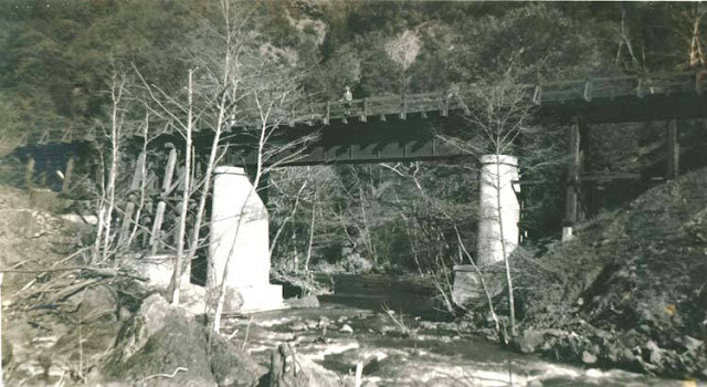
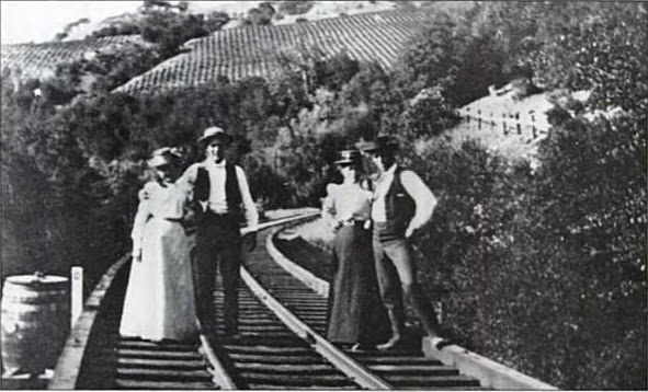
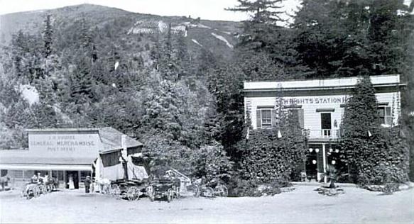
      On February 7, 1938, regularly-scheduled passenger service between Santa Cruz and Watsonville along the Southern Pacific Railroad Company’s Santa Cruz Branch was discontinued. Twice-daily passenger service continued across the Santa Cruz Mountains via the San Jose-Santa Cruz Branch for the next two years but this too was discontinued on February 26, 1940, when catastrophic damage to the route caused by severe winter storms rendered the line impassible. After months of discussion and debate, during which time passenger service was rerouted along the Santa Cruz Branch along the coast, the portion of the San Jose-Santa Cruz Branch between Los Gatos and Olympia, two miles north of Felton, was abandoned on November 7, 1940. Passenger service out of Santa Cruz County was replaced with Pacific Greyhound buses.

      Concurrent with the activity along the railroad lines, California State Route 17 (henceforth Highway 17) was nearing completion. Construction of the highway had begun in 1931 to replace the aged and overcrowded Glenwood Highway (then called State Route 5). The section from Santa Cruz to Los Gatos was completed in August 1940, adding further support to the idea that passenger service and the route through the Santa Cruz Mountains could be safely abandoned without consequences. Most commentators at the time felt that the new highway would adequately replace the absent railroad service.

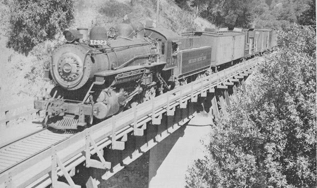
      Following the end of World War II, congestion along Highway 17 began to grow and Santa Cruz County began its slow transition into a commuter community for the Santa Clara Valley. A local suggested in 1946 that the resumption of passenger service was forthcoming due to the exponential population growth in the county. The next year, Southern Pacific resumed its seasonal Suntan Special excursion trains, which helped ease weekend traffic over Highway 17 in the summers between the Santa Clara Valley and the Santa Cruz Beach Boardwalk. However, these were discontinued in 1959 due to cost and declining interest. The last excursion trains along the Santa Cruz Branch occurred in 1965, after which Southern Pacific discontinued any passenger service within the county whatsoever due to the declining quality of the railbed.

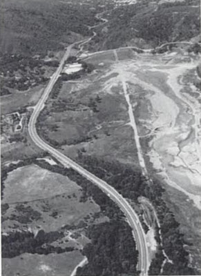
      Meanwhile, fatalities along Highway 17 increased rapidly, with five people killed in ten days in 1966. The state began looking for ways to widen Highway 17 and convert it into a full freeway or otherwise improve it to a make it safer. Other proposals at this time included converting Highway 17 into a toll road to reduce traffic and pay for upkeep and improvements, the construction of a second route between the Alamden Valley and Soquel, and adding a second road so that each could run one-way with more lanes. But all of these met with strong opposition from groups in Santa Cruz County and along the proposed routes. By January 1967, 20,000 vehicles crossed Pachen Pass each weekday and traffic had become a major issue. By 1983, that number had risen to 50,000 vehicles a day. And 1990 brought 74,000 vehicles over the highway. Yet there still remains no safer or more direct high-capacity route between Santa Cruz and San José.

      In the decades that followed abandonment, a number of studies and proposals have been conducted and published relating to the concept of restoring railroad service over the Santa Cruz Mountains.

      Historical Studies
      i. Murphy and Alquist Proposal (1969)
      In April 1969, California Assemblyman Frank Murphy Jr. and State Senator Alfred E. Alquist recommended resumption of the seasonal Suntan Special. They cited increased traffic on summer weekends along Highway 17 and an increase in deadly accidents along the route. They added that “the railroads could give youths summertime jobs as food concessionaires or stewards on the trains.” Nothing further came of this proposal at the time.

      ii. Lockheed Pilot Study (1971)
      In 1971, Alan Goetz, an engineer for the Lockheed Missiles & Space Company, Inc., of Sunnyvale initiated a pilot study to determine the feasibility of restoring service over the historic route. He did this conducted this study “as a public service” to the local community with the hope “that a more thorough study could be done, not necessarily using the old road, but on a mountain train route.” Although the actual report is not publicly available for review, a number of conclusions from the study have been published in other works. Goetz’s study concluded that, of the 26 total miles between Santa Cruz and Vasona Junction, 37% of the route was still intact and in use, 27% could be easily repaired, 26% required new construction, and 10% involved the tunnels and the status was, therefore, unknown. It claimed further that the interior of the three dynamited tunnels were generally intact but that “it is quite likely that gas is present in dangerous quantities in the interior” of the Summit Tunnel. Lockheed’s final statement regarding the matter was that there was “increasing public awareness of the detrimental effects the automobile and population pressures can have and are having on our quality of life.... We believe that strong words such as blight are justified, in reference to Highway 17 and Santa Cruz, in view of the acknowledged fragile nature of the environment of the Santa Cruz mountains and the narrow coastal shelf. As a local firm, Lockheed realizes the validity of the above statement, which helps place us in consonance with the goals of Santa Cruz County.” Lockheed did not participate further in the campaign to re-establish rail service over the historic line.

      iii. Santa Cruz County Transportation Policies Committee Report (1971)
      The findings in the Lockheed Pilot Study prompted the Santa Cruz County Transportation Policies Committee to appoint William Alschuler head of a subcommittee to see whether there was a “surface feasibility” to a trans-mountain railroad. However, his attention quickly turned to revitalising Suntan Special seasonal excursion service via the trackage between Pajaro and Santa Cruz rather than restoring service on the former route through the mountains. A lack of interest by the National Railroad Passenger Corporation (Amtrak) ended the prospect for passenger service along the coastal route. Company vice president of governmental affairs Gerald D. Morgan stated that “the proposed service could not in fact run at a profit, in part because the equipment that would be involved could not be efficiently utilized on a full-time basis.” The Urban Mass Transportation Administration was also contacted regarding the proposal but was told that no funds were available to subsidize the route. Alschuler presented his final report on December 15, 1971. He cautioned that “there is no way possible to [rebuild the route] in a short period of time. It would take years to get the land right-of-way, add new right-of-way, clean up the tunnels and build it.” He noted further regarding the use of the coastal line that “Southern Pacific was totally disinterested in any kind of passenger service.” Southern Pacific stated at the time that the track was “no longer smooth enough for passenger service. You wouldn’t want to ride on it at more than 10 miles per hour,” but Alschuler did not agree with this assessment and desired a second opinion by an unaffiliated expert. The conclusions made by this outsider, if consulted, are unknown.

      iv. California Department of Transportation Feasibility Study (1977)
      In 1975, the California State Senate passed SB283 which included a clause (Section 13, Chapter 1130) that granted funding for the Division of Mass Transportation of the Department of Transportation to study the feasibility of restoring railroad service between San Jose and Santa Cruz via any available route. The results of this study were published September 26, 1977.

      Three different proposals were considered:

      1. Upgrading 14 miles of existing track to 70 MPH top speeds and construction of 19 miles of new track, including all tunnels and structures, signals, right-of-way, a park-and-ride station at Los Gatos, and a new Santa Cruz station. The cost was estimated as $36.9 million ($174.7 million, adjusted for inflation).
      2. Realigning Highway 17 to support an electric railway along its median. The cost was estimated at $84.6 million ($400.53 million), including $48.8 million ($231.0 million) for widening the highway median.
      3. Providing railway service around the Santa Cruz Mountains via the Santa Cruz Branch. The cost was estimated at $22.8 million ($107.94 million) to construct a second mainline to avoid freight congestion and for branchline rehabilitation.

      It was found, as well, that passenger revenue would be adequate to cover operational costs; only the cost of construction was an issue and the study only speculated regarding sources that would cover these expenses, leaving the specific details for after the completion of a full engineering survey.


      In its executive summary, the report concluded that the “construction of a railway was found to be feasible because of the following advantages over highway expansion:

      • Greater energy efficiency
      • Lower air pollution emissions
      • Lower fatality rate
      • Lower costs”

      Regarding energy efficiency and air pollution emissions, the study found that there was an average of 15,00-20,000 commuter vehicles crossing the Summit per day in 1976. The study suggested six to eight self-propelled railcars could be used for commuter service along one of the proposed lines to reduce around ten percent (around 118 passengers per train) of the congestion. The rider fees paid by these passenger would also be sufficient to fund the daily operation of the railcars.

      Regarding the fatality rate, it was found via a report by the National Safety Council that driving in general was riding a railroad in 1975 was safer than driving an automobile by a factor of 21.4. Furthermore, the study reported that Highway 17 “has a fatal-accident rate above the statewide average.” Thus, rail service would provide a safer option for commuters and travellers between San Jose and Santa Cruz.

      Lastly, regarding cost, the study found that the total cost of upgrading Highway 17 to full freeway standards, which was proposed in 1971, would cost $183 million ($1.134 billion). In contrast, rebuilding the historic corridor would be significantly cheaper due to the existing infrastructure that could be reused. Furthermore, the median of Highway 17 could be expanded between Aldercroft and Vasona Junction to support the railroad in the center of the highway, thereby avoiding complications introduced by the construction of Lexington Reservoir and the conversion of the downtown Los Gatos right-of-way into a parking lot.

      Ultimately, a unanimous position was issued by the Santa Cruz County Board of Supervisors on June 14, 1976, that “Construction of an ‘over the hill’ rail connection between Santa Cruz and Santa Clara Counties...would not be consistent with the planning objectives of Santa Cruz County, and would be resisted by this County,” and that “Construction and/or restoration of an ‘around the hill’ route through Watsonville Junction to Santa Cruz County and the City of Santa Cruz, particularly as it might help meet the need for access for recreational visitors to Santa Cruz County, is of great interest to the Santa Cruz County Board of Supervisors, and we urge that the current study focus on the financial, engineering, and marketing possibilities of such a route.” Furthermore, it was feared that railroad service through the San Lorenzo Valley would cause increased settlement in the upper Zayante Creek region, along the proposed route, which went against the San Lorenzo Valley General Plan, especially if property developers petitioned for railroad stations within the valley. The election of George Deukmejian as governor of California ended any discussion of this specific project.

      v. Senate Bill 650 Study (1979)
      On March 20, 1979, California State Senator Alfred Alquist of San José wrote SB650, calling for an engineering study of the historic corridor through the Santa Cruz Mountains as a mandatory follow-up to the previous study, which still required more specific estimates of restoration and upgrade costs. The State Senate estimated the cost of the study to be $200,000 ($722,292, adjusted for inflation). According to a letter to the editor in the Santa Cruz Sentinel, the Santa Cruz Board of Supervisors voted on the proposal on May 1, 1979, without a public hearing, and voted 4-1 against the proposed study.

      vi. Capitola Chamber of Commerce Proposal (1980)
      A proposal to conduct a feasibility study for restoring the route through the Santa Cruz Mountains was again made in 1980, this time by Vic Tognazzini, president of the Capitola Chamber of Commerce. He was advised to confer with other county chambers of commerce to determine whether such a study should be conducted. The Modern Transit Society discussed the idea at a public meeting held June 19, 1981. A major stumbling block to restoring this route was removed on September 28, 1981, when California Governor Edmund Brown signed Senate Bill 523, which allowed private railroad companies to operate short-line railroads in areas not currently serviced by Caltrans or Amtrak. However, remaining restrictions meant fares would still have to cover at least 40% of operating costs along a line before Caltrans would consider allowing a passenger service to operate along said line. Nothing more regarding this proposed study or the possibility of restoring railroad service to the line appears in the Sentinel afterwards. A general transportation feasibility study begun by the Santa Cruz Metropolitan Transit District in 1984 decided against researching a restoration of the historic rail corridor because they estimated that it would cost at least $95 million ($229.9 million, adjusted for inflation) to rebuild the line to light-rail standards.

      vii. Eccles & Eastern Railroad Proposal (1988-1994)
      On June 22, 1988, the Eccles & Eastern Railroad was founded by Karl and Burneda Koenig, and Rick and Carol Hamman in Ben Lomond, California, with the aim to preserve and restore antique railroad equipment and to operate it for the public benefit, and to...provide common carrier freight and tourist oriented passenger service...through the Santa Cruz Mountains.” To accomplish these goals, the company sought the purchase of the historic Southern Pacific right-of-way between Olympia and Vasona Junction. The first step in this process was to purchase or lease the 3.5 miles of right-of-way between Olympia and Zayante Station. Stage two would have involved purchasing the right-of-way between Zayante and Tunnel #4 (under Mountain Charlie Road near Glenwood). The third stage, which proved the most problematic, would have required restoration of the two mile-long tunnels and restoration of trackage in the Los Gatos Creek basin, inundated since January 1953 by Lexington Reservoir. Rick Hamman stated in 1988 that, “though it would be possible to run commuter trains over the Eccles and Eastern lines, company research indicates such a service would be a financial loser. But the railroad is willing to lease its lines to either Santa Clara or Santa Cruz County if they wish to underwrite commuter trains.” Due to the 1989 Loma Prieta Earthquake and other issues, the Eccles & Eastern slowly pushed back their plans for restoration of the line.

      In 1992, Hamman stated that the rebuilding of the historic route would not be completed for at least seven years. At this time, he reported that Eccles & Eastern anticipated a 40 percent growth in truck traffic over Highway 17 over the next decade. His railroad company sought to remove 30-40% of that traffic from the road via two freight trains a day, six days a week in each direction. One of these trains would haul freight while the other would convey passengers. He estimated the total cost would be around $60 million $107.1 million, adjusted for inflation) to rehabilitate the line and purchase rolling stock. Although Eccles & Eastern conducted an environmental impact study of its proposed route, this study was rejected by the California State Office of Planning and Research, which stated applicants cannot prepare their own impact reports. The railroad also lost a bid for a key parcel along the right-of-way around this time. Residents in the Glenwood area specifically were against the restoration of the rail line, citing a decline in quality of life if a train ran 200 feet from their homes daily. These complaints intensified in 1994 and 1995 as other locals in the Zayante Creek area began protesting the proposed route, citing noise, cost, and potential property devaluation.

      Meanwhile, after four years of study, Eccles & Eastern determined that all but four miles of the existing right-of-way could be reused without displacing anybody. Their unpublished environmental impact report and engineering survey determined that most of the culverts were still in working operation along the line and that many of the bridge supports in Los Gatos Creek could also be reused. They also determined that the two long tunnels could be reopened with only minor repairs and shotcreting. Only about 10% of this portion of the right-of-way would require substantial work. Their engineer estimated that the route between the Eccles end-of-track near Felton and the southern end of Lexington Reservoir could be rebuilt to operational standards for $12-20 million ($21.4-35.7 million). The major costs not included in this figure related to a four-mile diversion around Lexington Reservoir. The company calculated that a 0.5-mile-long tunnel could bypass the reservoir and return the right-of-way to its former alignment along Los Gatos Creek in Cats Canyon—the current site of the Los Gatos Creek Trail. It would then parallel California State Route 17 until such a point that it could reconnect to the existing track near State Route 85 and Winchester Boulevard in Campbell. Their final assessment was that the entire route could be rebuilt by a private corporation with private money at possibly no cost to the taxpayer.

      Eccles & Eastern company officials announced plans to begin freight operations along the existing line between Olympia, Santa Cruz, and Watsonville in late September 1994. This prompted backlash from a community action group opposed to increased use of the corridor called RAILS (Right-of-way Alternatives In Local Suburbs). Organisation co-chairperson Barbara Rodak stated that “we would still love to see the whole Southern Pacific rail line converted from rails to trails for bicyclists and walkers. If that isn’t going to happen, then we will have to live with whatever comes down the tracks.” Hamman responded that “if we reach our goal in four years, we will take 60,000 one-way trips a year off of Highway 17. Further, we would save 275,000 gallons of fuel.” Of this meeting, Hamman later wrote that the “study and E&ERR’s plans completely collapsed at a public hearing when a few vociferous opponents were able to stymie the study group.” By July 1994, the Eccles & Eastern no longer planned to restore railroad service over the mountains, deferring to the plans of the Santa Clara County Board of Supervisors and other regional organisations who were conducting a feasibility study of the railroad route over the former Southern Pacific grade through the Santa Cruz Mountains. Eccles & Eastern abandoned operations in Santa Cruz County and reincorporated as the Sierra Pacific Coast Railway, which was later merged into the Sierra Railroad Company.

      viii. Santa Clara County Transportation Commission Feasibility Study (1995)
      The final and most recent attempt to restore railroad service over the Santa Cruz Mountains began on April 29, 1991 at a meeting between Santa Clara County Supervisor Rod Diridon and Santa Cruz County Board of Supervisors chairman Fred Keeley. Diridon expressed his desire to restore railroad service between San José and Santa Cruz, concerned that adding lanes to Highway 17 would cost over $200 million ($366.5 million, adjusted for inflation) and be detrimental to the environment. He stated that “a rail line over the top is much more environmentally sensitive...at just a fraction of the cost.” But his statements immediately sparked concern by another supervisor, Gary Patton. Patton asked the perennial question: “Do we really want to invest $100 million in order to increase our ties to Santa Clara County?” He stated further that “unless we have really given up on the idea of Santa Cruz County being something special, until we want to be a part of Silicon Valley, then, no. I’m not interested.” Keeley responded to this by saying that “I don’t think we should encourage Santa Cruz County to be the bedroom of Santa Clara County. But I also don’t think we can close our eyes to the fact that to a considerable degree we already are. It is not only right and proper but it’s also intelligent to try to provide better and safer transportation linkage for the people who are already here.” At the time, Southern Pacific expressed disinterest in being involved with the project.

      This discussion led to the second government-funded feasibility study on restoring the historic route over the Santa Cruz Mountains. In March 1992, the abeyant Suntan Special Committee of the Santa Clara County Board of Supervisors began the process of surveying and assessing the route. The committee received approval for a $100,000 study to be split between the federal government (40%), the Metropolitan Transportation Commission of the San Francisco Bay Region (40%), Santa Clara County (10%), and Santa Cruz County (10%). Keeley stated at the time that a “new study is needed because things have changed since the mid-1970s. A whole range of assumptions valid then are no longer valid. Back then, there was no growth management and only 5,000 commuters a day. Now we have growth management, 27,000 commuters and state clean-air requirements to reduce the number of automobiles.” Although his commuter estimates were off by an order of magnitude, Keeley supported the concept of a feasibility study and promoted the idea of a railroad right-of-way directly down the center of State Route 17 as had been proposed in the 1977 study.

      By 1994, three independent studies were being pursued by the county. Besides the study regarding the mountain route, one study investigated the resumption of passenger service along the Santa Cruz Branch between Santa Cruz and Pajaro, with a proposed extension to University of California, Santa Cruz. While another study focused on restoring the seasonal weekend Suntan Specials via the Santa Cruz Branch. Residents in the Glenwood area were opposed to the restoration of the former railroad route to Los Gatos, while RAILS, based out of Aptos, was against all three projects. RAILS co-chairperson Barbara Rodak informed the Sentinel in 1994 that “we would not like to see the commuter train proposal go in because we feel it will be cost prohibitive and have insufficient ridership.” The Sentinel also noted, however, that Rodak lived on Pine Street in Aptos, only feet from the Southern Pacific track.

      The feasibility study was released on February 12, 1995. It was by far the most extensive study conducted of the line and included a ridership study, engineering survey, and environmental impact study, among other items necessary to restore rail service over the mountains.

      Regarding ridership, the study concluded that approximately 4,400 total riders could be expected to take the train each weekday, of which 3,400 would be commuters travelling each direction. However, they also added that daily ridership would inevitably increase as more people became aware of the line and as it became more efficient with the addition of shuttles and park-and-ride locations. In the end, the study suggested that approximately fifteen percent of vehicular commuters would eventually transition to commuting via the railroad.

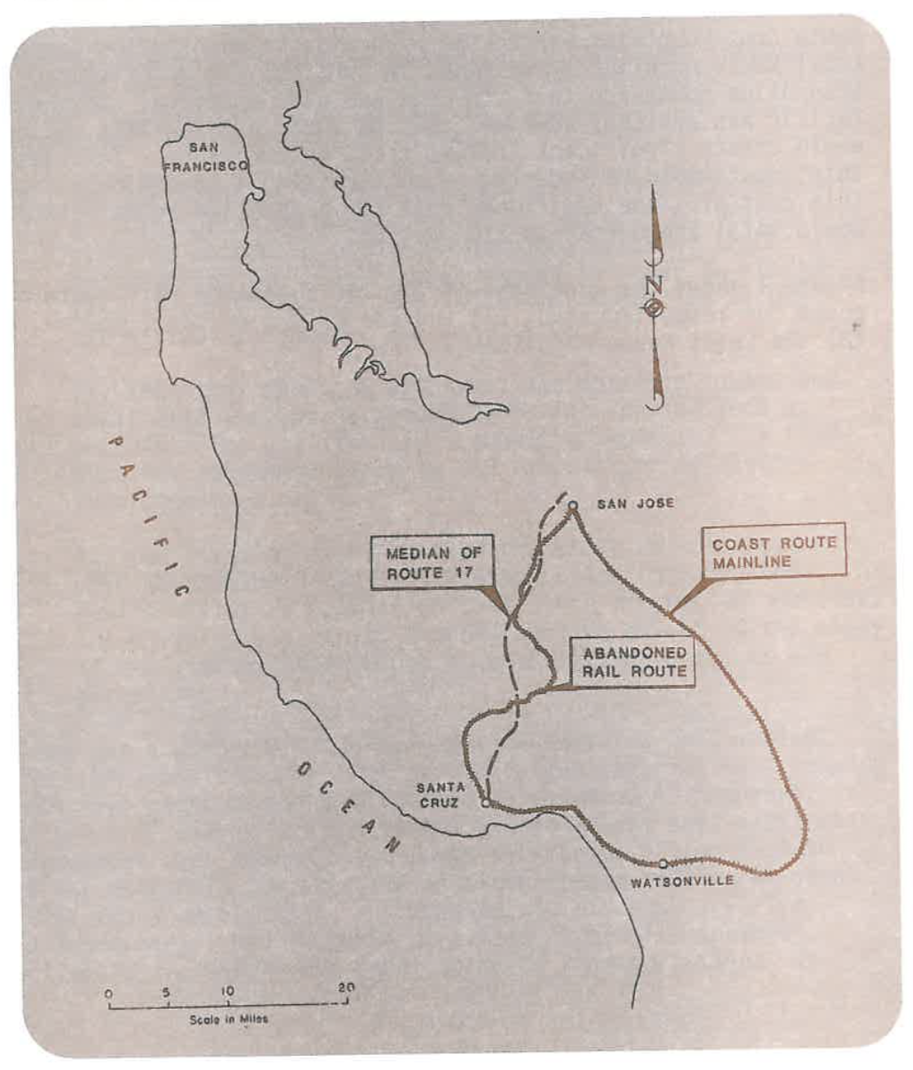
      Regarding the engineering of the line, three separate potential corridors were studied:

      1. The historic corridor that followed the old Southern Pacific route between Olympia and Los Gatos, except for a diversion around Lexington Reservoir. The cost to restore the route was estimated to range from $370.9 to $558.9 million ($612.4-$922.8 million, adjusted for inflation).
      2. A route that followed the proposed route above closely but began in Santa Cruz and paralleled Highway 17 until Scotts Valley, at which point it crossed the city and then met with the historic corridor via a tunnel between Lockhart Gulch and the grade above Zayante Creek. The estimated cost for this line was $437.1 to $646.2 million ($721.7 million-$1.07 billion).
      3. An entirely new light rail route that would follow the center median of Highway 17 for its entirety, much as that suggested in the 1977 survey. The estimated cost of this line was $429.2 to $587.3 million ($708.6-$969.6 million)

      The study also looked at, but dismissed, seven other alternative alignments.

      The study considered four different forms of motive power along the proposed routes including light rail, heavy rail, commuter rail, and self-propelled rail cars, but it settled on light rail and commuter rail technology to calculate its cost and usage estimates. Only passenger service was studied for this report, although the study did note that freight usage could be considerable.

      Regarding the environmental impact of the line, the study concluded that noise levels along the historic route would increase and there would be some negative impact on the riparian areas and to the water quality, although how significant these would be required additional research. The key item of importance here is that local communities could be negatively impacted by changes to the environment along the historic corridor, especially in the Glenwood and Laurel areas.


      The study concluded that the operating costs of maintaining the line would range from $6.4 to $9.6 million ($10.6-$15.8 million) per year depending on the route chosen. It advised policy-makers to conduct two studies, one looking at the feasibility of expanding Highway 17 and another surveying the potential sources of funding that could be used to fund a proposed rail route between Santa Cruz and San José.

      After numerous public discussions throughout February 1995, the study was finally dismissed by both Santa Clara and Santa Cruz Counties on March 3, opting instead to improve bus service along State Route 17 and to construct truck-climbing lanes along the road. However, Assemblyman Bruce McPherson noted that the funds for a truck-climbing lane would not be forthcoming until at least the year 2000 and probably later and would cost upwards of $4.8 million per mile. Mike Hart, president of the Sierra Pacific Railroad Company, warned that a railroad company is “going to do this.... If you bow out, you will be abdicating control of a major transportation corridor to a private enterprise.” However, no such company has come forward in the two decades since this study was published to restore railroad service over the Santa Cruz Mountains.

      Conclusions
      Public opinion is still the overwhelming obstacle to restoring this route. Property owners and lessees along the right-of-way near Zayante Creek, Bean Creek, Laurel, and Los Gatos will undoubtedly protest any attempt to restore service, especially if the route will pass through or adjacent to their properties. There are approximately fifteen homes and businesses in these areas that have property that overlaps the right-of-way, although only around five structures are situated atop the route. Roaring Camp Railroads has expressed support for the restoration of railroad service over the mountains before and may be convinced to do so again, although such a service would undercut their profits on the Santa Cruz Big Trees & Felton Railroad since any passenger service between Felton and Santa Cruz would share the same track.

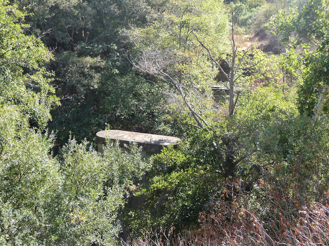
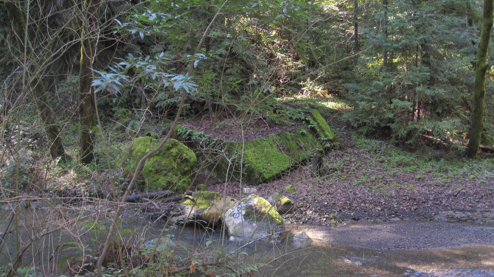
      Structurally, the route would require significant improvements from its 1940 alignment. At the time Southern Pacific abandoned the route, they had been planning to conduct extensive upgrades of the line to protect it from future storm damage like that caused in February 1940 and to make the line more efficient. They proposed straightening a number of curves and replacing numerous bridges. However, San Lorenzo Gorge has always proved to be an insurmountable obstacle. Even today, the route between Felton and Santa Cruz is unusually steep for a mainline track and also involves a sharp, 21-degree turn where once Tunnel #5 was situated (this tunnel burned down on January 21, 1993). The former tunnel would need to be rebuilt but due to the grade through this area, the line could never reach peak speeds, except perhaps with light rail cars. Overall, the findings of the 1995 study remain valid.

      Despite thousands of dollars of survey work, though, no such route has been constructed. Similarly, no significant improvements have been made to allow Highway 17 to handle higher capacities of traffic or make the road safer. For decades, the reason was public disinterest and a general desire by those in Santa Cruz County to remain voluntarily isolated from the Santa Clara Valley. But this is no longer the case and has not been for some time. Hamman stated in 2002 that “polls have indicated that a 65% or better support for some kind of service to exist.” Santa Clara County has continuously pushed for improved passenger rail services and has expanded its light rail system as far south as Campbell, with longstanding plans to extend these to Vasona and, eventually Los Gatos.

      Citations & Credits:

      • “Alquist Wants More Study On SC-San Jose Rail Link.” Santa Cruz Sentinel (March 21, 1979): 2.
      • “Amtrack Discourages Revival Of Suntan Special Route.” Santa Cruz Sentinel (December 2, 1971): 30.
      • Beal, Richard A. Highway 17: The Road to Santa Cruz. Second edition. Aptos, CA: The Pacific Group, 1991.
      • Beebe, Greg. “New talk about rail link to SJ.” Santa Cruz Sentinel (April 29, 1991): 1, 12.
      • “Bring Back Suntan Special.” Santa Cruz Sentinel (April 20, 1969): 29.
      • De Leuw, Cather & Company. “Santa Cruz-Los Gatos Rail Corridor Feasibility Study—Draft Final Report.” Prepared for the Joint Policy Board (Santa Clara County Transit District, Santa Cruz County Regional Transportation Commission, and Santa Cruz Metropolitan Transit District). December 1994. http://bayrailalliance.org/files/library/Santa_Cruz-Los_Gatos_Rail_Corridor_study.pdf.
      • Franklin, Denise. “Railroads would link Santa Cruz, San Jose.” Santa Cruz Sentinel (March 16, 1992): A2.
      • Franklin, Denise. “Areawide rail service studied.” Santa Cruz Sentinel (May 19, 1994): A3.
      • Franklin, Denise. “SLV residents oppose rail line’s expansion.” Santa Cruz Sentinel (July 21, 1994): A2.
      • Franklin, Denise. “Trains get set to roll.” Santa Cruz Sentinel (July 31, 1994): A1, A18.
      • Franklin, Denise. “Trying to avoid gridlocked future.” Santa Cruz Sentinel (February 13, 1995): A1, A6.
      • Franklin, Denise. “Commuter rail plan thrown off track.” Santa Cruz Sentinel (March 4, 1995): A1, A12.
      • Gaura, Maria. “Railroad company hopes to revive an old dream.” Santa Cruz Sentinel (September 25, 1988): 1, 4.
      • Hamman, Rick. California Central Coast Railways. Second edition. Santa Cruz, CA: Otter B Books, 2002.
      • Jones, Frank N. “Railroad Important to Santa Cruz Area.” Santa Cruz Sentinel-News (August 16, 1946): 9.
      • Marks, Jamie. “Politicians give support to ‘fixed guide way’ transit system.” Santa Cruz Sentinel (September 16, 1984): A5.
      • McFadden, Ruth. “Private Hearing?” Letter to the Editor, Santa Cruz Sentinel (May 6, 1979): 36.
      • Plomp, Gary. “As you see it: Support for rail system.” Santa Cruz Sentinel (January 31, 1995): 11.
      • “Railway Interests Capitola.” Santa Cruz Sentinel (January 18, 1980): 38.
      • “Suntan Special.” Santa Cruz Sentinel (June 18, 1981): 2.
      • “Suntan Special Legislation.” Santa Cruz Sentinel (September 29, 1981): 16.
      • Santa Clara Valley Transportation Authority. “Fact Sheet: Transit—Vasona Light Rail Extension Project.” 2012. http://www.vta.org/sfc/servlet.shepherd/document/download/069A0000001EO3BIAW.
      • Santa Cruz County Regional Transportation Commission. “Santa Cruz Branch Line Acquisition Frequently Asked Questions (FAQs).” May 4, 2010.
      • Santa Cruz County Regional Transportation Commission. “Rail Transit Feasibility Study.” December 2015. https://sccrtc.org/wp-content/uploads/2016/02/RailTransitStudy_FullDoc.pdf.
      • Whaley, Derek R. “The End of the Line: The Abandonment of Passenger Services in Santa Cruz County, California,” Railroad History 215 (2006): 12-33.
      • Whaley, Derek R. Santa Cruz Trains: Railroads of the Santa Cruz Mountains. Santa Cruz, CA, 2015.
      • Wood, Wallace. “The Sun Tan Special: Will It Run Again?” Santa Cruz Sentinel (October 29, 1971): 1-2.
      • Wood, Wallace. “Why Bring Back the Suntan Special?” Santa Cruz Sentinel (December 19, 1971): 6. 

      People: Thomas L. and Weltha A. Bell

      $
      0
      0
      Santa Cruz County did not simply develop because of the railroad. It was the effort of individual people who helped turn a small, isolated county on the northern fringe of the Monterey Bay into a tourism Mecca. One such individual was Thomas L. Bell. The origins and ultimate fate of Thomas Bell are not well know. He first entered the local scene in the 1880s as the superintendent of the Pacific Manufacturing Company mill that sat midway between Felton and Boulder Creek. His boss, James Pieronnet Pierce, was a forward-thinking man who also understood public relations. When the Felton & Pescadero Railroad first passed through the mill in 1884, Pierce saw the end of logging in the area and the birth of a town.

      Ben Lomond & Hotel Rowardennan (1887-1899)
      In 1887, Bell, under orders from Pierce, founded the Ben Lomond Land & Lumber Company with the expressed purpose of subdividing the mill lot into housing parcels. A number of business were already in town, vestiges of the milling days, but a new community was established called Sunnyside behind the depot to attract more high-end residents. The local post office was founded that year under the name Ben Lomond, and the railroad station adopted that name in 1888. The Sentinel praised the settlement, noting that “Mr. Pierce, by these sales, is proving himself a benefactor to the neighborhood – new people are moving to that locality, houses are being erected, homes established, grounds cultivated, orchards set out and a population of sterling, thrifty citizens secured.”

      Ben Lomond depot during a major event, c. 1895.
      In 1891, the area around the confluence of Love Creek into the San Lorenzo River was logged out and Ben Lomond transitioned completely to a tourist town. On the northwest side of town, Bell constructed the Hotel Ben Lomond as the first tourism-specific venture in town. Pierce, meanwhile, built a mansion he named Hillside, visible from throughout the town, to showcase the benefits of building summer cottages in this region of the San Lorenzo Valley. But neither of these were quite enough. The town required something grander.

      Bell Lake behind Hotel Rowardennan in Ben Lomond, c. 1900.
      Bell founded the Ben Lomond Improvement Company in 1896 alongside his wife, Weltha A. Bell, and his son, William. The purpose of this new company was to construct a fabulous 300-acre resort just south of Ben Lomond along the county road. Bell took the lead on this project and accepted Southern Pacific Railroad money to help fund it. Hotel Rowardennan opened in the summer of 1896. It spared no expense to attract people. The property included tennis courts, a campground, forest paths, and an artificial boating lake named "Lake Bell," created by damming the San Lorenzo River. The dam also generated power for the hotel, which featured dozens of electric lights.
      Hotel Rowardennan from the front, Ben Lomond, c. 1900.
      The original structure burned to the ground in February 1897, but Bell rebuilt quickly and the project continued to grow. The second structure included, among other amenities, a large restaurant, a dance hall, billiards room, and a telegraph office. Hotel Ben Lomond, on the other side of town, attempted to match Hotel Rowardennan feature-for-feature. But the latter was always the more refined, catering only to the elite and even denying stays to those management deemed disreputable, including Jews.

      Advertisement for Hotel Rowardennan, 1900. [Santa Cruz Sentinel]
      Competition with Hotel Ben Lomond and other local ventures cut into his profit and he decided to move onto his next project. In 1899, he sold Hotel Rowardennan to H. Francis Anderson, who hired Benjamin and Gertrude Dickinson to run the hotel. In later years, they would also found the adjacent Hotel Dickinson. Anderson renamed the hotel Ben Lomond Lodge in the 1920s, and the resort burned to the ground on April 9, 1932. The detached ballroom burned the next year. All that remains of this facility is the concrete fountain that still welcomes people to Ben Lomond.

      Arcadia & Tuxedo (1898-1906)
      A series of fortuitous transactions brought Thomas and Weltha Bell to their next project. Frederick A. Hihn, who had worked with Pierce at various times, had acquired title to a large tract of land at the confluence of Bean and Zayante Creeks on the site of Isaac Graham's original lumber mill. Desiring to put this prime real estate to use, Hihn sold or leased the land to the Bell, who founded the Arcadia Development Company in 1898. He moved fast, converting the large meadow beside the railroad tracks into a small cottage city. Like he did in Ben Lomond, Bell dammed Zayante Creek, thereby creating a boating pond that doubled as a source of power for 200 lights strung throughout the campground. He also built an outdoor dancing pavilion and tent dining room. He named his new resort Arcadia, a reference to Ancient Greece.

      A local, John Morrow, visited the site in 1900 and gave his impression in the Santa Cruz Evening Sentinel:
      Following up the Zayante Creek a few hundred yards, above the depot, I saw a large sign which read: "Campus Station." Under this is the name of the hotel and grounds, which is Arcadia, and it all belongs to and is conducted by Thomas L. Bell and his wife. It is conducted on the hotel plan. I went all over the place and found a large dining-room and kitchen, a large fine ball-room and electric light plant. The plant is a 12 horse-power engine, and furnishes 200 lights, which are sufficient to light up all the rooms and ground. The sleeping apartments are in cottages of from two to four rooms each. There are 25 of these cottages, and all furnished in the most comfortable manner. About 100 feet below the office, on the Zayante Creek, is a beautiful lake, formed by a dam thrown across the creek. On this is three boats for pleasure riding. Just on the opposite side Bean Creek dashes down over a fall about 40 feet, and joins Zayante. The whole place, the creek and the dam, are in a fine grove of redwood, pine, oak and madrona Mr. Bell intends, before another season, to plough, scrape and level down all the plaza-like grounds between the grove and the railroad tracks, and will erect a large, central building, which will be the hotel proper.
      Bell ran into problems, though, when he petitioned the railroad for a stop there. The station was initially known simply as Campus, pending a better name. However, Arcadia already existed in the Southern Pacific network and the railroad did not want yet another duplicate name. After some research, Bell renamed the resort Tuxedo, after Edward Henry Harriman's park in New York state. To match this new grandeur, Bell built the two-story Tuxedo Inn in 1901 and petitioned the railroad to built a formal depot structure alongside the tracks in 1903. Tuxedo proved to be the peak of Santa Cruz County resort culture, but Bell was already looking elsewhere.

      Tuxedo campus grounds, 1904. The station sign was altered by an editor to read Mount Hermon. [Mt Hermon Association]
      On December 12, 1905, Bell finalized the sale of Tuxedo to the Mount Hermon Association for $45,300. The F.A. Hihn Company finalized the sale of the property and its water rights in March the next year. Why precisely Bell and Hihn decided to sell the resort less than a decade after founding it is unclear. The resort had picked up an unsavory reputation in a short matter of time, so Mount Hermon renamed it the "Zayante Inn" in April 1906. Liquor sales and gambling tables, for which the hotel was infamous, quietly were discontinued. The railroad stop was renamed Mount Hermon in 1907 and the site has served as Redwood Camp since the 1960s.
      Tanglewood (1906)
      Thomas and Weltha's final known project in Santa Cruz County was less audacious than their previous two. In 1906, they founded the Artesia Development Company and once again purchased or leased lands from Frederick Hihn. In May 1907, a subdivision plat was filed with the county records showing the Tanglewood subdivision in south Felton located on either side of San Lorenzo Avenue. The couple named the settlement after Nathaniel Hawthorne's book, Tanglewood Tales for Boys and Girls, published in 1853. When the old narrow-gauge tracks of the South Pacific Coast Railway were removed in 1909, the subdivision spread out further, both up the hill and to either side, eventually encompassing everything between Gold Gulch and Shingle Mill Creek.

      Map of Tanglewood near Felton, 1907, showing historic and modern property lines. [Michael Rugg]
      William L. Bell, Thomas and Weltha's son, continued to oversee property sales for the next decade. He had been appointed a surgeon on the US Navy ship Independence in 1898 during the Spanish-Amrican War, and he also served in World War I in the same capacity. By 1912, he was divorced and had at least one child. In 1948, he became a doctor in Felton, where he could also oversee the estate of his parents. When Thomas and Weltha abandoned Tanglewood is unknown, but they disappear from newspaper records after 1911. Tanglewood, meanwhile, hosted two gas stations, a maintenance shop, a market, and a restaurant through the 1960s, but declined as a commercial area afterwards. Today, it hosts Cowboy Diner and Felton Guild, as well as the Big Foot Discovery Museum, but is otherwise just a residential subdivision.

      The Harbor Inn restaurant at Tanglewood, c. 1950s. [Howard Rugg]
      Citations & Credits:

        Bridges: Soquel Creek

        $
        0
        0
        Bridges are an essential part of any railroad and nowhere in Santa Cruz County is there a bridge more iconic than the Soquel Creek bridge that towers over Capitola Village. Two bridges have spanned this 669-foot-long gulch and both were—and the latter remains—popular subjects for photographers.

        Stereograph of Camp Capitola with the original Sequel Creek bridge in the background, c. 1885. Photo by Carleton Watkins. [California State Library]
        The first bridge was constructed by Tom Carter under contract for the Santa Cruz Railroad in summer 1874. The bridge was a fairly standard design for a long span such as this. More than half of the length, from Depot Hill to Soquel Creek, was composed of a simple redwood open-deck trestle. A similar, albeit much shorter, span connected the other bank of Soquel Creek to the west bank. Over the creek itself, a roughly 200-foot-long redwood double-intersecting Warren truss ensured trains travelled safely and securely over the creek. No piers were required to support the truss span, but dense redwood piers were built on either side of the span to keep the bridge aloft.

        Camp Capitola with the Soquel Creek bridge in the distance, 1875. [Covello & Covello]
        This narrow-gauge bridge underwent a heavy remodeling in 1883-1884 to convert it for use by standard-gauge trains after the Southern Pacific Railroad purchased the Santa Cruz Railroad in 1882. Whether these changes were highly visible is unknown, but Southern Pacific did at this time relocate Soquel station from the western end of the bridge to Depot Hill, changing its name to Capitola in the process. At some point in the 1890s, the truss span was also enclosed, probably to protect it from the corrosive sea spray.

        Railroad bridge over Soquel Creek with train approaching covered truss span, c. 1890s. [Santa Cruz MAH]
        The second and current bridge over Soquel Creek was built in a number of waves as the community beneath the bridge transitioned from a seasonal resort to a year-round town. The oldest sections of this bridge closely resembled the original bridge, including a 335-foot-long redwood trestle from Depot Hill and a 100-foot-long trestle extending to the west bank. Over the creek itself, the old wooden truss was replaced with a 150-foot-long open-deck, wrought iron, truncated, upside-down curved chord Pratt truss span that was unique among the bridges along the Central Coast. To support this truss, two large concrete piers were installed on either side of the creek. This truss was not original to Soquel Creek—Southern Pacific had repurposed it from elsewhere in its system and sawed off portions on each end resulting in its unique design.

        Colorized photograph of the Soquel Creek bridge, c. 1910. [Santa Cruz Museum of Art & History]
        At some point, probably in the 1930s, the trestle span over Capitola Avenue was bisected to allow for the insertion of a 120-foot-long prefabricated open-deck steel plate girder span, which was supported by heavily-reinforced trestlework on either side. This allowed automobiles to more comfortably pass under the bridge and into Camp Capitola.

        A Southern Pacific train passing over the Soquel Creek bridge, c. 1930. [Phil Reader]
        In 1971, the original plate girder span over Capitola Avenue was replaced with a three-part concrete ballast deck span, which better protects cars passing underneath from train debris. On the opposite side of the bridge, over Wharf Road, a similar 60-foot-long concrete ballast deck span was installed to provide better clearance for cars and a safer passage beneath the bridge. This latter span replaced the wood abutment originally found on the west side of the bridge and also replaced the majority of the trestlework from the truss.

        The bridge still standing high above Soquel Creek, 2012. [Madeline Horn]
         The current bridge is, unfortunately, no longer fit to support fully-laden railroads operating at branch line speeds and is not designed nor upgradable for use as a pedestrian corridor. As such, it will undoubtedly undergo a partial replacement within the coming years. An engineering evaluation and rehabilitation report from 2012 estimated a cost of roughly $1.2 million to rehabilitate and rebuild the bridge for regular use, although the structure will have to be replaced within 20-30 years regardless.

        Geo-Coordinates & Access Rights:
        Eastern end: 36.974˚N, 121.953˚W
        Western end: 26.973˚N, 121.954˚W

        Use of the bridge by pedestrians is not advised and technically illegal, although dozens of people cross the bridge on foot each day. The bridge, as well as the rest of the right-of-way, was purchased by Santa Cruz County in 2012 and is under the jurisdiction of the Santa Cruz County Regional Transportation Commission.

        Citations & Credits:

        • Hamman, Rick. California Central Coast Railways. Second edition. Santa Cruz, CA: Otter B Books, 2002.
        • MacGregor, Bruce, and Richard Truesdale. A Centennial: South Pacific Coast. Boulder, CO: Pruett Publishing, 1982.
        • Santa Cruz County Regional Transportation Commission. "Santa Cruz Branch Rail Line: Alignment and Bridge Evaluation & Repair / Rehabilitation or Replacement Recommendation Report." Compiled by Patterson & Associates, August 12, 2012.

        Curiosities: Big Trees

        $
        0
        0
        For such a popular tourist resort, Big Trees in Felton—now known as Henry Cowell Redwoods State Park—is one of the least understood places in the county. The history of the site begins in February 1846, when Lieutenant-Colonel John C. Frémont, with his partner Kit Carson, passed through the San Lorenzo Valley on a surveying expedition and allegedly camped within a hollowed-out tree on the edge of the Big Trees grove. It was not until twenty-two years later, though, that the location was made accessible to the wider public. The completion of the toll road between Santa Cruz and the newly laid-out town of Felton in 1868 allowed visitors to come to the redwood grove and peruse the towering giants. A number of small hotels, restaurants, saloons, and other amenities sprang up in the town to support both the industrial trades—mining, lumbering, and tanning—and the nascent tourism market. A year earlier, a San Francisco couple, Joseph Warren Welch and his wife, Anna, purchased 350 acres of Rancho Zayante, which included the redwood grove and the large meadow beside it. Initially, the Welchs intended to use the property as a private ranch—which they did with over half the estate—but a constant flow of seasonal tourists convinced them that access to the redwood grove could not be denied to the public.

        General Frémont beside his tree at Big Trees, 1888. [Penny Postcards of California]
        A tree covered in postcards at Big Trees,
        c. 1900. [Santa Cruz Public Libraries]
        President Theodorore Roosevelt at Big Trees, 1903. [Bancroft Library]
        The primary attraction at Welch's Big Trees, as it came to be called, was the "Fremont Tree," the hollowed-out redwood that he had apparently camped within in 1846. However, until the late 1870s, another larger tree was also known as the "Fremont Tree" since Isaac Graham, owner of Rancho Zayante, had named it such back in the 1840s and even carved an "F" in the bark to designate it. Slowly, the name transferred to the smaller, albeit more famous tree, and the larger tree was rechristened the "Giant" around 1884, right around the time the "F" had entirely disappeared. From the mid-1870s to the mid-1900s, thousands of people came to visit Welch's Big Trees, and a tradition began of nailing postcards to the bark of the giant trees. All of the named trees, which increased in number almost annually, eventually were marked with postcards until President Theodore Roosevelt visited in 1903 and effectively ended the practice by making a derisive off-hand comment about it. The arrival of the Santa Cruz & Felton Railroad in 1875, which installed a passenger station across the San Lorenzo River near the modern-day site of Cotillion Gardens, only increased the popularity of the grove.

        Big Trees Hotel with man reading newspaper, c. 1880s. Photo by Charles Wallace Jacob Johnson. [California State Library]
        When Joseph Welch died in 1875, his wife leased the grove to J.M. Hooper. Hooper quickly began building structures across from the Fremont Tree, beginning with a small hotel. The arrival of the South Pacific Coast Railroad in May 1880, which passed immediately above the hotel and through the Welch property, prompted Hooper to expand and add a dance floor between the Fremont Tree's grove and the lonely Giant. The railroad, meanwhile, set up a flag and picnic stop nearby for use by tourists. Over the years, the hotel resort expanded to include two additional buildings that extended housing, with a total of approximately ten rooms available to visitors by 1884. At one point, a restaurant was added to the main building with a canopied dining area situated beside the structure. A saloon and general store were also maintained to support visitors to the resort. But all this expansion bankrupted Hooper. Anna Welch transferred the resort lease to David Aldrich and then Joseph Ball, the latter of whom ran the Central Hotel in Felton. Ball left in 1900 and one of Anna's sons, Stanly, took over. Stanly lacked the vision of his parents or his predecessors in management. He saw the grove purely as a source of profit and did not care for either the trees or the family's reputation in the community.
        The Club House at Hopkins' Big Trees resort with visitors on the patio, c. 1910. [Santa Cruz Public Libraries]
        Swing bridge and river ford installed beside Hopkins' Big Trees, c. 1905. [Santa Cruz Public Libraries]
        In response, the Welchs' neighbor to the south opened up his own resort. Henry Cowell owned thousands of acres of mostly second-growth redwood which had been harvested continuously since the 1850s for use as limekiln fuel. By 1901, much of the area around the grove was suitably regrown enough to support a second resort, which was appropriately named Cowell's Big Trees. Milo Hopkins was given the resort lease and permission to build appropriate structures to support the resort. In a clearing between the Giant and the railroad tracks, Hopkins erected a small club house which included a coffee and gift shop, with a photo hut across the clearing from it. Nearby, cabins and a tennis court were erected alongside the San Lorenzo River for seasonal tourists. The Welchs, furious, built a tall fence along its property line, barring entry from anyone except those who paid an entry fee. Cowell and Hopkins, with their less impressive redwoods, did not charge a fee, making their money primarily through concessions. Milo and his son George ran the resort until 1942.

        Colorized photograph of the entrance to Welch Grove, c. 1940. [Santa Cruz Public Libraries]
        Competition with Cowell and the Hopkins certainly ate into the Welch family's profits, but the allure of the more ancient trees within their grove still attracted tourists. Nonetheless, the advent of the automobile and the ease of visiting the park via train meant that the buildings in the Welch Grove declined in importance. By 1919, they were in disrepair and Metro Pictures repurposed them as a "Pioneer Town" appearing in the film False Evidence. One of the buildings became a Pony Express office for the film and postcards at the time advertised this leading to a persistent rumor that the Pony Express extended to Felton despite the fact that Big Trees did not yet exist when the Pony Express went defunct in 1861.

        Postcard for Santa Cruz County Big Trees Park, c. 1940.
        The Welch Grove itself was purchased by Santa Cruz County in 1930 after a brief attempt by Joseph and Anna's two sons to sell the property to a logging company. Since the former access to the grove was through property still owned by the Welch family, the county quickly constructed a bypass road that crossed the San Lorenzo River just south of Felton along State Route 9. At the junction of this road with Highway 9, a large redwood trunk was installed with the name of the park engraved on either side. Since the road now entered from the west rather than the north, a road was built through the large meadow between the river and the Welch Grove, at the end of which a small dirt parking lot was built. Just within the grove, the Big Trees Inn was built in December 1932 and served as a concession stand and visitor center, as well as a home for the concessionaire.

        Restored copy of a 1932 trail map of Santa Cruz Count Big Trees County Park. [Ken Lande]
        The conversion of Welch's Big Trees to a public—and free—park in 1930 crippled Hopkins' Big Trees, which was struggling already due to the Great Depression. The railroad continued to bring customers to the park throughout the year, but photographs of the time show the buildings in a declining state of repair. The end of railroad service over the mountains and the US entry into World War II ultimately ended the park since tourism was virtually non-existent. The park closed in 1942 but remained in private hands until 1954. Whether there was any tourism activity in Cowell's property during this time is unknown. Prior to 1954, visitors to the park parked at modern-day Cotillion Gardens and crossed the San Lorenzo River via a swing bridge, but buses were able to come to the park by crossing a seasonal ford built across the river at the bottom of Old Big Trees Road beside the Toll House Resort south of Felton.

        The Big Trees Inn across from the modern-day visitor's center, c. 1950.
        In August 1954, Samuel H. Cowell sold 1,623 acres of his lands—almost everything within the San Lorenzo Gorge including his Big Trees Resort—to the state with the requirement that the Santa Cruz County Big Trees Park also be included and the two units be combined under the name Henry Cowell Redwoods State Park. Both the state and county acquiesced and the park has changed relatively little ever since. The ford over the San Lorenzo River was immediately abandoned and the aged swing bridge was destroyed in the 1955 flood.

        Big Trees Hotel complex after a tree collapsed on the oldest structure, c. 1950s. [TexasWaterTowers.com]
        There are few remnants of the old park left. Above the railroad tracks, there is still a clearing where the dirt tennis court once was located. Meanwhile, a seasonal bridge is still installed across the river near the railroad bridge at roughly the same location as the old swing bridge. On the opposite side of the park, the large entry sign log has been re-carved to represent the current name of the park, but otherwise sits where it has always been. And lastly, the posts that stop vehicles from entering the redwood loop are still those installed in 1932 in front of the Big Trees Inn. Otherwise, only empty lots remain to mark the foundation sites of buildings long since demolished. The old Welch buildings were demolished around 1957 after a tree fell through the middle structure and the state park decided the buildings were in too much disrepair to maintain. Posts sat in the clearing until the mid-2000s when new bathrooms were installed and construction crews removed this lingering trip hazards. The fate of Hopkins' club house and its adjacent buildings is unknown, but may have disappeared soon after the resort closed in 1942. In September 1984, the old visitor center (the Big Trees Inn) shut down and was replaced by the current visitor center that now sits across the trail from the site of its predecessor.

        Citations & Credits:
        • Bliss, Traci, and Randall Brown. "Two Trees for General Fremont."Redwood Logging and Conservation in the Santa Cruz Mountains—A Split History. Santa Cruz History 7. Edited by Lisa Robinson, 101-112. Santa Cruz, CA: Otter B Books, 2014.
        • Clark, Donald. Santa Cruz Count Place Names: A Geographic Dictionary. Second edition. Scotts Valley, CA: Kestrel Press, 2008.
        • Whaley, Derek. Santa Cruz Trains: Railroads of the Santa Cruz Mountains. Santa Cruz, CA, 2015.

        Railroads: Ocean Shore Railway & Railroad Companies

        $
        0
        0
        Official Ocean Shore Railroad map, c. 1910s.
        The years prior to the San Francisco earthquake of April 1906 were bonanza years for railroads along the Central Coast. Numerous plans were taking shape to settle the coast and connect it with both Santa Cruz and San Francisco. Surveys of the route between the two end points had been conducted in the 1880s and 1890s and already proven the feasibility of construction. All that was left was implementation.

        Ocean Shore Railway Company (1905-1911)
        While no venture ever succeeded in connecting San Francisco and Santa Cruz, the Ocean Shore Railway Company came the closest. Founded on May 18, 1905, less than a year before the earthquake that led to its ultimate financial failure, the railroad was established with the explicit aim to connect the two cities via a double-tracked, standard-gauge, electric railroad line totalling eighty miles in length. A longer term goal of the company was to link up with other railroads that were under construction or being incorporated to build a new transcontinental line that would bypass the Southern Pacific monopoly on western rail transportation.

        Throughout the next few months, land was purchased for use as a right-of-way. The Ocean Shore, unlike other railroads, bought most of its land outright rather than buying rail easements through properties. This allowed them greater flexibility, but it also made everything drastically more expensive. But the Central Coast was still poorly developed, so prices remained reasonable. The railroad also purchased excess land in a number of bays south of San Francisco for future development as resorts, housing subdivisions, and commercial-industrial ventures. Large tracts of lumber in the Pescadero and Butano basins attracted the railroad, while the potentially lucrative cement market developing in Davenport also caught the railroad's eye.
        The Ocean Shore office on Bay Street in Santa Cruz, 1906. Annotations by Peter Nurkse. Photo by George Lawrence. [Santa Cruz MAH]
        As construction began, it was clear in the south that the Ocean Shore Railway and Coast Line Railroad (a Southern Pacific subsidiary) would be competing heavily for the cement market. The Ocean Shore right-of-way was developed first, heading out of Santa Cruz down Delaware Avenue before turning toward the foothills, where it met with the Coast Line right-of-way just east of Wilder Ranch. The two lines more or less paralleled each other for the next ten miles to Davenport, with the Ocean Shore remaining on the ocean side throughout. This effectively blocked them from accessing the Santa Cruz Portland Cement Company plant, as well as a number of farms and homesteads which were located between the Coast Road (future State Route 1) and the railroad tracks. Shattuck and Desmond were hired to build both railroad routes, but Southern Pacific became delayed in late 1905, allowing the Ocean Shore to push ahead to Davenport without competition. Between late October 1905 and January 1906, tracks were laid between Santa Cruz and Davenport and massive wooden trestle bridges were erected over roughly ten deep gulches south of the coastal town. Southern Pacific, risking the forfeiture of their shipping contract with the cement plant, outsourced to Ocean Shore until their line was completed later in 1906.
        Extract from "Bird's Eye View of the City of Santa Cruz," 1907, showing the Ocean Shore route through West Side with the proposed viaduct over the Southern Pacific's Union Depot Yards on Center Street. [Bancroft Library]
        Progress continued steadily. By April 1906, the Ocean Shore grading crews in the north had reached as far south as Devil's Slide near Pacifica, while in the south they had reached as far north as Scott Creek near Davenport. Plans were afoot to construct a small creekside resort along Scott Creek named Folger, after the investor and coffee magnate. The railroad had also purchased a subsidiary of the Union Traction Company, a streetcar company, in Santa Cruz to convert it to mainline service. A large depot was planned in downtown near the Cooper House that would have put the Southern Pacific depot to shame. And between Bay Street and Garfield Avenue (Woodrow), a sprawling maintenance yard developed that included numerous spurs and sidings, workshops and engine houses, and a wye to turn trains around. But the 1906 earthquake changed everything. Much of its equipment and right-of-way had fallen into the ocean and most of its investors were now struggling to remain afloat. In the south, construction continued after the temblor. Trains began regular service on June 15, while track-building to Scott Creek was finished in October. Fourteen miles of rail had now been placed out from Santa Cruz.
        Ocean Shore train assisting in the recovery of San Francisco, 1906. [Bancroft Library]
        Things began to fall apart in 1907. A financial panic that years deprived the company of many of its investors. Meanwhile, the recovery from the earthquake was going differently than planned—people were not moving out of San Francisco to the coast. Rather, they were rebuilding within the city limits. The future of the resorts and subdivisions planned along the coast were in doubt. Meanwhile, expenses in recovering lost equipment and rebuilding right-of-way deprived the railroad of much of its limited revenue. And lastly, the Coast Line Railroad was nearly completed. By August 1907, regular service between Santa Cruz and Davenport via the Coast Line began and the Ocean Shore was literally cut off from the main trade on both ends. In Davenport, the Coast Line extended its track to Davenport Landing, where it built a wye and numerous sidings and spurs, effectively blocking any transfer of material to the adjacent Ocean Shore tracks. In Santa Cruz, Southern Pacific extended a spur out to Cowell Beach, blocking the Ocean Shore from entering Santa Cruz through their proposed route. Their alternative—building a massive causeway over the Southern Pacific yard and down Center Street—was rejected by the city council. They relocated their passenger depot from the temporary structure overlooking the Southern Pacific yards to a slightly larger building on Bay Street. It remains a mystery where passengers boarded, but passenger service largely fell off in 1908 and it never recovered. While the Northern Division seemed promising due to steady property sales and sustained interest, the Southern Division was stagnating and trending toward a loss.

        The Southern Division only survived due to the fortuitous interest of the San Vicente Lumber Company, which was founded in May 1908 to harvest the timber along Little Creek near the tiny hamlet of Swanton. Since the Ocean Shore had already built track to Scott Creek, it took little effort to convince the railroad to extend a track two miles up the creek to the confluence of Little Creek. The lumber firm build their large mill at Antonelli Pond, midway between the Ocean Shore and Coast Line right-of-ways, which allowed for an easy exchange of train cars between the two lines. At Swanton, the line was extended further to the base of Mill Creek, where the Loma Prieta Lumber Company built a mill.
        Ocean Shore Railway passenger train at Devil's Slide, 1910. Photo by Bruno Crenci. [Pacific History Wikispaces]
        The Northern Division ultimately reached Tunitas Glen in late 1908, but this would be the maximum extent of the railway line. Twenty-seven miles of partially graded right-of-way still stood between Tunitas and Scott Creek, and this section would never be filled. Storms in early 1909 delayed further construction as portions of the existing right-of-way had to be repaired. Throughout the year, creditors called for repayment and the railroad fell further into debt. On December 6, 1909, the railroad went bankrupt.

        Ocean Shore Railroad Company (1911-1934, as a railroad until 1920)
        Bondholders of the company purchased the Ocean Shore at auction in January 1911 and reincorporated as the Ocean Shore Railroad Company on October 9. Although the new owners no longer advertised a double track or electric railroad, they did still seek to connect the two ends and ultimately expand further, to Boulder Creek, to Watsonville, and eventually to the Central Valley. Most of the plans for the Southern Division were on long-term hold, pending funds. Passenger service continued, with a Stanley Steamer autobus connecting passengers over the gap between Scott and Tunitas from 1914, but it is unlikely this service was overly popular or heavily utilised. Most of the revenue in the south came from the San Vicente and Loma Prieta lumber operations above Scott Creek.
        Articles of Incorporation for the Ocean Shore Railroad Company, October 1911. [Bancroft Library]
        By 1920, competition with automobiles had cut deeply into Ocean Shore pockets, while labor disputes in August across the line forced railroad operations to come to a sudden halt. This proved to be the end of the Ocean Shore Railroad. Both divisions were formally abandoned in October, the Northern Division on the 10th, the Southern Division on the 23rd. The right-of-way (but not property), tracks, and rolling stock on the southern division was sold to the San Vicente Lumber Company on October 27, which continued to use the route for the next three years. The Ocean Shore Railroad did not actually close at this time but rather remained as a property developer that maintained a distant hope that their railroad would someday be realized.
        Demolished turntable at Half Moon Bay, 1922. [Bancroft Library]

        Ocean Shore Railroad Company, Inc. (1934-Present)
        After roughly a decade of court proceedings against them, largely over the fact that the company no longer operated a railroad, the Ocean Shore reincorporated once again, this time as the Ocean Shore Railroad Company, Inc., founded in Reno, Nevada on November 16, 1934. Like its predecessors, it was founded with the explicit, though perhaps not genuine, goal of rehabilitating the abandoned Ocean Shore right-of-way. The previous company had spent nearly fourteen years attempting to find the funds to rebuild the line while simultaneously defending its right-of-way from neighbors and others who wished to utilize it for other purposes. The incorporation of a new company was intended to fix some problems but the death in August 1935 of Selah Chamberlain, the new company's chief financier and dreamer, threatened to end this project before it began. In the nine months between incorporation and Chamberlain's death, the entire route was surveyed, new alignments were found, and portions were graded. Two decades later, however, it was found that this work was simply an attempt by the company to appear as if they desired to rehabilitate the line in order to maintain a firmer footing in condemnation proceedings which were being held against them for portions of the right-of-way. On September 28, 1956, it was ruled that the company had no intention to rebuild the railroad line and that condemnation proceedings could proceed against the organization. The company remains a property holder, essentially owning strips of right-of-way between San Francisco and Santa Cruz along the coast, but they have been absent from most public records since their last court cases in the 1970s. Who owns this company, how it operates, and indeed how much land the company still owns is not entirely known.

        Citations & Credits:
        • Hamman, Rick. California Central Coast Railways. Second edition. Santa Cruz, CA: Otter B Books, 2002.
        • Hunter, Chris. Images of Rail: Ocean Shore Railroad. Charleston, SC: Arcadia Publishing, 2004.
        • Wagner, Jack Russel. The Last Whistle: Ocean Shore Railroad. Berkeley, CA: Howell-North Books, 1974.
        Viewing all 490 articles
        Browse latest View live


        <script src="https://jsc.adskeeper.com/r/s/rssing.com.1596347.js" async> </script>